Warm Winter Ahead For Much of the United States
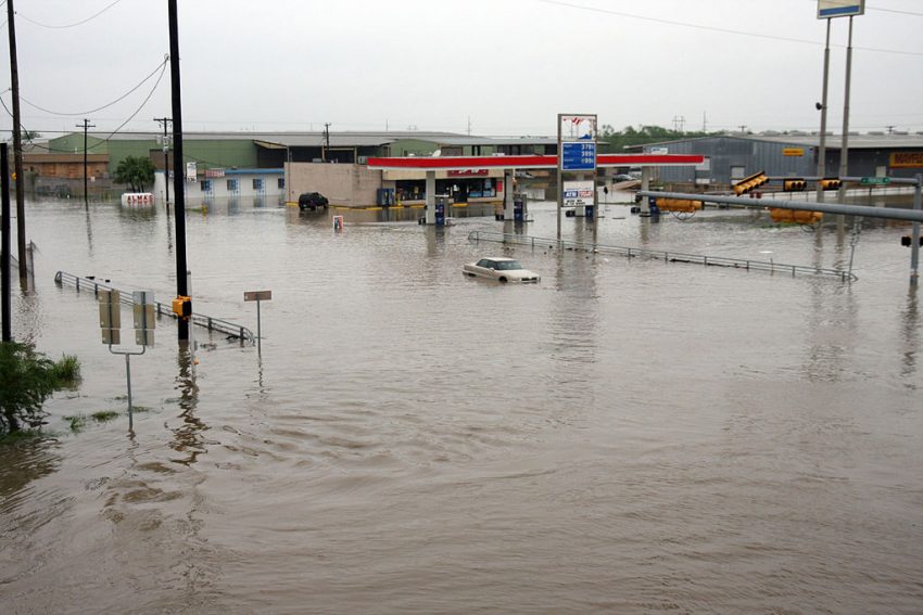
We’re approaching the end of an active Atlantic hurricane season. Fall colors are descending further and further south. Frost and freeze warnings are in effect for much of the Mid-Atlantic and southern New England. We’re even seeing a bit of snow over the mountains. But what kind of weather can we expect as we move into the 2018-19 winter season?
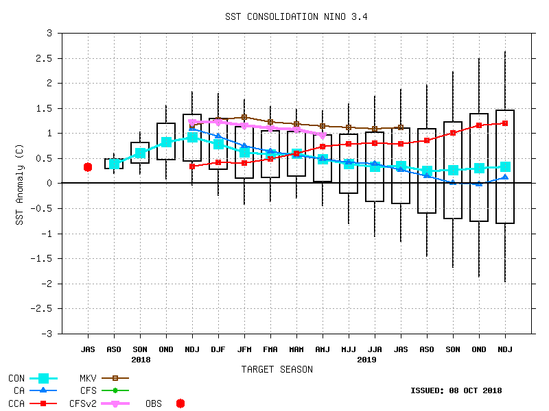
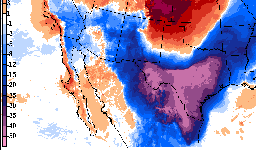
Wintertime weather patterns across the U.S. are typically influenced by the El Nino – Southern Oscillation (ENSO). ENSO is a variation in sea surface temperatures in the eastern Pacific. This cycle of warming and cooling ocean waters in turn affects temperature and precipitation over much of the globe. Model guidance and other signals for the next several months continue to suggest we’re heading towards a weak El Nino, the warm (positive) phase of the ENSO (see graphic above).
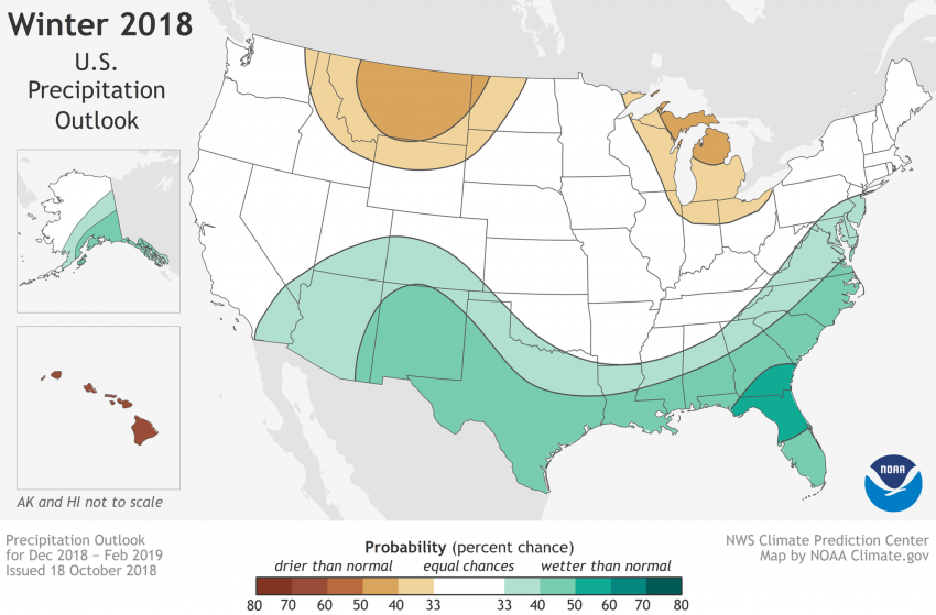
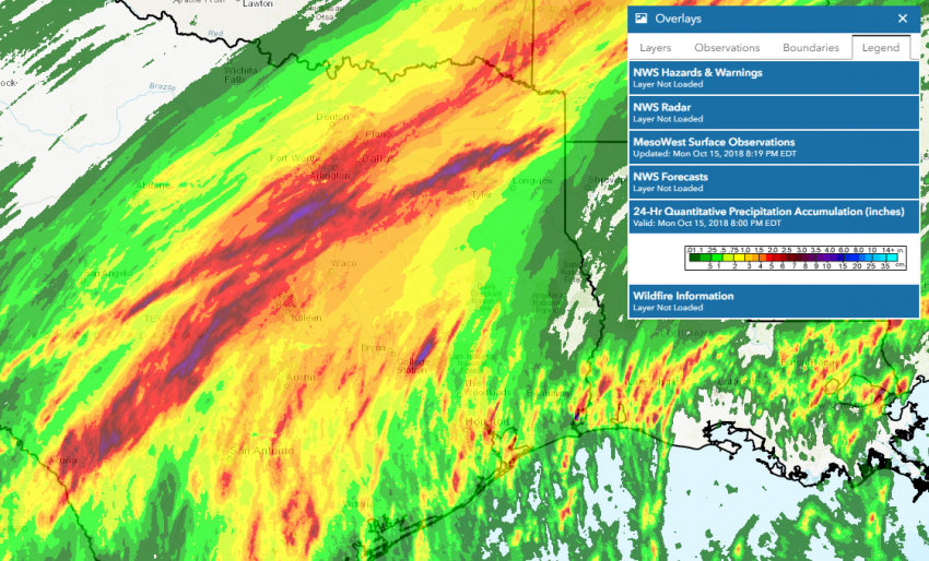
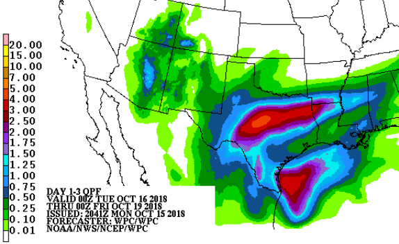
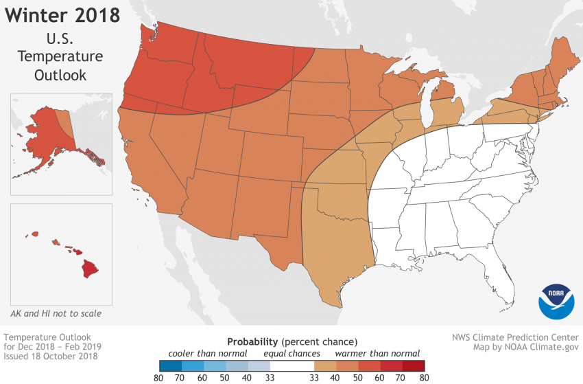
Over the U.S.A. the El Nino is typically associated with an active southern jet stream. More and stronger disturbances pass across the southern tier. This storminess combined with above-normal water temperatures in the Gulf should result in above-normal precipitation across the southern states (see map above). This active southern tier and a typically fast, zonal upper level flow pattern may also limit the intrusion of frigid Arctic air into the States. Warmer-than-average temperatures would be likely over many areas (see map below).
Of course, long-term trends in precipitation and temperature don’t necessarily have much bearing on snowfall forecasts. For instance, an active southern jet stream can lead to more snow than usual over portions of the Appalachians and Northeast, despite the expectation of normal to warm temperatures.