Heavy Rains and Winds Target Eastern Queensland Later This Week
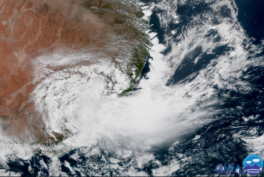
The remnants of Tropical Cyclone Owen will push slowly towards the Queensland coast in the next several days. The cyclone has weakened and is now just a tropical low. However, moist onshore flow colliding with the hilly terrain of eastern QLD will produce torrential rainfall through early next week.
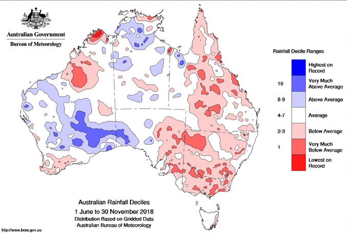
Much of Queensland has seen below normal precipitation over the winter and spring (see graphic above). These dry conditions have contributed to massive wildfires in the past few weeks, leading to thousands of home evacuations and school closings. In that context, any steady rain will be welcome.
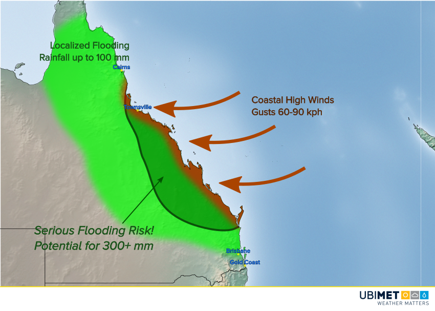
However, the rain may come too much, too fast in east-central sections. Our models are uncertain about the exact track of the remnant tropical low. Some carry it north towards the Cape York peninsula, some south towards southeast QLD. Rainfall and winds will be heaviest south of the low. Models do agree that a large area will see upwards of 300 mm late this week through Monday. Strong winds will also affect mainly the exposed coasts with gusts to 90 kph. Watch for rough surf as well along the entire coast of Queensland. Lead photo courtesy flickr user shebalso.