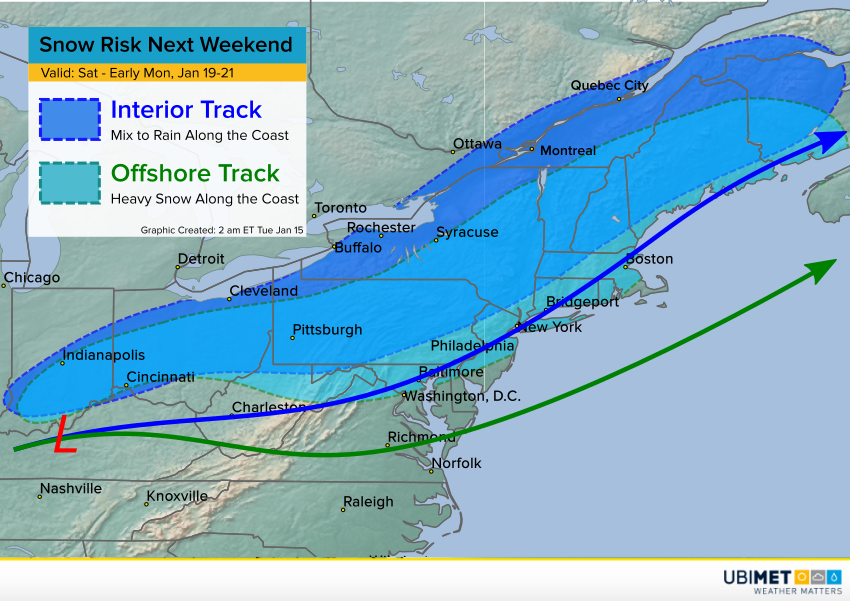
Big Winter Storm Headed for the Northeast U.S. and Maritime Canada!
The storm that we first suggested on Monday continues to look likely. The models have trended towards a more northerly storm track that would drop the biggest snows over interior sections of the Northeast. The big cities aren’t out of the woods yet, though. We’re still several days away and it wouldn’t take much of a shift to bring the bullseye to the coast.
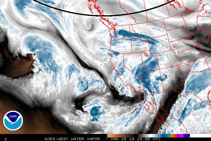
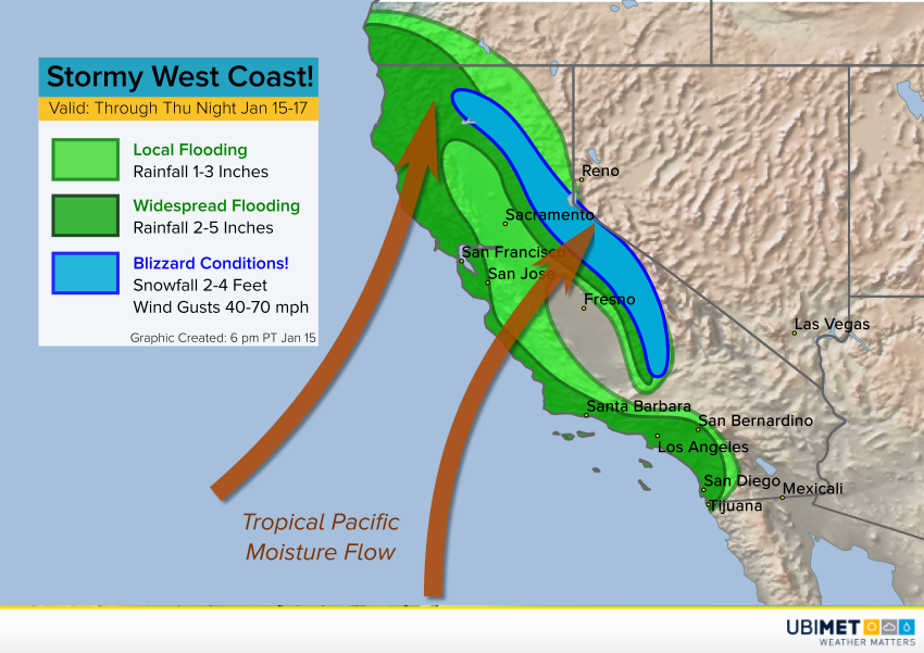
Two upper level systems will merge late in the week to produce the big storm. One is entering the West coast tonight; the other will dive down from the Canadian Arctic. The northern system will bring with it not only the winter storm potential but also a shot of frigid Arctic air that will dominate the central and eastern sections of the country well into next week. Snow will develop from the Midwest into the central Appalachians and the Northeast from Saturday into Saturday night. Initial snows will likely change to rain along the immediate coast, including the major coastal cities. Just inland, snow will mix with sleet and freezing rain. A dangerous accumulation of slick ice will present a major hazard for travelers over these interior sections through Sunday.
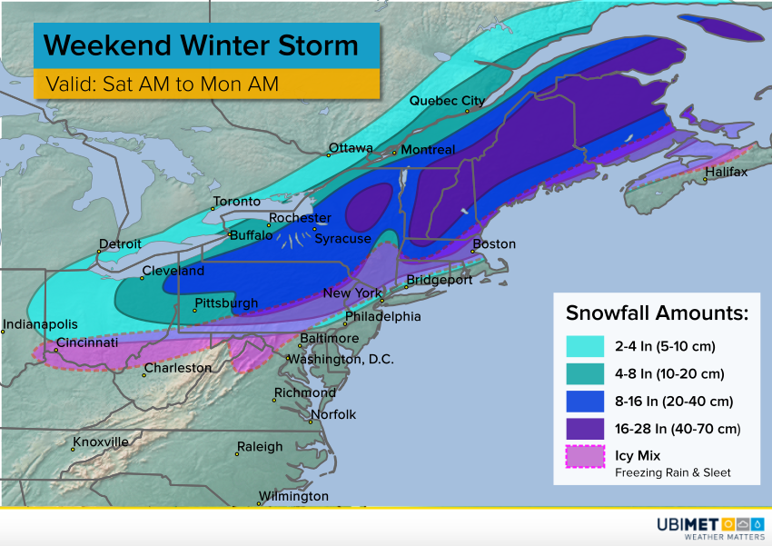
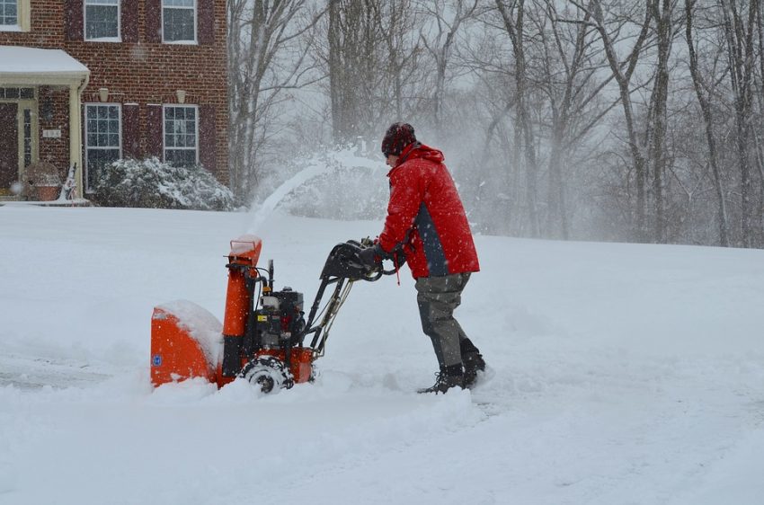
Inland from the mix, precipitation will fall as mainly snow. The snow will be quite heavy starting Saturday night over parts of Pennsylvania and New York, then Maine into Canada on Sunday and Sunday night. Rates will approach 1-2″ (2-5 cm) per hour in this time frame. The heaviest storm totals of 16-28 inches (40-70 cm) will occur mainly over the mountains of interior New England and into adjacent portions of New Brunswick. These heavy snows will be accompanied by high winds, leading to near-blizzard conditions with drifts of several feet. Travel will become virtually impossible Sunday! Stay tuned to your local weather provider or morecast.com for the latest updates.