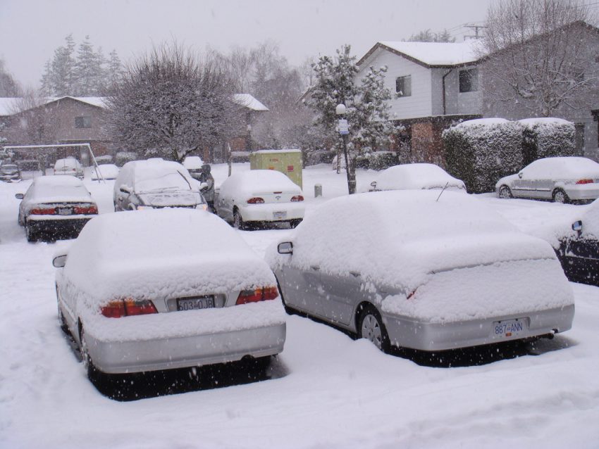
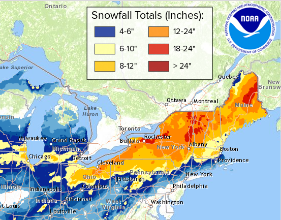
Powerful Arctic Surge to Invade the Upper Midwest and Great Lakes Next Week!
Winter has taken a firm grip on much of the Midwest and East through the last few weeks. The map below shows temperatures from four to as much as ten degrees colder than normal over portions of the Upper Midwest, Great Lakes, and Northeast in the last week or so. However, the coldest air of the season could be poised to descend on these regions early next week.
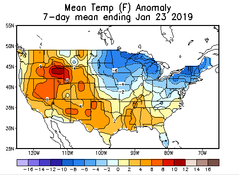
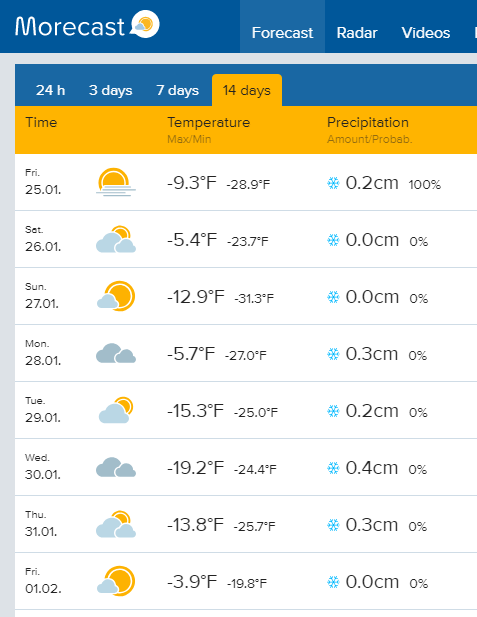
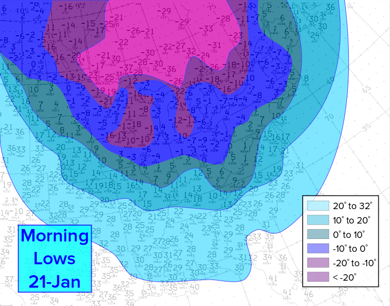
A steady supply of frigid Arctic air is streaming down from the high latitudes towards central and eastern portions of the Lower 48. A large, deep upper level trough is providing the pipeline. One last batch of this Arctic air will move into the Upper Midwest early next week, spreading across the Great Lakes and Northeast by mid-week (see animation at top). Many areas will stay well below zero ˚F (-18 ˚C) for several days. In the case of International Falls, MN, at the border with Canada, the streak of subzero temperatures could reach eight or nine days (see forecast graphic below). Some locations will see record-threatening morning lows as low as minus 45 ˚F (-43 ˚C)! Needless to say, cold of this magnitude is dangerous and potentially deadly. Fortunately, it appears that the pattern will change with warmer weather likely the week after next.