Midwest and Eastern U.S. Broiling in Record-Breaking Heatwave

A massive dome of extreme heat has enveloped central and eastern portions of the U.S. in the last few days. Numerous major cities have set daily and even monthly high temperature records, putting a significant strain on water and power resources across these regions.
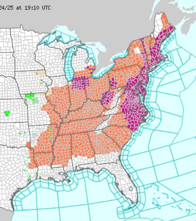
The heat built first over the Upper Midwest and Great Lakes on Sunday. Minneapolis saw a high of 96 deg F (35.6 deg C) on Sunday, setting a new daily record, while Chicago set a new record for warm overnight low Sunday night. The heat dome spread east for Monday and Tuesday, encompassing all the major cities along the Urban Corridor. At one point over 150 million Americans were under heat advisories or Extreme Heat Warnings (see image above). New monthly high temperature records were set in Boston, Massachusetts (102 deg F / 38.9 deg C), Providence, Rhode Island (100 deg F / 37.8 deg C), New York, NY (102 deg F / 38.9 deg C), and Newark, New Jersey (103 deg F / 39.4 deg C). Heat index values soared well into the 110s, greatly escalating the risk of heat stroke for anyone spending time outdoors.
Video captured the moment a road buckled and sent a car flying as a heatwave impacted Missouri on Sunday. pic.twitter.com/wPVLrk3XZY
— AccuWeather (@accuweather) June 23, 2025
The overwhelming strain on power grids caused thousands to lose power in several states, a significant danger when air conditioning is so essential. Rail commuters faced major delays as extreme heat caused significant speed restrictions due to the danger of track warping. The heat even caused hazardous buckling in roadways (see video above).