Record-Breaking Arctic Air Chills Midwest, Northeast USA!
A frigid Arctic air mass has settled across the northern tier from the Upper Midwest to the Northeast. Temperatures have plummeted to record-breaking low levels in multiple states. Unfortunately, the cold temperatures have proven deadly in some locations.
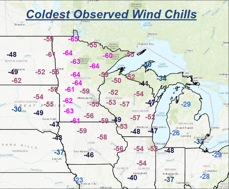
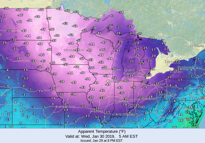
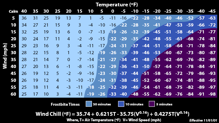
The initial surge was accompanied by gusty winds over the Upper Midwest on Tuesday night into Wednesday. That allowed wind chills to fall below minus 60 °F over a wide area (see map above provided by NOAA’s Weather Prediction Center). As we explained on Tuesday, wind chills of this magnitude will cause frostbite of exposed skin within a few minutes.
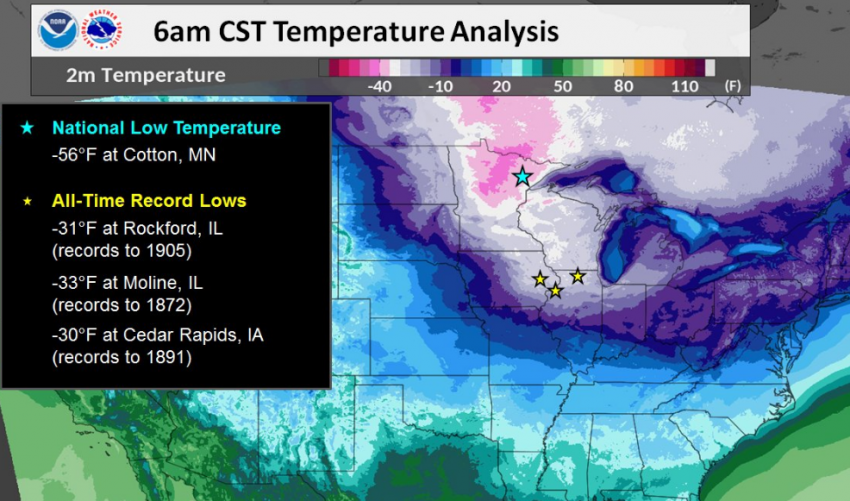
Winds diminished Wednesday night into Thursday morning. This reduced the magnitude of the wind chill, but allowed actual temperatures to bottom out. The map below shows Thursday morning low temperatures. At least three sites in Iowa and Illinois reported their lowest temperature readings ever. A trained weather observer in Mt. Carroll, IL reported a low of minus 38 °F. If officially verified, it would be the coldest temperature ever reported in the state of Illinois! The coldest low of the morning was in Cotton, Minnesota, at minus 56 °F, only four degrees from a state record there.
Some noteworthy impacts of the historic Arctic surge:
- At least 7-10 deaths have been blamed on the extreme cold. A student of the University of Iowa was found unresponsive behind an academic hall and was later declared dead at the hospital.
- Populations of the homeless and elderly are particularly vulnerable and the Chicago Transit Authority has turned some of their buses into mobile warming shelters.
- Rolling power outages affected large portions of the Midwest due to the extraordinary demand on the electrical grid.
- The governors of Michigan and Wisconsin both declared states of emergency and closed state offices.
- The U.S. Postal Service suspended delivery operations in some areas.
- Thousands of flights have been delayed or cancelled, especially in and out of Chicago’s O’Hare International, where Wednesday morning temperatures came within a few degrees of the all-time record low.
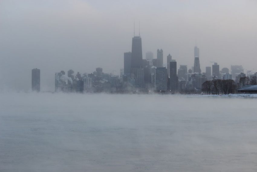
Lead photo courtesy flickr contributor Edward Stojakovic