Tropical Cyclone Oma Threatens Eastern Australia Late Week!
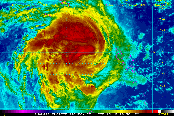
Massive Cyclone Oma has spent the last several days sideswiping the islands of Vanuatu and New Caledonia. A large area of open ocean is in the storm’s immediate path. Unfortunately, mainland Australia could be on the target list for late this week. Residents from northeast New South Wales to coastal Queensland should be vigilant.
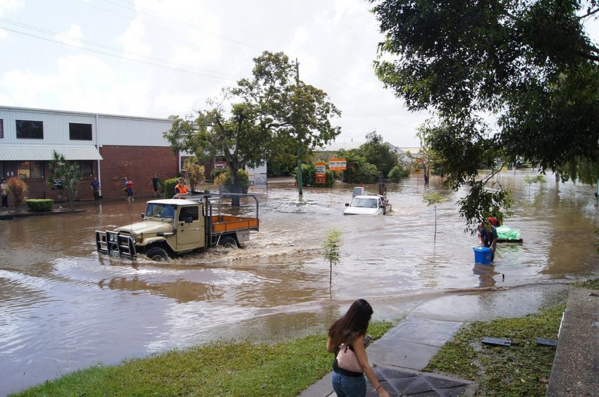
Streets flood as Cyclone Oma approaches south-east Queensland https://t.co/DAKQ5zp9lC
— noel cole (@aussiecoley) February 20, 2019
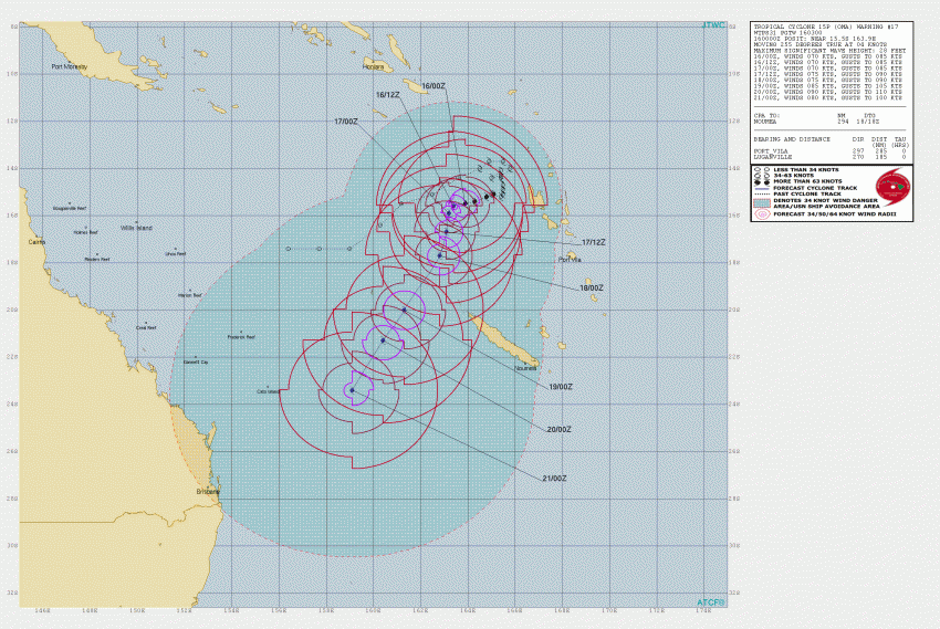
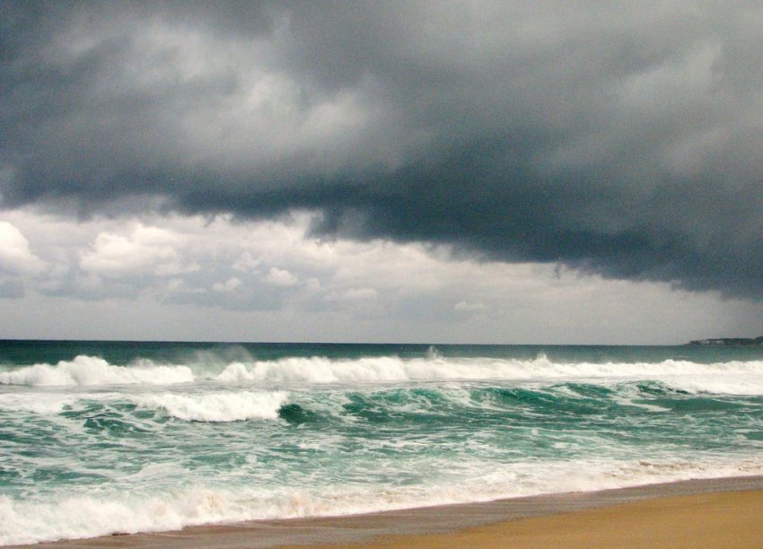
Oma is a very large storm generating large waves and higher tides that are already causing significant beach erosion and coastal flooding along the east coast of Australia. The cyclone will continue to move slowly southwest over the next few days. The models diverge, however, as we approach this weekend. Weak steering winds aloft mean a number of different potential tracks. Some models take the storm southeast and back out to sea. Others move it northeast, paralleling coastal Queensland, while others threaten southeast QLD with a landfall (see graphic below).
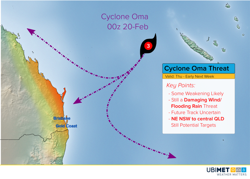
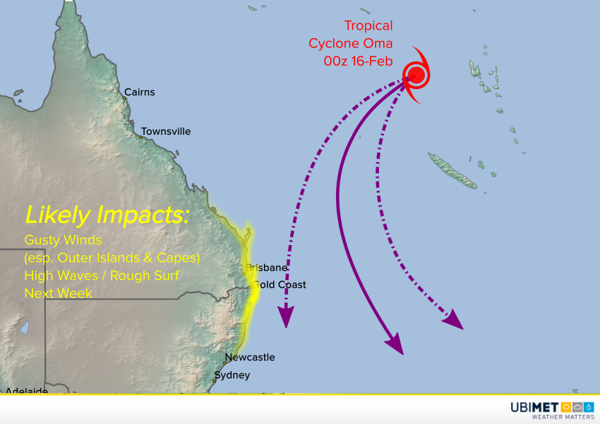
Another uncertainty is the intensity of the storm. Water temperatures in the storm’s path are a bit cool to support a major cyclone and some weakening is likely. However, Oma could also become a hybrid tropical/non-tropical system that would spread potentially damaging winds over a larger area. Even the most optimistic offshore model solutions now bring significant weather to the coast. Winds will be on increase for the outer islands and capes as early as Thursday night with flooding rainfall likely by this weekend. We’ll have additional updates in the next few days as this dangerous situation unfolds! Lead photo courtesy flickr user Ana Rodriguez Carrington