Severe Storms Rip Across the Plains Monday to Early Tuesday!

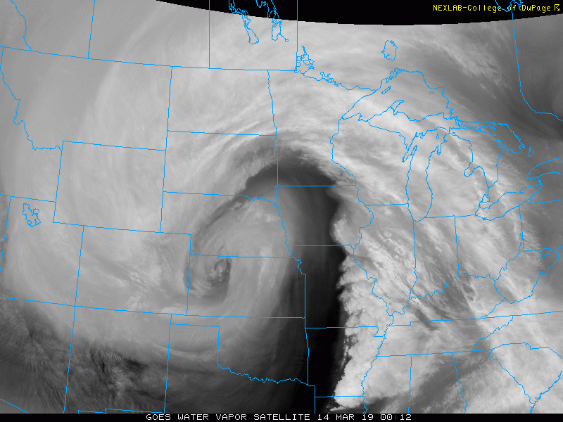
An unusually strong upper level low spun out of the Southern Rockies on Monday. It encountered plenty of warm Gulf moisture over the Southern Plains, setting the stage for a classic spring severe storm outbreak.
Some of the most incredible videos we receive are from the viewers, right outside of their homes! This is a video of the Mangum tornado earlier today from Dawson Henry. @kfor #okwx pic.twitter.com/iW3KyofNkp
— Emily Sutton (@emilyrsutton) May 20, 2019
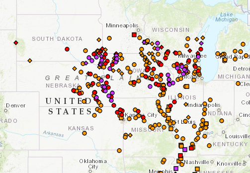
The ingredients were all there for dangerous severe cells. Strong upper level winds rolled over a very warm, moist near-surface environment. There was also plenty of cyclonic spin to help generate supercells capable of producing tornadoes and giant hail. Conditions were so favorable, in fact, that the Storm Prediction Center (SPC) issued a rare “high-risk” severe outlook for the day, the first time in two years that such a forecast has been warranted.
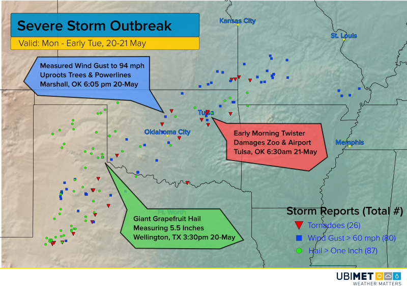
A few isolated severe cells flared during the morning hours, but the outbreak really accelerated in the mid-afternoon. Numerous reports of hail larger than two inches (five cm) were reported, including a stone that was 5.5 inches wide (11 cm) at Wellington, TX! Wind gusts with the stronger squalls reached 70-90 mph (110-140 kph). Many of the cells also produced tornadoes well into the overnight hours, one of the most dangerous weather situations. A tornado moved very close to Tulsa International Airport just past 6:30 am Tuesday morning, causing some damage to the neighboring zoo. Officials quickly reassured concerned citizens that no animals were harmed!

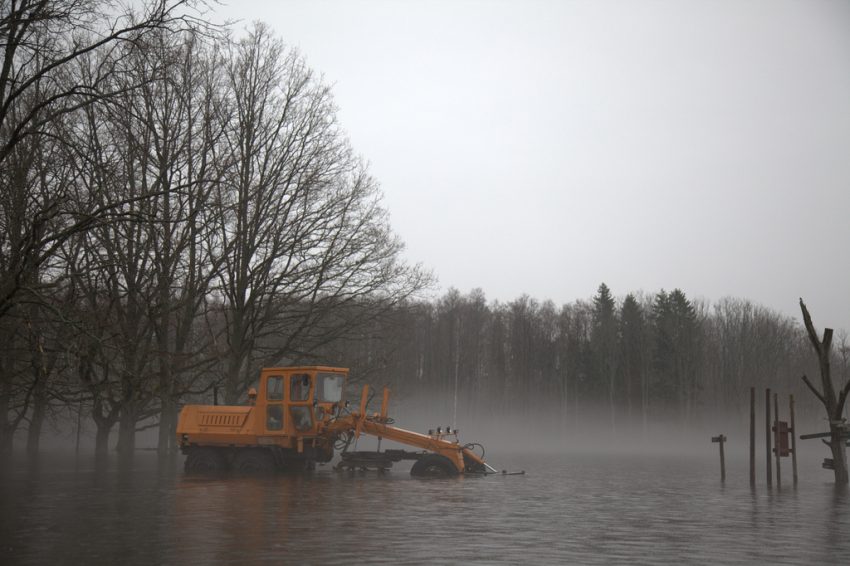
Persistent heavy rains also created flooding problems across portions of Oklahoma, Kansas, and Missouri that are still ongoing as of Tuesday evening. Much of the region has seen 4-8 inch (100-200 mm) rains since Monday morning. The latest round of heavy rains have contributed to totals 5-6 times higher than normal so far in May. Numerous road closures and emergency water rescues were necessary. Record-breaking river flooding is likely in the coming days as runoff flows into larger streams and rivers.
Troop W is up in the Skiatook area getting ready to go out in an air boat. Residents of 5 different homes are waiting to be rescued from the high flood waters. pic.twitter.com/Q2YdKJCiPK
— OK Highway Patrol/DPS (@OHPDPS) May 21, 2019