Deadly Two-Week Tornado Outbreak Across the Central USA!
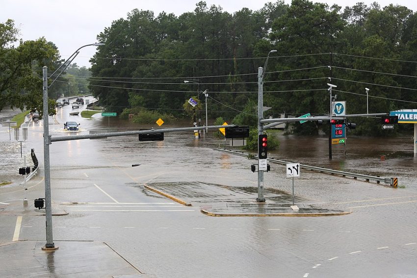
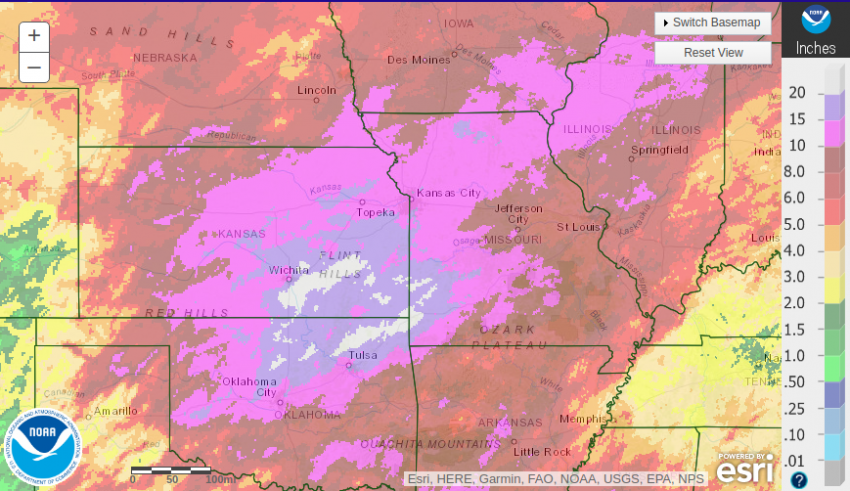
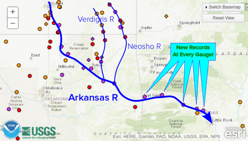
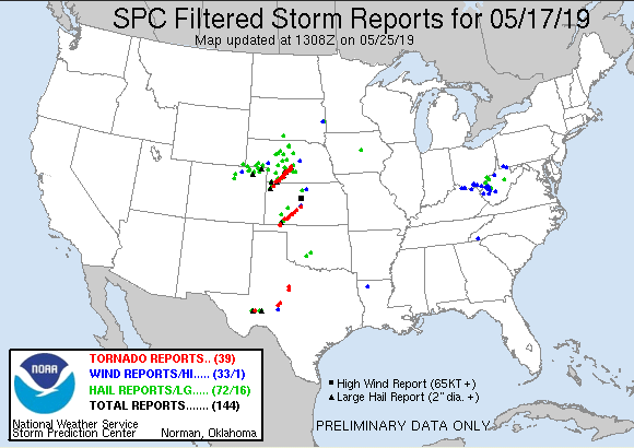
A pattern of rich, warm Gulf moisture surging into an area of strong upper level winds over the Plains and Midwest has persisted since mid-May. The result has been waves of severe storms developing on a daily basis, hammering the same regions time and time again. These severe cells have put down over 200 tornadoes in the past two weeks.
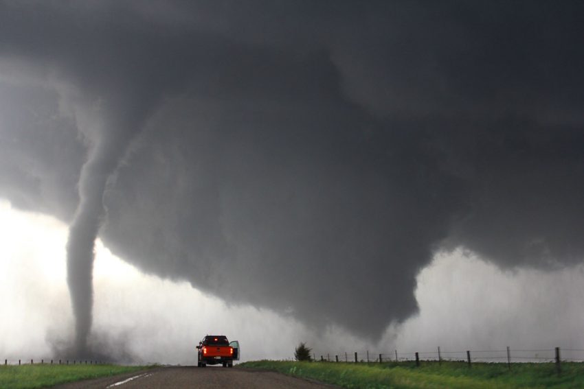
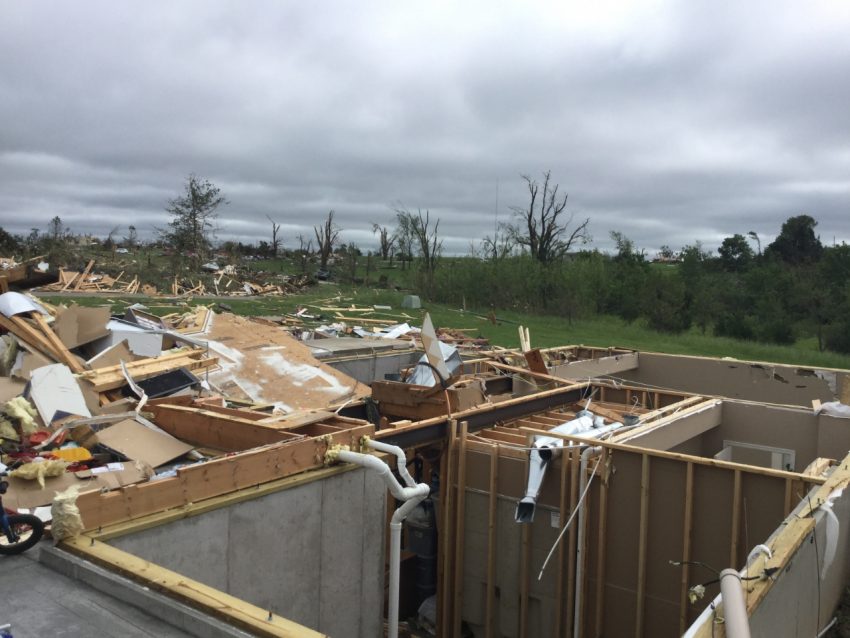
The record for consecutive days with at least eight tornado reports was broken on May 28th. More tornadic storms on Wednesday (29-May) extended the record to 13 days. Of these tornadoes, 47 have been classified as EF-2 intensity after careful analysis by National Weather Service meteorologists. The EF (Enhanced Fujita) scale is based on the nature and severity of the damage the tornado causes. Those rated EF-2 and EF-3 are considered “strong” tornadoes, while EF-4 and EF-5 rated twisters are classified as “violent”. Only one tornado so far in the outbreak has been rated EF-4, the one that leveled Linwood, Kansas on Tuesday (28-May). However, even EF-2 and EF-3 tornadoes produce devastating wind speeds of 111-165 mph (180-265 kph)!
@ReedTimmerAccu right in our backyard last night. Linwood, KS. Awful destruction. pic.twitter.com/utWwLaW1Ww
— Luke Terrell (@LTerrell10) May 29, 2019
Aerials showing the #tornado destruction across Linwood, KS Video courtesy of @Johnny_Rowlands at @kmbc #KSwx #severe pic.twitter.com/JMEMs4Pk0M
— Mike Seidel (@mikeseidel) May 29, 2019
This outbreak has been historic not only for its persistence, but for the major population centers that have been directly impacted. Over the past few weeks the following cities have been hit by EF-3 storms:
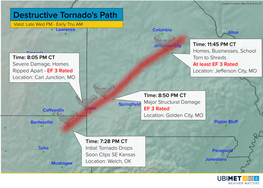
- Jefferson City, MO (pop 42,838) on 22-May
- Dayton, OH (pop 140,640) on 27-May
- Lawrence, KS (pop 96,892) on 28-May
The Jefferson City and Dayton tornadoes were made all the more dangerous by the fact that they struck late in the evening, potentially catching some residents asleep and off-guard. Damage estimates are still being tallied, but costs will likely run at least into the tens of millions of dollars. One saving grace has been that warnings have been timely and accurate from the National Weather Service. As a result, despite the devastation to homes and businesses, relatively few lives have been lost, likely less than ten for the entire outbreak.