Tropical Disturbance Has Gulf of Mexico Residents on Edge

An area of low pressure, which began as a cluster of thunderstorms over the Midwest several days ago, has now drifted into the northern Gulf of Mexico. Although it has not yet developed a defined center of circulation, the ingredients are coming together for significant strengthening. By the late week or this weekend, a tropical storm or even hurricane could be menacing the Gulf coast!
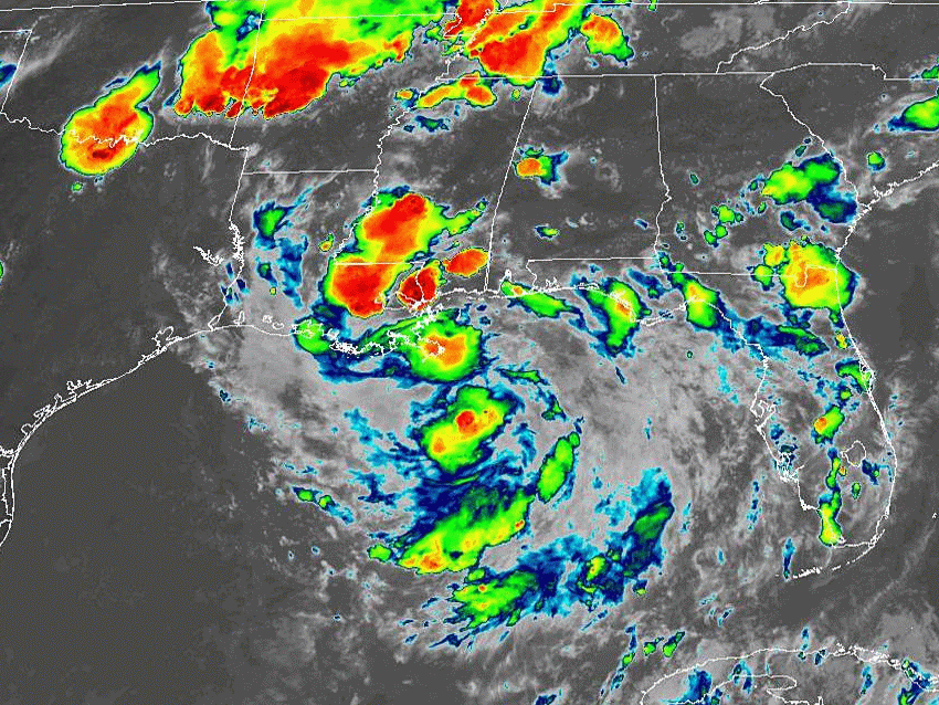
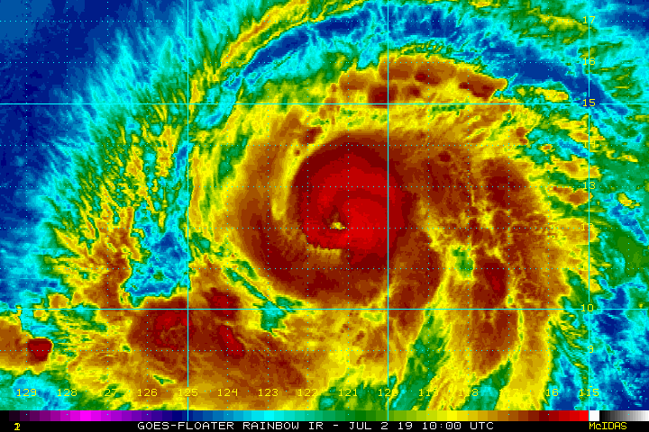
The low pressure area has a decent presentation on satellite imagery (notice the swirl of clouds in the animation above). It’s already producing torrential rains along the Gulf coast. These rains will continue to cause serious flooding issues as the low moves slowly west over the northern Gulf. Water temperatures in this area are very warm, in the upper 80s deg F (lower 30s deg C). Upper level winds are also quite favorable for tropical cyclone development. If the system can organize a bit more in its core, these ingredients will enable rapid intensification.
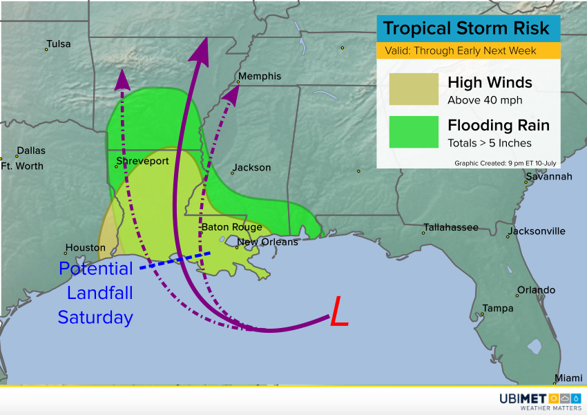
Model guidance is still somewhat undecided since the system remains poorly organized. Some guidance brings the storm to the west, some to the east. Likewise, intensity forecasts vary. However, there is starting to be some agreement on a track initially towards the west and then eventually north. A potential landfall looms along the coast of Louisiana by Saturday. As long the center organizes sufficiently into Thursday, that still leaves a 36+ hour window for rapid intensification. Some models even suggest the system could be a hurricane by early Saturday. Regardless of whether it’s a weak hurricane or a strong tropical storm, significant impacts can be expected in the form of flooding rains, damaging winds, and a life-threatening storm surge. The map above shows the area likely to see wind and rain hazards.