Deadly Heat Wave Spreading to the East Coast for the Weekend!

The first major heat wave of the summer is affecting the Plains and Midwest. By late this week into the weekend, the scorching hot air mass will spread east. Cities in the Urban Corridor will see heat index values well above 100 deg F!
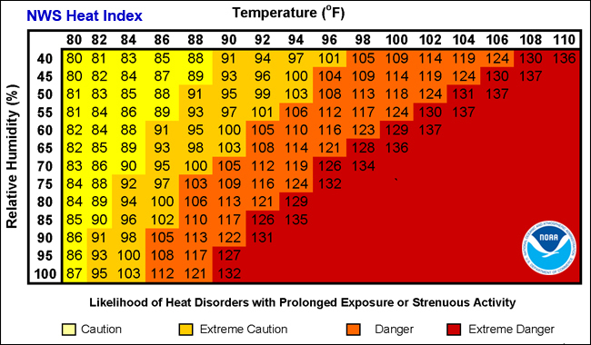
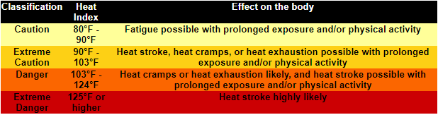
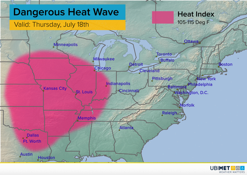
A dome of strong high pressure has helped push air temperatures well above normal over much of the U.S. Meanwhile, a surge of tropical moisture originally tapped by now-extinct Hurricane Barry has encompassed much of the central and eastern states. This combination of hot temperatures and high humidity results in dangerous heat index values. Studies have shown that heat index values above 105 deg F greatly increase the risk of serious health impacts (see chart above). These include heat stroke, which can be fatal especially in the population of elderly and infirm. As you can see from the map below, this threshold will be passed over a large area of the central and eastern U.S. from Thursday through Sunday. Some areas will see peak heat index values of 115 deg F or higher! In urban areas like New York City, heat retained by the vast amount of asphalt and concrete will mean overnight temperatures staying warm. This is critically important as the human body requires recovery time between hot spells, especially those in vulnerable populations like the elderly. Indeed, extreme heat events are the deadliest among all weather events, killing more people annually than floods, tornadoes, or hurricanes.
Many areas have seen excessive heat warnings and advisories issued by the National Weather Service. More will be needed for the Thu-Sun time frame. Officials in some communities are going door-to-door to make sure vulnerable residents have supplies and shelter options as needed. Saturday looks to be the hottest day from the Mid-Atlantic to southern New England with some cooling likely beyond Sunday.