Latest Winter Storm Brings Rare Tornado to Los Angeles


The stormy late-season pattern continues in the western U.S. The latest storm brought more flooding rains and mountain snows. It also spun down a rare tornado in the L.A. Basin, damaging buildings and cars. On a positive note, the abundant rainfall has refilled numerous lakes and reservoirs in the region that had been decimated by drought in recent years. Springtime snow melt will bring additional flooding potential and lake replenishment.


The tornado, rated EF1 after a survey by the National Weather Service damage assessment team, was the strongest to hit the Los Angeles metro area in forty years. Tornadic winds up to 110 mph (177 kph) tore roofs from a dozen buildings and destroyed several cars (see video above). It was the second tornado to hit southern California in the past week. The same system brought damaging winds to mountain communities just south of San Francisco after rapidly intensifying just offshore (see video below). At one point more than 700,000 Californians were without power due to the storm.


The active weather pattern has actually been beneficial for many parts of California and neighboring states. Snowpack statewide is running nearly twice as much as normal and some ski resorts are making plans to remain open through July. Indeed, some resorts have gotten so much snow that lifts are unable to run (see video below). One station near Lake Tahoe in the Sierra Nevada range has reported 677 inches (17.2 m) of snowfall this winter.


Brutal Heat Wave Torches Northern and Central Argentina


The hottest summer on record in portions of Argentina has not ended with the calendar start of autumn on 1-March. The first ten days of March saw temperatures soaring up to 10 degrees C warmer than average. Record highs have been recorded again and again across the country. The hot, dry weather has sparked numerous wildfires, burning nearly 250,000 acres (100,000 hectares) of forest and farmland since the beginning of the year.


Years of below normal rainfall set the stage for unusual heat coming into the summer. The three-years-long La NiΓ±a also contributed to below normal rainfall and above normal temperatures. However, the heat wave this summer is unprecedented. The capital city of Buenos Aires has seen highs exceeding 30 deg C (86 deg F) every day since 28-February, including their hottest March temperature ever this past Monday. Numerous other cities and towns have seen record highs exceeding 40 deg C (104 deg F).


Corn, soybean, and wheat crops have taken catastrophic losses up to 30% due to the heat and wildfires. This will exacerbate economic woes in a country already seeing one of the world’s highest rates of inflation, more than 100% according to the latest figures. Farmers project losses up to $14 billion.

Frigid Winter Storm Blasts the Western U.S.


A strong winter storm is raking the west coast of the U.S. with historic cold and wind. Snow has been over lower elevations totally unaccustomed to seeing flakes fly, including Las Vegas and parts of the Los Angeles Basin. At the lower elevations, torrential rain is producing devastating flooding and landslides. Gusty winds are combining with rain-loosened soils to fell powerlines and trees, leaving nearly a million residents in the dark.


The storm first affected portions of Washington and Oregon. As temperatures plummeted, heavy rain changed to snow even as low in elevation as the Oregon coast (see video above). Nearly eleven inches (28 cm) of snow accumulated Thursday in the city of Portland, the second-snowiest day on record. The surprise snowstorm stranded thousands of motorists, some of them stuck for up to 13 hours trying to get home. This was followed by record cold temperatures early Friday morning.


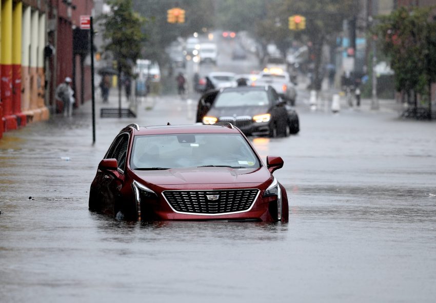
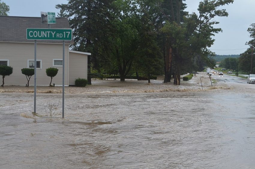
A band of rich tropical moisture is shifting south tonight with the storm into Southern California. Up to seven inches (178 mm) of rain has already fallen in the L.A. Basin, leading to flash flooding and swelling rivers (see above). As the powerful cold low approaches, snow levels will be falling. The highest peaks above 4,000 feet (1,219 m) will see several feet of accumulation through this weekend. Elevations as low as 1,000 feet will see significant accumulations of wet, heavy snow, putting pressure on trees and powerlines. Winds will also be gusting as 75 mph (120 kph), leading to dangerous whiteout conditions. This has prompted the National Weather Service office in Los Angeles to issue its first blizzard warning since 1989, while the San Diego office issued its first ever. These dangerous conditions will shut down major travel arteries across the region, including Interstates 5 and 81.

State of Emergency for Northern New Zealand as Cyclone Gabrielle Roars Through


For just the third time in the nation’s history, New Zealand has declared a national state of emergency after Cyclone Gabrielle rolled across the north. The worst cyclone in a generation has swept roads and bridges away, cutting off whole communities and swallowing homes and businesses. Three fatalities have been reported so far, but more are missing and thousands have been forced out of their homes and communities.


Gabrielle began to approach northern New Zealand over the weekend. Unfortunately, the storm slowed to a crawl as it entered the Bay of Plenty. Prolonged high winds gusting up to 150 kph (93 mph) knocked down trees and powerlines and took roofs off of some houses. At one point 250,000 residents reported being without power. Considering the massive damage to infrastructure, it will probably be days or weeks before power is restored to all residents.


Bands of torrential rain pounded the northern islands for at least 48 hours. Numerous stations reported rainfall exceeding 400 mm (15.7 in) (including 488 mm, or 19.2 inches, at Hikuwai).Β  As a result, numerous rivers have burst their banks, setting new record levels and inundating whole towns. Some residents reported having to flee to their rooftops to escape the flooding. Several major bridges have been destroyed, severely restricting rescue and recovery efforts to isolated communities. This cyclone strike comes only two weeks after crippling rain and flooding across much the same region.