Devastating Winter Storm Claims Dozens of Lives in Iran, Pakistan and Afghanistan
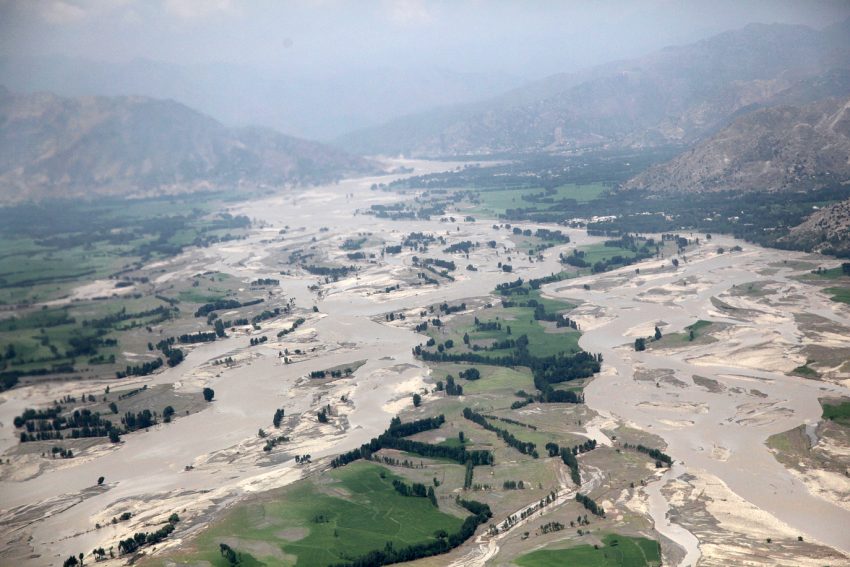
A brutal winter storm has dumped heavy rains and snows over portions of southeast Iran, southwest Pakistan and southeast Afghanistan. Heavy, wet snow accumulations up to 15 cm have overloaded roofs, leading to deadly collapses. Torrential rains have turned rivers into raging rapids, flooding vast regions and destroying hundreds of homes. At least 54 deaths have been attributed to the severe weather.
Quetta Baluchistan, Pakistan
Snow fall @ beauty . pic.twitter.com/zY0CrtagZP— Bogar khattak (@Bogar_Khattak) January 12, 2020
The volume of floods in some villages of Sistan and Baluchistan is so huge that one village has disappeared.
A spokesman for the emergency department of Iran said the flood had so far left two dead and two injured. pic.twitter.com/SgIc5VNiuq— Alireza KeshavarzChoobeh (@keshavarzchoobe) January 12, 2020
Quetta Baluchistan, Pakistan
Snow fall @ beauty . pic.twitter.com/zY0CrtagZP— Bogar khattak (@Bogar_Khattak) January 12, 2020
Temperatures in the Afghani capital of Kabul plunged down to minus 15 deg. Hundreds of drivers struggling to get to work were forced to abandon their cars on the snow-packed roads. Officials are scrambling to reopen highways closed by the heavy weather despite a continued threat for avalanches and landslides. The flooded rivers have compromised roadways and bridges, hampering efforts to move much-needed supplies to the devastated areas. Thousands have been evacuated from threatened communities with thousands more cutoff and isolated by the high waters.