Tropical Storm Fay Makes Landfall in New Jersey!
After just becoming a named storm on Thursday afternoon, Tropical Storm Fay made landfall along the coast of New Jersey on Friday afternoon. Fay, the sixth named storm of the 2020 Atlantic Basin hurricane season, has broken the record for the earliest in a season that a sixth storm has formed. This record is just the latest in a series of broken records for the already active 2020 season. The previous record for earliest sixth storm formation was set on July 22, 2005 with Tropical Storm Franklin.
#Fay has made landfall near Atlantic City, NJ. Fay is the first named storm to make landfall in New Jersey since Tropical Storm Irene in 2011. Sandy (2012) was officially post-tropical at landfall. #hurricane pic.twitter.com/YN22sDnjXk
— Philip Klotzbach (@philklotzbach) July 10, 2020
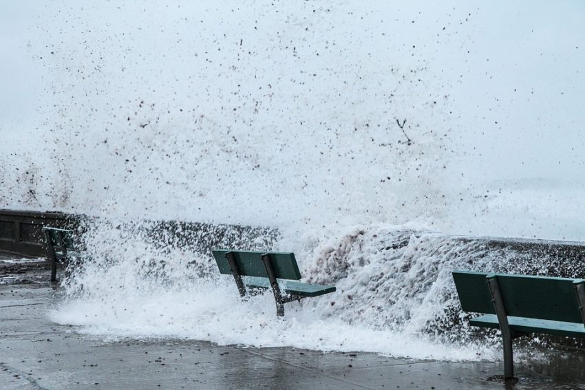
Fay has brought flooding rains, along with gusty winds, and high surf up and down the Mid-Atlantic coast from Maryland to New York. Although the highest wind gusts over land did not exceed 60 mph (97 kph), peaking at 57 mph (92 kph) in Manasquan, New Jersey, they have proven strong enough to bring down trees and power lines throughout the area. This had led to thousands of power outages across portions of New Jersey and Delaware.
Heavy rain and wind hit New Jersey, as Tropical Storm Fay moves north, causing a warning to be issued for the entire New Jersey coast, New York City, Long Island and the Connecticut coastline. https://t.co/Wv9p7NLb4H pic.twitter.com/Uv6vG75HMn
— ABC News (@ABC) July 10, 2020
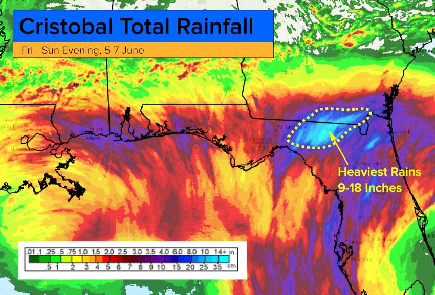
Rainfall amounts across the region have averaged between 2-5 inches (51-127 mm), with the highest total coming in at 5.84 inches (148 mm) in Mullica Hill, New Jersey. The heavy rain has led to widespread street flooding in cities such as Newark, New Jersey, and New York City. The flooding turned subway platforms in New York city into cascading waterfalls at numerous stations, including the famed Herald Square station.
#TropcialStormFay lashed the Northeast coast with high wind & #flooding downpours!
Persistent heavy rain form #Fay cause floodinging inside the 149th Street subway station in the Bronx on Friday! #NYwx pic.twitter.com/TjqfpNnvwN
— WeatherNation (@WeatherNation) July 10, 2020
In the Mid-Atlantic region of the United States, tropical systems do not occur very frequently, and when they do, it’s usually later in the season. The last two to effect the region were Irene and Sandy in 2011 and 2012 respectively. To have a storm form this far north in latitude, and strengthen, the way Fay did, is rather unprecedented. The fact that this happened in July is even more unusual.
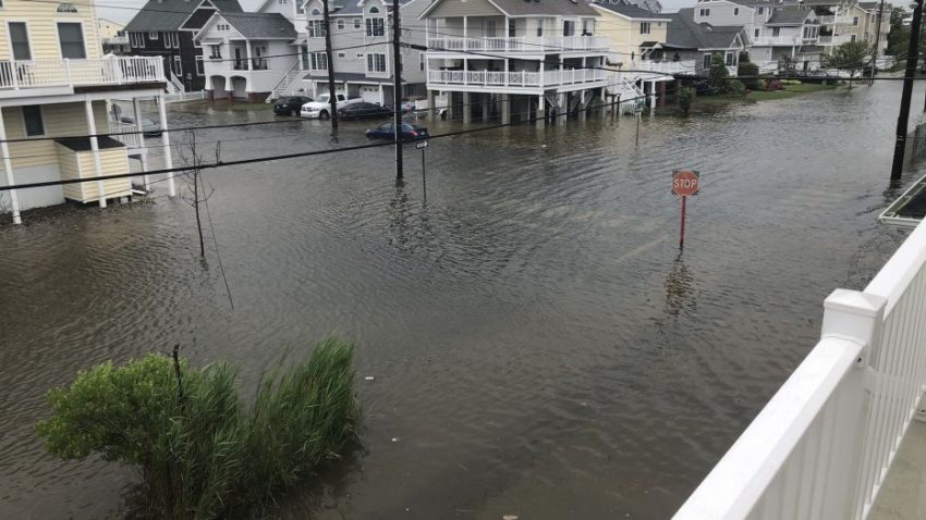
VIDEO OF FLOODING: Flood reported in Towns near shore like Sea of Isle in New Jersey – #Floods #SeaofIsle #NJ pic.twitter.com/drxm96szib
— Insider Paper (@TheInsiderPaper) July 10, 2020