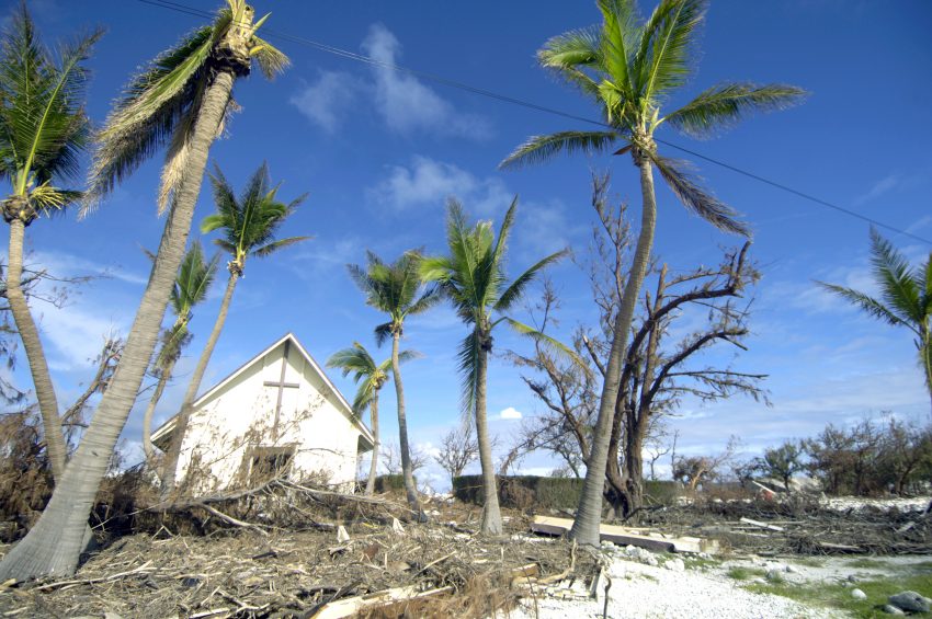
Hurricane Hanna Slams Southern Texas, but Douglas Spares Hawaii
Over the past three days, not one but two hurricanes threatened people and property in the United States. Residents of the Hawaiian Islands were lucky to escape any significant damage from Hurricane Douglas. However, Hurricane Hanna slammed directly into southern Texas and adjacent northeast Mexico. Major flooding and high winds caused significant damage.
This is a photo of water in Corpus Christi Bay covering the street on People’s Street at the marina (near where the Selena Statue is) in all my life I have NEVER seen water over this road…absolutely incredible #TxWx #HurricaneHanna #Hanna pic.twitter.com/2nGqAGOokq
— Hurricane Updates (@hurricaneupds) July 26, 2020
Calle Colón y Fco Morazán, centro de Santa Catarina
Ojalá que el taxista se encuentre bien 🙏
La corriente es demasiado fuerte#Hanna 🌀🌧️ pic.twitter.com/Or9GIRugoM
— Yari Edebaldo (@yari_trevino) July 27, 2020
HURRICANE #HANNA eye wall 90 mph sustained winds now with damage to boat park in Port Mansfield Texas. Eye wall will not give up here in PM. Waiting for eye. Tracking edge of eye calm on @RadarOmega_WX app #HurricaneHanna #Hanna pic.twitter.com/3bEg3ojiRz
— Reed Timmer (@ReedTimmerAccu) July 25, 2020
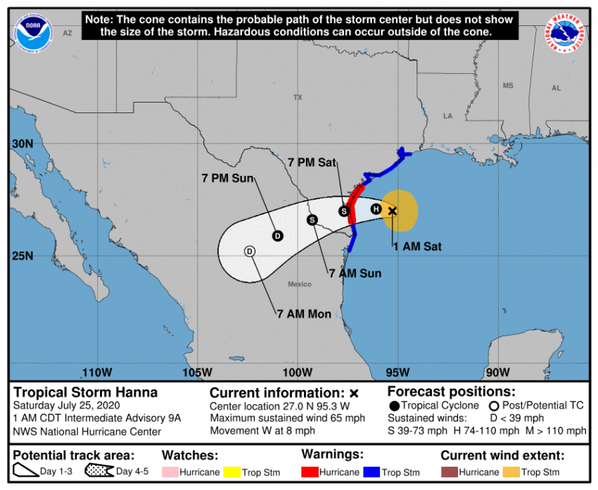
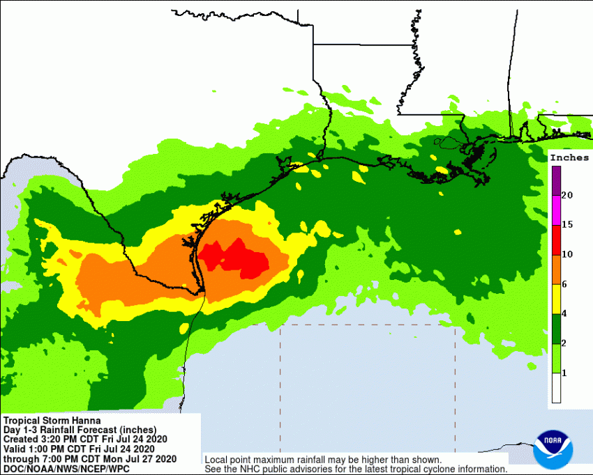
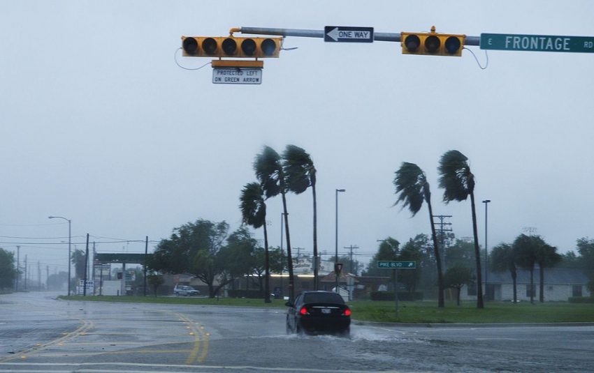
Hanna came ashore on Saturday afternoon after rapidly intensifying Friday night into Saturday morning. Torrential rainfall fell across southern Texas and the adjacent Mexican states of Tamaulipas and Nuevo Leon. Totals were generally 5-10 inches (125-250 mm) with locally higher amounts (14.35″ near Sullivan City, Texas). The highest winds were recorded at the coast, up to 103 mph (166 kph) at Rincon Del San Jose, Texas. Most inland areas saw gusts of around 60-70 mph (95-110 kph) but that was plenty enough to damage or destroy many mobile homes across the region. Power lines were knocked down across the region with outages which are expected to last through the rest of the week in some cases. Other homes reported flood waters entering the ground floors, and emergency services responded to numerous calls for water rescues from stalled vehicles.
Several brief tornadoes were embedded within the larger hurricane circulation. One of them struck the Brownsville International Airport, ramming a 737 passenger jet into the terminal wall, causing significant damage.
Here’s another look at #Hawaii‘s close call with Hurricane #Douglas via storm-centered Morphed Integrated Microwave Imagery at CIMSS (MIMIC-TC). More #HIwx #HurricaneDouglas info & imagery at https://t.co/xDmCoovIjo pic.twitter.com/TDLZn8kOBt
— UW-Madison CIMSS (@UWCIMSS) July 27, 2020
Fortunately, the story was different a few thousand miles to the west. Hurricane Douglas appeared to be a major threat for the Hawaiian Islands, holding strength despite repeated forecasts of weakening. Ultimately the storm turned a bit north and missed causing significant damage (see satellite animation above).