TUESDAY MORNING UPDATE: Upgraded Hurricane Isaias Makes Landfall in North Carolina!

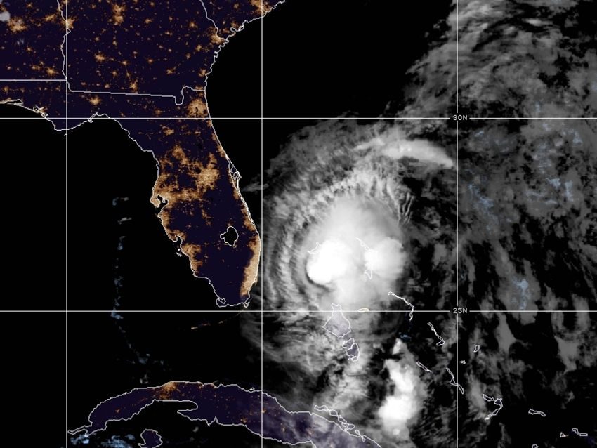
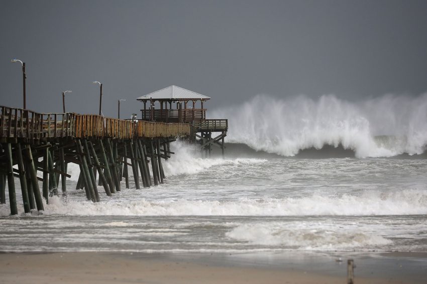
As feared, Isaias gained strength on Monday feeding on warm Gulf Stream waters off the southeast US coast. The storm was upgraded back to hurricane status before making landfall late on Monday evening near Ocean Isle Beach, NC. Very strong winds have occurred near the landfall point with one gust measured to 87 mph (140 kph). A major storm surge is also being reported (see tweet video below) up to six feet (1.8 m) in places, some of the highest water levels ever recorded. A devastating fire sparked by the high winds has consumed multiple homes in Ocean Isle Beach with fatalities reported. Dangerous winds and tides will continue to affect portions of the North Carolina coast through the early morning hours.
This is our second U.S. hurricane strike of the 2020 season #Isaias
Boy this storm got itself together again before this Carolina landfall. pic.twitter.com/L91n5HvuNl
— MJVentrice (@MJVentrice) August 4, 2020
One of the worst ideas possibly but so worth it this is incredible at oak island #ncwx #isaias @wxbrad @EdPiotrowski @jamiearnoldWMBF @Midlands_Wx @MAGAWeatherman pic.twitter.com/WqkLWSVAVc
— Pee Dee Weather (@PeeDee_WxSC) August 4, 2020
Breaking: Significant storm surge is affecting Oak Island, NC, due to Hurricane Isaias. pic.twitter.com/iErU5oGuiS
— Porter Medium (@PorterMedium) August 4, 2020
Breaking: Multiple homes are on fire in Ocean Isle Beach, North Carolina, as Hurricane Isaias makes landfall in the area. pic.twitter.com/MecCyzg5eT
— PM Breaking News (@PMBreakingNews) August 4, 2020
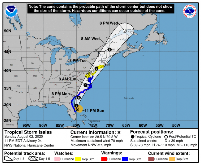
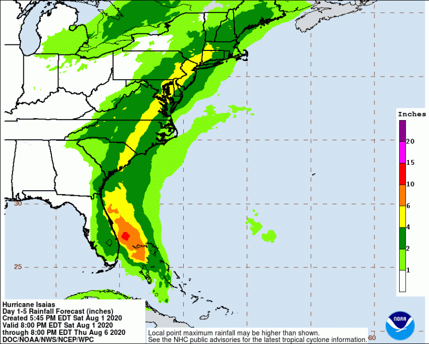
Isaias will continue to accelerate north-northeastward through the Mid-Atlantic and Northeast in the next 24-36 hours. The storm is merging with a strong trough over the Midwest which will lend it energy. As a result, Isaias will not weaken as fast as tropical cyclones usually do. Destructive winds and flooding rainfall will continue to accompany the storm as it moves northeastward. The coastal Mid-Atlantic will see the brunt of the storm during the day on Tuesday. New England residents should expect tropical storm-force conditions late Tuesday afternoon into Tuesday night. Winds commonly reaching 60-75 mph (100-120 kph) will lead to numerous downed trees and branches and widespread power outages through the major cities of the urban corridor. Isolated tornadoes will also be a danger, resulting in localized extreme damage. Interior areas will see the heaviest rains, up to 5-6 inches (125-150 mm) in spots, leading to serious flash flooding. By early Wednesday, the storm’s remnants will be affecting Maritime Canada.