Sally Intensifies Rapidly, Landfall Late Tonight or Early Wednesday in Mississippi
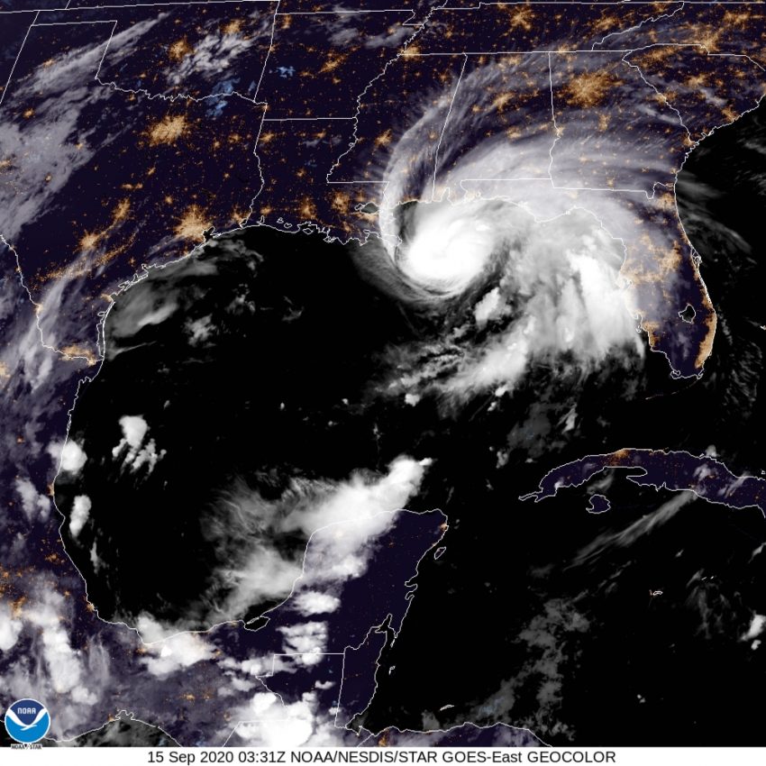
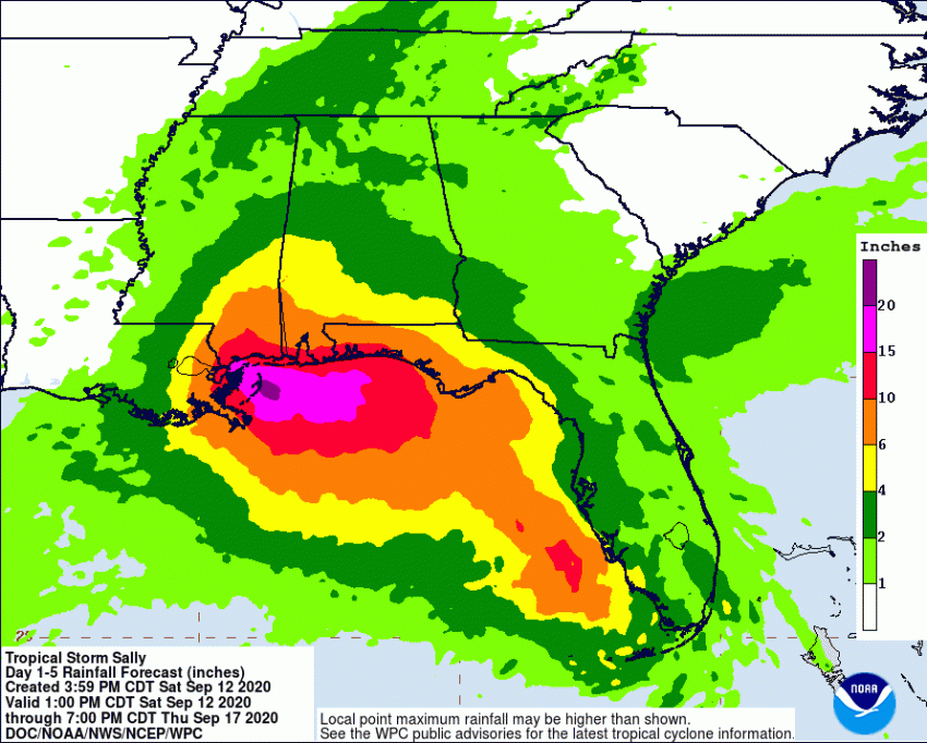
Sally started the day as a tropical storm but has undergone rapid intensification due to very warm waters and favorable upper level winds. Now a dangerous Category Two, Sally could intensify further before landfall late Tuesday or early Wednesday. Deadly storm surge, destructive winds, and torrential rainfall will hammer the Gulf Coast from Louisiana to the Florida panhandle.
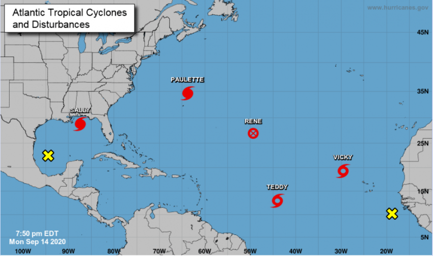
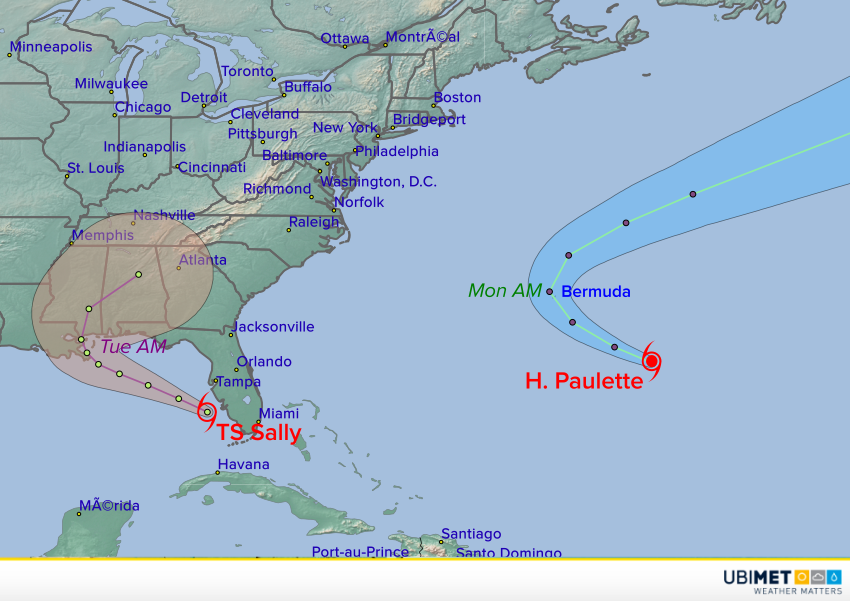
For the first time since 1971, five named cyclones occupied the tropical Atlantic basin simultaneously Monday (see map above). Rene has weakened to a remnant low. Tropical Storms Teddy and Vicky pose no immediate threat to land. Paulette passed directly over the island nation of Bermuda on Sunday night into Monday morning as a Category One hurricane. It’s only the tenth time in recorded history that a mature hurricane’s eye passed directly over the island. Some residents reported damage to their homes, but for the most part it seems the island escaped significant impacts.
The rapid evolution of Hurricane #Sallypic.twitter.com/y4CpGDwyWp
— MJVentrice (@MJVentrice) September 14, 2020
Dauphin Island Alabama from just a little bit ago. Some vehicles got stuck. Probably waited too long to leave and the combination of a higher tide and increasing onshore winds got them. #HurricaneSally2020 #sally #alwx pic.twitter.com/1u2VHl28sY
— Brian Emfinger (@brianemfinger) September 14, 2020
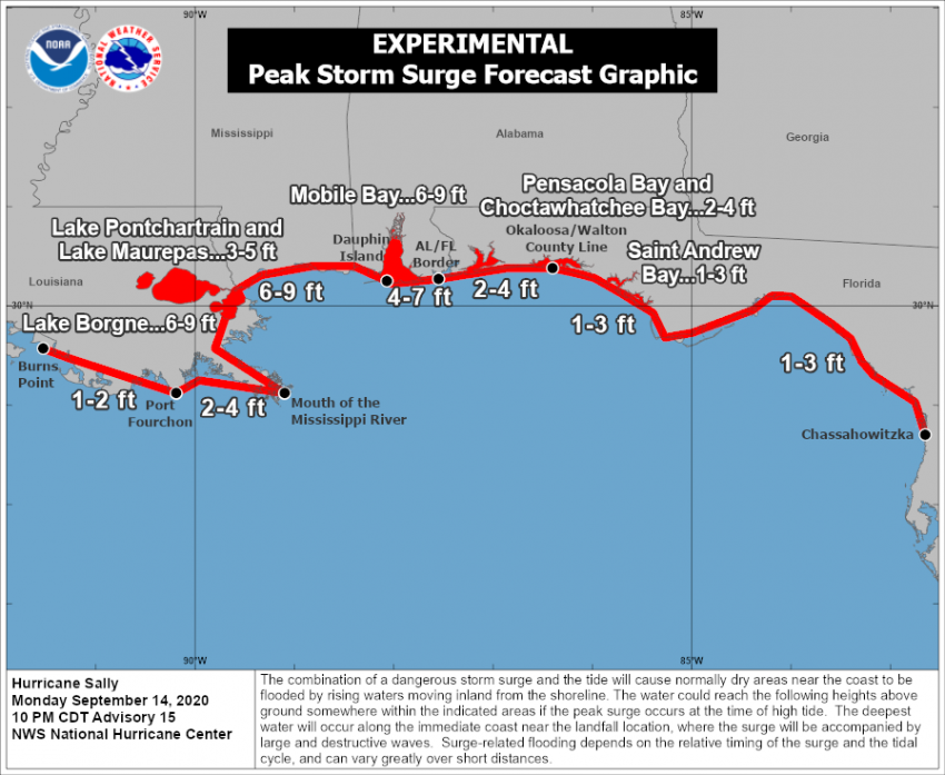
Unfortunately, Hurricane Sally won’t be so passive. Significant surge flooding is already being reported along the Alabama coast with torrential rainfall over parts of the Florida Panhandle. Sally is moving slowly west-northwest and may slow down even more into Tuesday. The very warm waters over the northeastern Gulf will continue to provide fuel for intensification. Sally may even approach major hurricane status as it approaches the coast. Regardless, locations along the coast from southeast Louisiana to the Florida-Alabama border will be inundated by a deadly storm surge up to nine feet (2.75 m). Destructive winds gusting to 120 mph (190 kph) will bring down numerous trees and powerlines and tear roofs from homes. The slow storm motion will also translate into prodigious rainfall totals up to 18 inches (450 mm) in spots, leading to major freshwater flooding. Conditions will continue to deteriorate through Tuesday in the target zone with landfall expected on Wednesday morning.