Surprise Snowfall for New England Sets up a Rare White Halloween

A vigorous upper level low spent much of the week over the Southwest US, coating portions of west Texas, Oklahoma, Kansas, and the Front Range with heavy snow and ice. Sections of western Oklahoma saw ice accumulations up to 1.5 inches (38 mm), felling numerous trees and large branches still also bearing their leaves. Widespread power outages have left more than 300,000 households in the dark with some not likely to be restored until the end of next week. Needless to say, this wintry mess has severely complicated the early voting process in these states.
Massive tree limb falls, narrowly misses man during the ice storm in Oklahoma. #okwx pic.twitter.com/wQXc3jO2o4
— Chad ➐ (@ChadBlue_83) October 27, 2020
I forgot a ruler so I used a golf ball (1.75” diameter). This is at the US 270 & old hwy 66 junction at 4pm south of Calumet, OK #okwx @NWSNorman pic.twitter.com/szBBJl1hHl
— Basehunters Chasing (@Basehunters) October 27, 2020
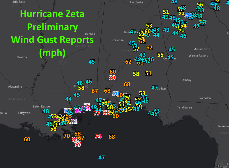
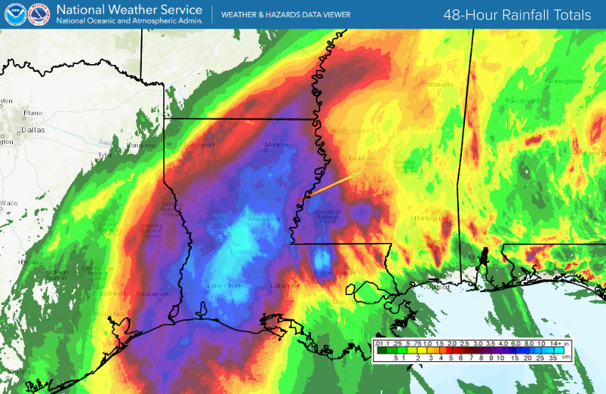
The winter storm finally vacated the Southwest in the mid- to late week, taking the remnants of Hurricane Zeta with it. The infusion of tropical moisture resulted in widespread heavy rains from the Ohio Valley to southern New England. Rainfall of 1.5-3 inches (38-75 mm) was common across these regions. In most areas, it was a welcome, soaking rainfall, however minor flooding was reported in a few areas.
Snow day in the Boston area ❄️ pic.twitter.com/iGf1lvzcuW
— Krystal Wu (@HelloKrystalWu) October 30, 2020
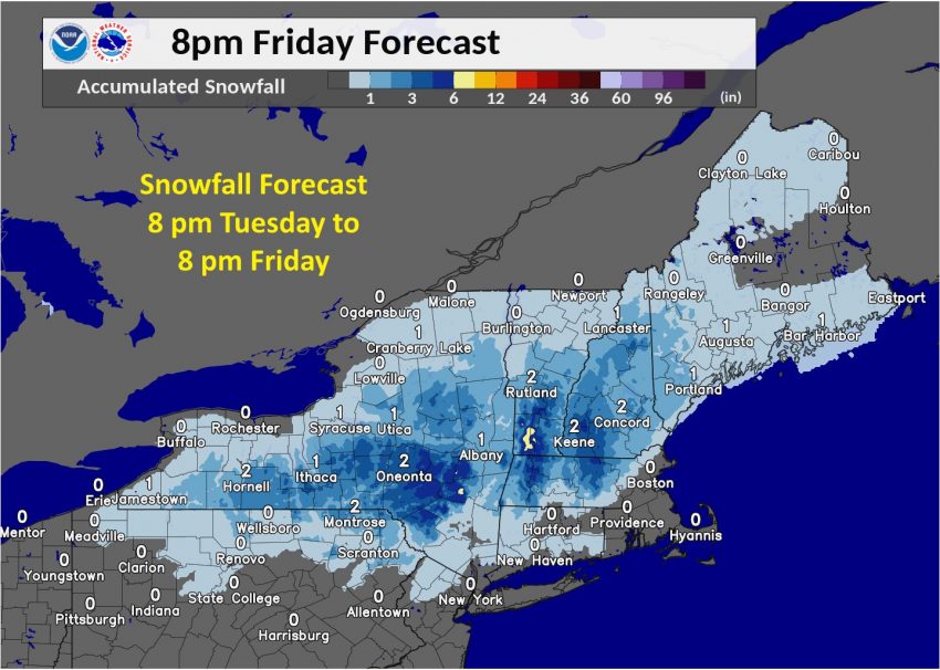
Cold air over the Northeast states combined with the moisture to produce heavy, wet snow from Thursday night into Friday. However, the transition from rain to snow occurred much more quickly and further south than expected. The result was significant snow accumulation even along the Urban Corridor from Boston to Providence, Rhode Island and Hartford, Connecticut. Boston’s Logan International Airport reported 4.3 inches (10.9 cm) of accumulation on Friday, shattering the previous record of single-day snow accumulation in October. It was the biggest snowfall since mid-December 2019. In fact, it was as much as snow as was tallied throughout all of January, February, and March! Locations further inland saw totals upwards of six inches (15 cm). Subfreezing temps overnight Friday should ensure a rare White Halloween across much of southern New England!