Eta Lashes Central America; Eyes Cuba, & U.S.
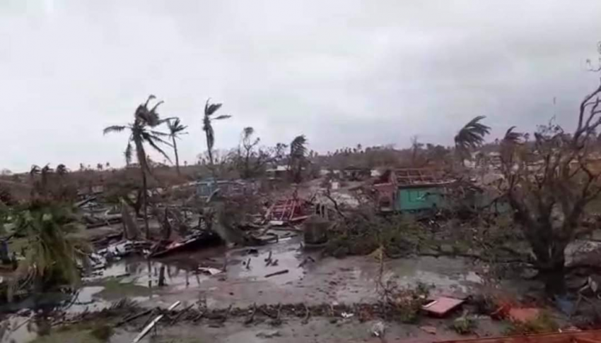
After making a landfall near the town of Puerto Cabezas, Nicaragua on Tuesday as a Category 4 hurricane with winds of 140 mph (225 kph), Eta, currently a tropical depression, has been ravaging the countries of Nicaragua, Belize, Guatemala, and Honduras for the last several days. Another record breaker, Eta is the 28th named storm of the 2020 Atlantic hurricane season, tying the record set in 2005 for most named storms in one season. Eta is also the third strongest hurricane to occur during the month of November in the Atlantic, as well as only the fifth hurricane to reach Category 4 strength or higher throughout the month. It also was only the fifth storm recorded of greater than or equal to Category 4 strength to strike the country of Nicaragua.
Honduras is in a state of national emergency due to the Hurricane ETA. This is the second largest hurricane ever to hit Honduras and has caused sudden and potential lethal floodings and mudslides have ravaged the country. This is how you can help! – #HuracanEta pic.twitter.com/VGCig9Unl8
— it’s fweaking bats 🦇🎃 (@menabae101) November 5, 2020
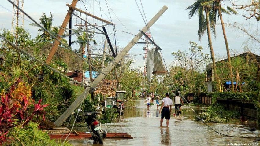
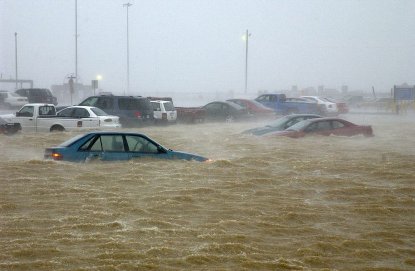
Damage across the region has been described as catastrophic by local officials, with multiple effects of the storm causing havoc. The perilous winds have damaged thousands of homes and structures, with many roofs simply peeled off like a sticker. Due to lack of instrumentation, an official measure of the storm surge at the coast has not been confirmed, but estimates are that it ranged from 15-21 feet (4.5-6.4 meters).
Nicaragua 03/11, man trying to hold his roof on #ETA #HuracanEta #HurricaneEta pic.twitter.com/XG3Iiol2l9
— cri-criminal (@popogatepe) November 4, 2020
By far, the most devastating effects from Eta have been the heavy rains. The slow moving, almost snail-like pace of Eta, has made the storm an extremely prolific rainmaker. Astronomical rainfall totals have been recorded, including 13.98 inches (355 mm) during one day, in Puerto Barrios, Guatemala, while the average over the last several days has been between 20-40 inches (508-1016 mm) in many locations. The relentless rains have triggered widespread flooding and landslides. The Ulua River in Honduras has seen a water level rise 13 feet (3.9 meters) higher than what was recorded during Hurricane Mitch of 1998, the benchmark storm for the region.
This is Barrio Chamelecon in San Pedro Sula, one of many across Honduras where people are awaiting rescue on their rooftops. The water doesn’t have much farther to go & is expected to continue to rise in the coming hours. #HurricaneEta pic.twitter.com/5NBkxWRaNR
— Jeff Ernst (@jeffgernst) November 5, 2020
57 people have been confirmed dead, while numerous others are missing. Most of the deaths have been attributed to the rampant landslides. One such example is in the town of San Cristobal Verapaz, Guatemala, where a water logged mountainside gave way, and sent tons of mud and rocks flowing into the village below. 25 people were killed.
I know we are focused on the U.S. election but please pray for my family and the people of Honduras dealing with massive flooding from Hurricane Eta 🇭🇳 pic.twitter.com/S5sTJ4F5Uk
— Gabey Da Baby™️ (@BigGabeO) November 5, 2020
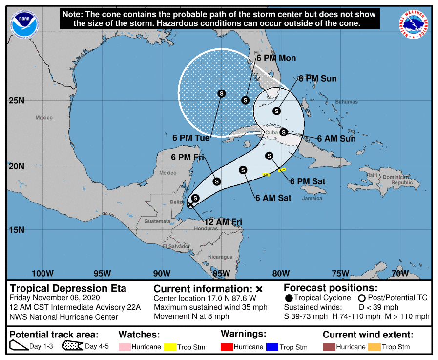
Eta is forecast to remerge over the open waters of the Caribbean Sea on Friday. Although some strengthening is expected, it is likely to remain just a tropical storm by the time it reaches Cuba on Sunday morning. South Florida may be begin to see the effects of Eta as early as Sunday evening after it crosses over Cuba.