Cyclone Seroja Bearing Down on the Western Australia Coast
Residents of Western Australia are bracing for the arrival of Cyclone Seroja later this weekend. Evacuation orders have been issued for the outer islands. Seroja has been meandering over the Indian Ocean for the past few days, but is expected to turn southeast and pick up speed later today. Seroja will make landfall near Geraldton before racing diagonally across south-central WA.
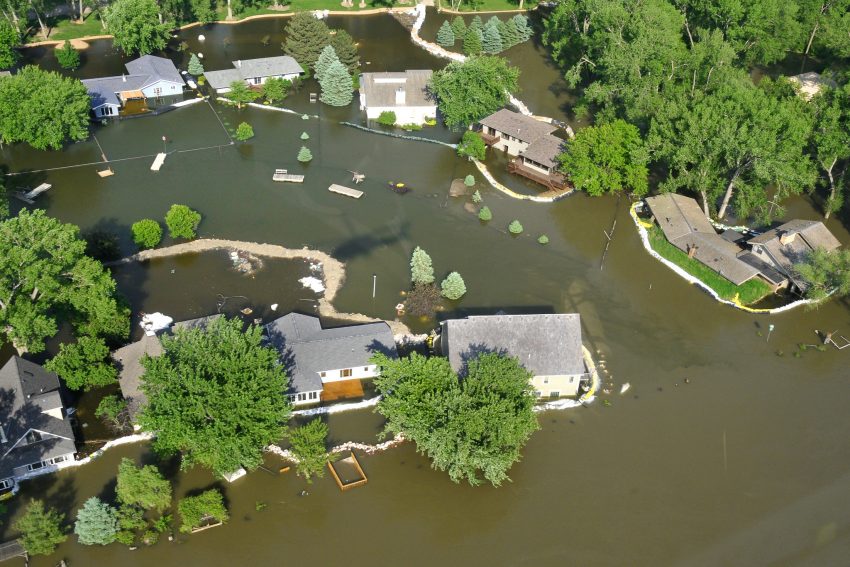
The flash flood incident that occurred in East Flores, NTT, besides killing as many as 67 local residents, the river carrying mud and logs also damaged people’s houses and infrastructure facilities of roads and bridges #Indonesia pic.twitter.com/cx36AIC7Na
— ariel moshe (@ambarukmo15) April 5, 2021
Deadly Tropical Cyclone Seroja Brings Landslides and Flooding to Indonesia and East Timor (PHOTOS) https://t.co/vR5Vt0vlyG
— MSN Weather (@msnweather) April 5, 2021
Seroja affected Timor and Indonesia last weekend as a slow-moving tropical low. Torrential rainfall lead to severe flooding and landslides, destroying numerous homes and roads. As of Friday, the death toll had risen up to 167 in Indonesia alone with dozens more killed in East Timor. Thousands more have been left homeless. The prime minister of East Timor, Taur Matan Rauk, called the floods one of the most devastating natural disasters in decades.
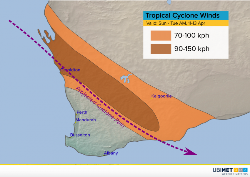
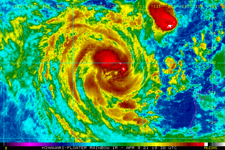
Cyclone Seroja has intensified this week over the favorably warm waters of the eastern Indian Ocean. Another short-lived cyclone named Odette was recently downgraded just to the northeast. Odette is being absorbed by the larger and more powerful Seroja. Once this process is complete, Seroja will accelerate towards the Western Australia coast, making landfall late Sunday near Geraldton. As it picks up speed, the main threat will increasingly be damaging winds, especially near and north of the track of the cyclone (see graphic above). Gusts up to 150 kph will lead to downed trees and powerlines. Power outages will be common, some long-lived, especially in rural areas. There will be a significant storm surge as well, especially near or just north of Geraldton and up into the Shark Bay region. Heavy rain and freshwater flooding will be less of a concern due to the fast forward motion of the storm, but some minor flooding could occur in poor drainage areas.