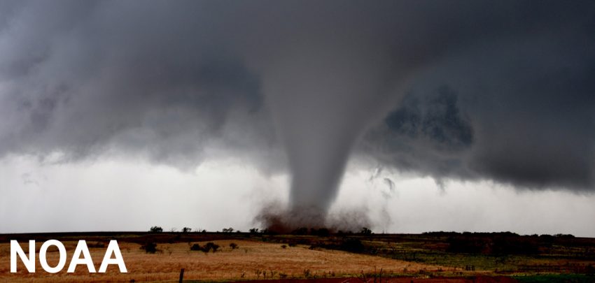
Deadly Tornado Outbreak Rips Across the Mississippi Valley!
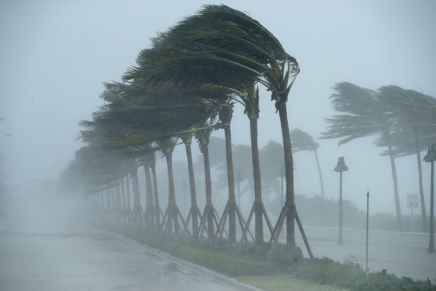
Dozens are feared dead in the wake of severe tornadoes that roared over portions of six states on Friday night. One long-lived tornadic storm alone may have shredded a path of destruction nearly 230 miles (370 km) long. Just weeks ahead of Christmas, thousands are now facing a holiday season mourning the sudden loss of their businesses, homes and even loved ones.
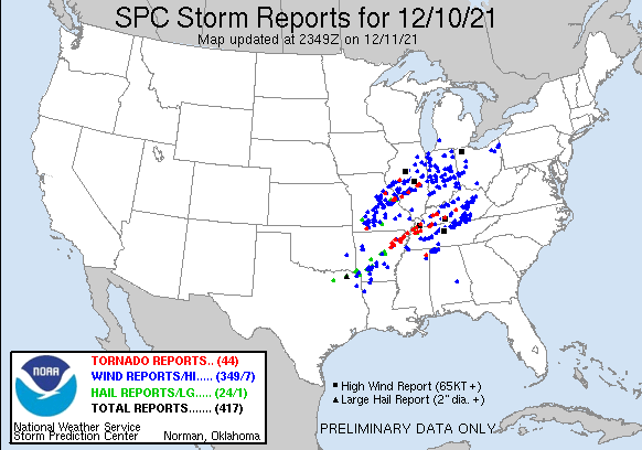
The outbreak was unique in that it occurred in mid-December, typically a quiet time of year for severe storms. It was also exclusively a nighttime event. Fast-moving, strong tornadoes are particularly dangerous at night due to the lack of visibility and potential to catch people off guard. As of Saturday night, 44 tornado reports had been received by the Storm Prediction Center from the period between 7 p.m. and 2 a.m. Friday night. More will probably accumulate as National Weather Service teams continue to survey the catastrophic damage in the coming days.
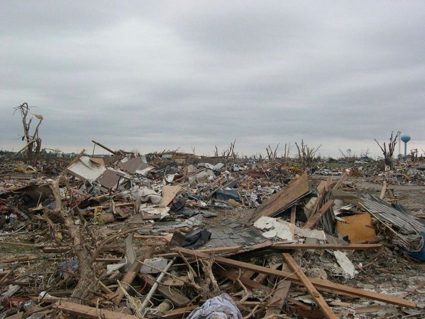
Slabs everywhere.
Slab: The concrete foundation of a home. This is on Cardinal Road right off of US45 southwest of downtown Mayfield. #kywx pic.twitter.com/6WfaCzIWuD
— ☈ Chris Jackson ☈ (@ChrisJacksonSC) December 11, 2021
Dawson Springs, Ky is 70 miles away from #Mayfield and was also devastated by the #Tornado #WX pic.twitter.com/kBwBxcxURi
— WxChasing- Brandon Clement (@bclemms) December 11, 2021
A tornado rated EF3 on the intensity scale struck Bowling Green, Kentucky just after midnight. Another EF3 tore through Edwardsville, Illinois producing winds up to 155 mph (250 kph). It caused the partial collapse of an Amazon warehouse there, claiming six lives in the process. A candle factory in Mayfield, Kentucky was completely leveled with 100 people inside. First responders have rescued 40 workers, but the rest are still missing and feared dead. The damage is still being analyzed, but early speculation suggests the Mayfield tornado could be EF4 or even EF5, the maximum end of the scale with winds over 200 mph (320 kph). It has been eight years since the last EF5 struck anywhere in the United States, and more than 45 years since there was tornado of that intensity in Kentucky.
All told, this outbreak may claim a triple-digit death toll, making it one of the most deadly outbreaks in decades. President Biden has approved an emergency declaration for Kentucky, opening up federal recovery funds. His administration stands ready to approve the same measures for the other states affected as necessary. Lead photo courtesy National Weather Service.