All-Time Record Heat Across Southwest
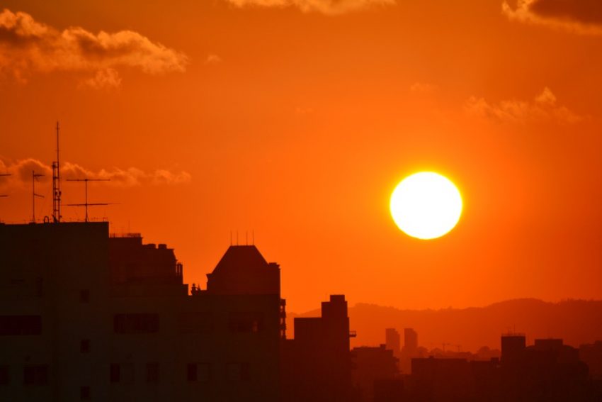
Las Vegas, NV tied their all-time record high temperature of 117°F Tuesday! Many other US cities saw daily record high temperatures and this heat is expected to continue through the week.
Las Vegas, NV tied their all-time record high temperature of 117°F Tuesday! Many other US cities saw daily record high temperatures and this heat is expected to continue through the week.
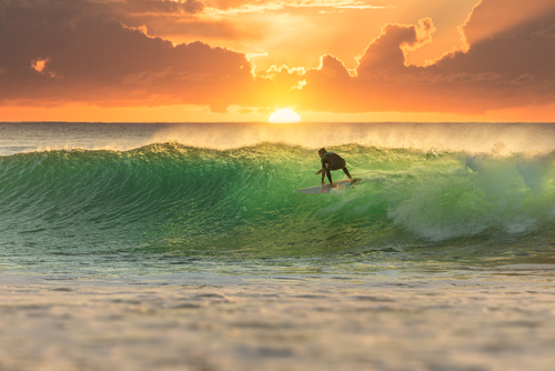
Want to escaped the hustle and bustle of city life this weekend? Why not grab the surfing board gathering dust in the corner and head for the coast.
A series of weather systems passing to the south of Australia over the next few days are set to see swells building to 3 – 4 metres over the weekend for parts of the Victorian coast.
Where to go! Check out the known Victorian surf spots below suitable for both novice and seasoned pro alike and only a relatively short drive from Melbourne.
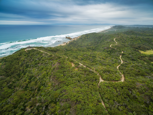
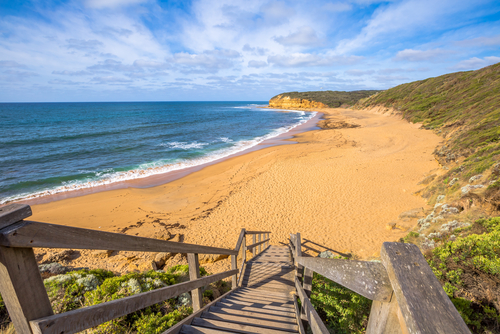
Only a 1.5hr drive from Melbourne on the south eastern side of Port Philip bay. This 36 km stretch of rugged coastline harbours numerous beaches with excellent breaks.
| Surf spots | Wave dir | Wave type |
| Cummanatta beach | Right & Left | Beach break |
| Honey Suckle | Right | Point break |
| Meanos | Right & Left | Reef break |
| Sorrento back | Right & Left | Beach break |
Alternatively If surfing is not your thing why try out the latest vintages at the huge variety of local wineries.
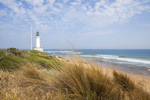
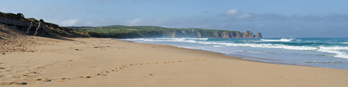
Located on the south western side of Port Philip bay and about 25km south of Geelong. This indented coastline hides some decent surf spots.
| Surf spots | Wave dir | Wave type |
| Point Lonsdale | Right | Reef break |
| Ocean Grove | Right & Left | Beach break |
| Thirteenth beach | Right & Left | Beach break |
One location that embodies the Australian surfing lifestyle, made famous by the movie Point Break which featured the legendary bells beach. At 1.5hrs drive from the metropolitan area its an easy escape for suburbia.
| Surf spots | Wave dir | Wave type |
| Bells beach | Right | Point break |
| Torquay surf beach | Right & Left | Beach break |
| Winkipop | Right & Left | Point break |
Located about a 1.5hr drive south east of Melbourne, its known for iconic Australian wildlife, hi “octane motor sports” and of course pristine white beaches.
Exposed to the full vigour of the Southern Ocean its wind swept south coast holds the best surf spots.
| Surf spots | Wave dir | Wave type |
| Cape Woolamai | Right & Left | Beach break |
| Surfers point | Right | Reef break |
| Berrys beach | Right | Reef break |
| Express point | Right | Reef break |
| Kitty Miller bay | Right | Reef break |
2 to 4hrs from Melbourne
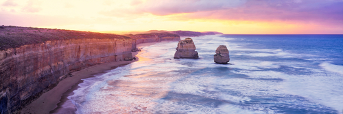
Known as the surf coast this wild and stunning coastline that extends from Anglesea to Portland holds some of the best breaks in Australia. Pummelled by the relentless swells that travel unimpeded across the vast Southern Ocean before unleashing their energy upon this 250km stretch of coast.
| Surf spots | Wave dir | Wave type | Location |
| Fairhaven | Right & Left | Beach break | Airley Inlet |
| Wye river | Right | Beach break | Lorne |
| Johanna beach | Right & Left | Beach break | Cape Otway |
| Japs | Right & Left | Beach break | Warrnambool |
| Blacknose point | Right | Point break | Portland |
Check out Morecast for the latest weather forecasts, hour by hour for each location and download the App to always be one step ahead of the weather.
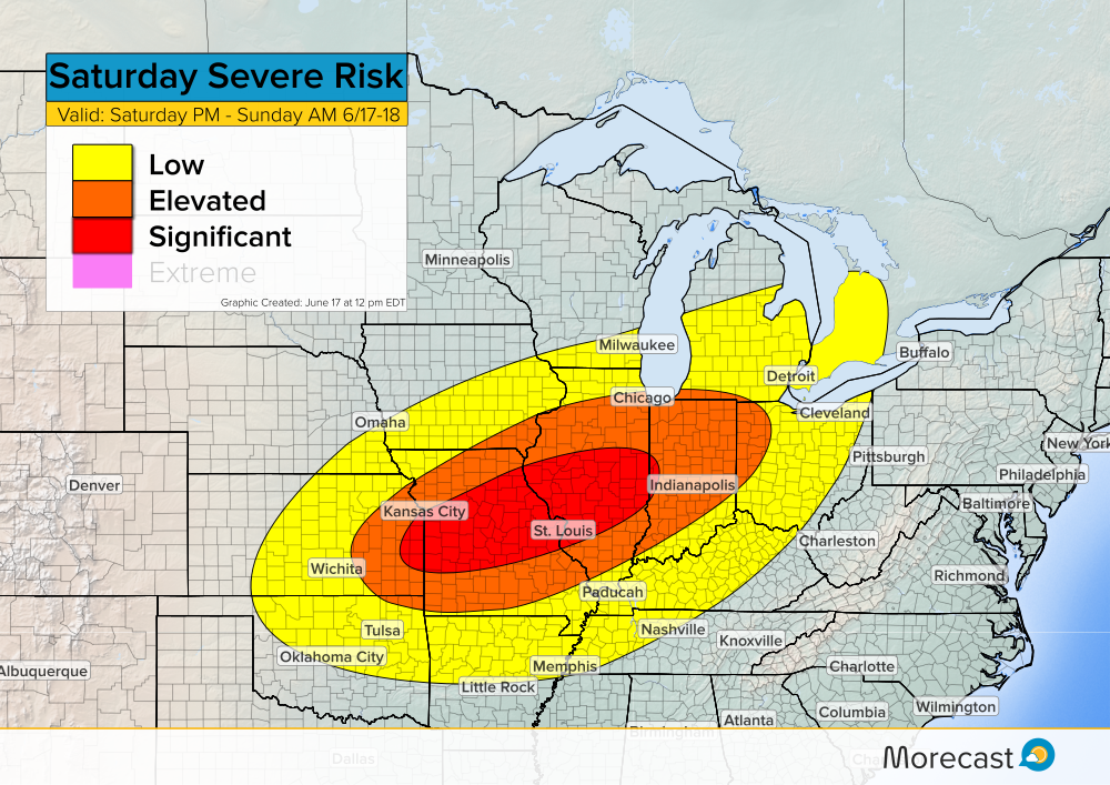
After severe storms pummeled parts of the Midwest and Great Plains on Saturday, the severe threat pushes into the eastern half of the country for Father’s Day Sunday.
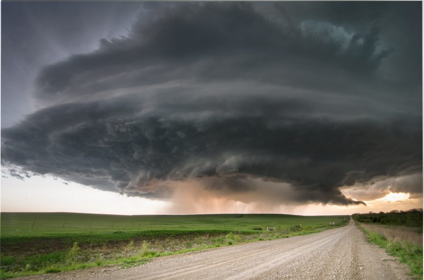
Another round of severe weather is expected Saturday afternoon and will last into Sunday morning. The threat area shifts south and east compared to those impacted Friday.
Currently, a surface boundary stretches from the Oklahoma panhandle up through central Kansas and into eastern Iowa. As this boundary slowly moves southeast during the afternoon hours, severe storms are likely to develop ahead of it.
Similar to Friday’s severe storms, the main hazards on Saturday will primarily be large hail and damaging winds. Hail sizes could exceed 2 inches in certain areas and damaging wind gusts may exceed 70 mph. As storms develop, an isolated tornado threat may also exist.
When traveling, watch out for heavy rain and flash flooding. Take necessary action if severe weather approaches: secure loose outdoor items, move vehicles indoors, and relocate to a safe area.
Storms are expected to develop in the mid afternoon hours around 3PM CDT and generally move from west to east.
Upload any storm related weather photos to the Morecast app if conditions are safe. Follow along with the Morecast Team via our Facebook and Twitter pages for updates on the severe weather.
For up to the minute forecasts for your exact location, be sure to visit our website.
Featured photo taken by flickr user Lane Pearman in Severy, Kansas.