GOES-17 Satellite Launch Puts Latest Weather Tech Into Orbit
The latest in the GOES series of weather satellites, GOES-S, was launched from Cape Canaveral, Florida on Thursday. It joins GOES-16 in geostationary orbit, launched in late 2016. GOES-S will be redesignated GOES-17 when it becomes operational later this year. It will serve as NOAA’s GOES West satellite, responsible for covering the U.S. west coast, Hawaii, Alaska, and much of the Pacific Ocean.
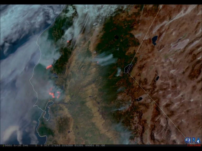
The new GOES satellites will be able to collect three times the amount of meteorological data as their predecessors. They’ll also collect the data at four times the spatial resolution, five times as fast! GOES 17 in particular will have critical responsibilities that include monitoring winter storm systems approaching the U.S. and Pacific basin hurricanes. Thermal infrared imagery will help meteorologists spot fires faster (see above – image courtesy CIRA).
One of the most exciting new technologies on board the new GOES satellites is the Geostationary Lightning Mapper (GLM). Unlike ground sensor-based lightning detection networks, the GLM will be able to monitor lightning strikes over the ocean. These data could help radically improve forecasts of hurricane strength, for instance. However, it will not be able to distinguish between cloud-to-ground and cloud-to-cloud lightning strikes on its own.