Watching Two Potential Cyclone Threats for Coast of Australia
The weather is generally quiet to start off the week across much of Australia, however, there are two tropical cyclone threats to watch.
Tropical Cyclone 13
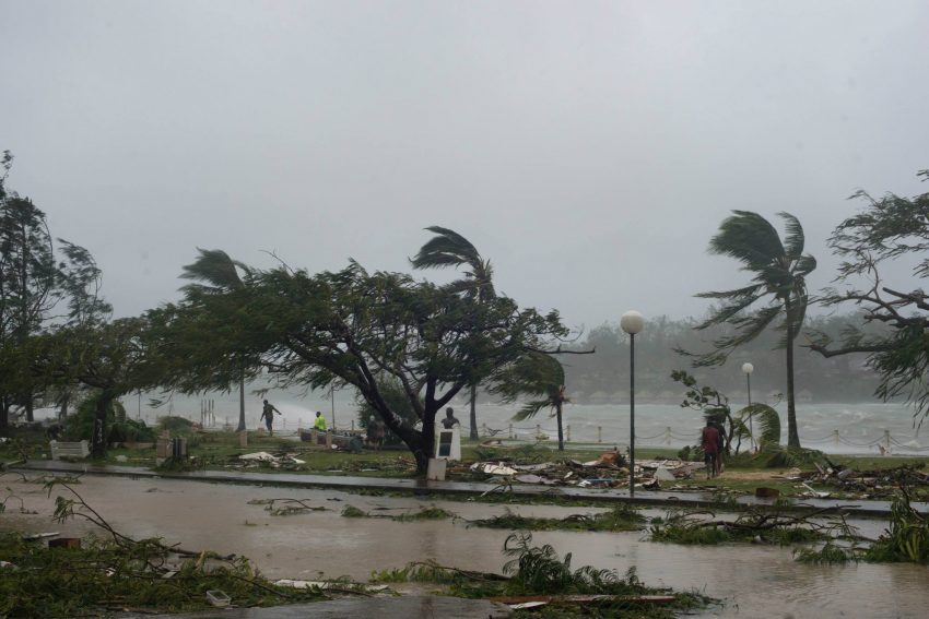
Tropical Cyclone 13 developed on Monday in the Coral Sea about 1,500 km northeast of Brisbane.
The cyclone is expected to strengthen some through Wednesday morning as it tracks southwestward across warmer waters. Steering winds will take TC 13 toward the south-central QLD coast on Thursday, however, the storm will encounter colder waters and increased wind sheer. Consequently, a weakening trend is expected beginning later on Wednesday.
Beyond Thursday, the TC 13 is expected to take a more southerly turn. The south track should keep the cyclone just off shore for the end of the week and this weekend.
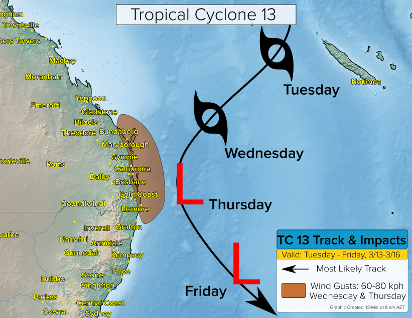
Despite some weakening later in the week, gusty winds in excess of 60 kph are expected to develop Wednesday across coastal southeast QLD. Winds will remain gusty on Thursday as the storm nears the coast. Showers and perhaps a steadier rain could impact southeast QLD beginning Wednesday night and continuing into Friday.
Second Cyclone Threat
The second potential cyclone looks to form close to the coast of Northern Territory later this week. This development would mean potential rain and wind impacts along the coastline from Darwin to perhaps northern WA through the weekend or early next week.
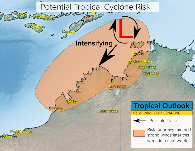
It’s too early to specify intensity and landfall information this far out. However, the ingredients are in place for a strong cyclone with very warm sea surface temperatures and weak wind shear. We’ll keep a close eye on these potential headline-makers and have updates later in the week.
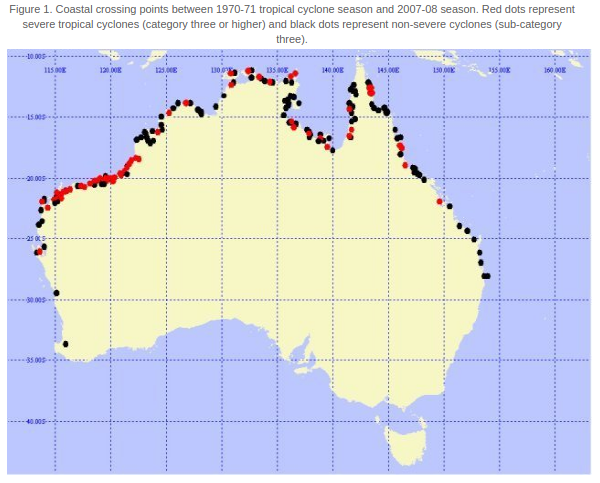
Tropical Cyclone Climatology
March is historically the most active month for tropical cyclones to threaten Australia. Data collected from the Bureau of Meteorology shows that there have been 14 coastal crossings from tropical cyclones in March from 1970-2008.
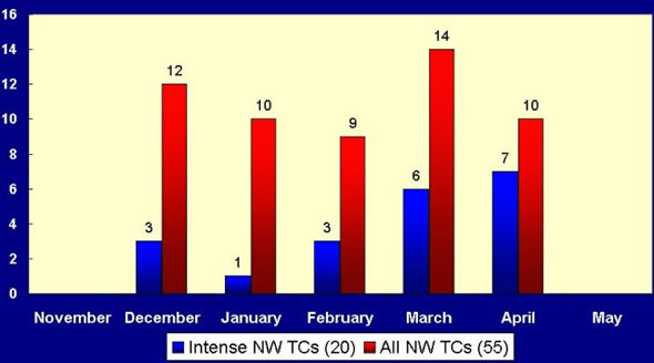
The most likely areas to experience a hit from a tropical cyclone is the northern-central coast of WA. However, tropical cyclone coastal crossings have been observed as far south as near Perth and Brisbane.