Typhoon Hagibis Targets Japan!

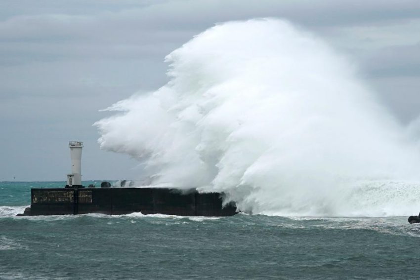
As Typhoon Hagibis is heading towards Japan, the island nation is bracing for it’s impact. The storm is currently churning offshore, packing winds of 162kph, and is expected to make landfall late on Saturday night. Hagibis is very dangerous not just because of it’s strength, but it’s sheer size. It’s wind field spans 1400km, which is nearly half the length of Japan.

Before coming down to it’s current pressure of 943hPa, Hagibis went from 992hPa to 915hPa within 24 hours, making it the ninth most rapidly intensifying storm in recorded history, and one of the most intense tropical cyclones of 2019. Forecasts are calling for Hagibis to have a central pressure of 950hPa as it makes landfall near Tokyo. If this occurs, it would be the strongest storm to ever hit that region.

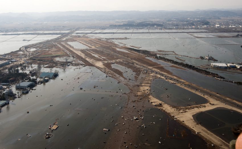
Hagibis has potential to break records as it is expected to bring wind gusts of up to 216kph, 300-500mm of rain, with some spots seeing up to 800mm, and devastating storm surge, with water levels possibly reaching as high as 13m. If those effects weren’t bad enough, the storm will make landfall during a full moon phase, which will lead to higher than normal tides, and only exacerbate the coastal flooding.

Although Japan is no stranger to typhoons, with 11 typhoons approaching, and two directly hitting the country on average every year, Hagibis is coming on the heels of Typhoon Faxai, which struck the region last month. That storm brought record breaking gusts of 207kph, several people were killed, and hundreds of thousands of homes were damaged or destroyed. Many residents remain in shelters, while numerous homes still have plastic tarps in place as makeshift roofs.


In preparation of the storm, flights have been canceled, trains halted, and both the Rugby World Cup and Japanese Grand Prix, have postponed games until Sunday. Supermarket shelves have been completely wiped out as shoppers stock up on supplies to get them through the storm.

Deadly Dorian Crawls Towards US!

After ravaging the northern Bahamas for the last few days, Hurricane Dorian has finally started to turn northward, with its eye set on the southeast coast of the US. The storm, which is responsible for at least 7 deaths so far, is departing the Bahamas after spending the last two days pummeling the area with punishing winds, torrential rains, and a ferocious storm surge. Dorian became the strongest hurricane to ever hit The Bahamas, as it made it’s first landfall on Sunday with sustained winds of 185mph(298kph), on the Abaco Islands. With a central pressure of 910mb before it’s first landfall, Dorian had the lowest pressure ever recorded in the Atlantic east of Florida and north of the Caribbean. Within just nine hours on Sunday, it’s peak winds increased from 150mph(241kph) to 185mph(298kph) making it the fastest intensifying hurricane of this magnitude ever seen in the Atlantic Basin.

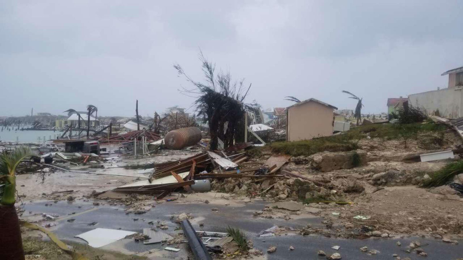
Aside from breaking records, Dorian has delivered a devastating blow to the Abaco Islands and Grand Bahama Island. After several landfalls, and two days of basically stalling over the area, these islands have been completely inundated by the storm. Homes have been leveled, trees stripped of their leaves, and roads have been turned into raging rivers, as the ocean became one with the land. The islands remain without power, or running water, as many residents remained stranded, trapped in their homes, and are awaiting to be rescued. Numerous people are still unaccounted for.

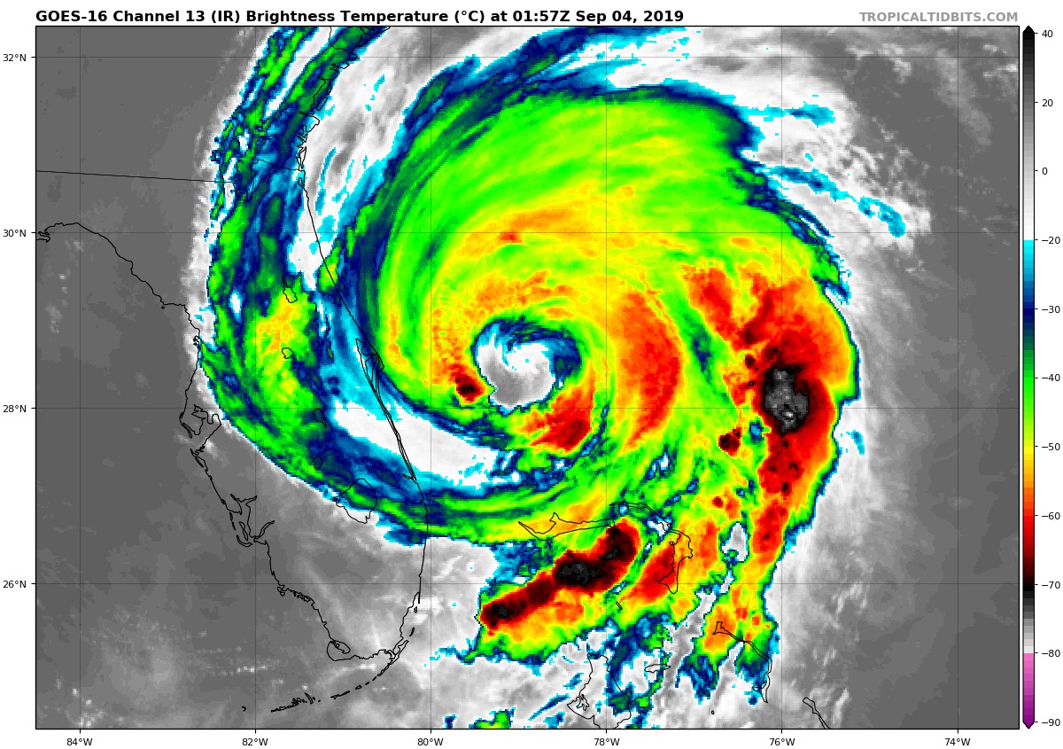
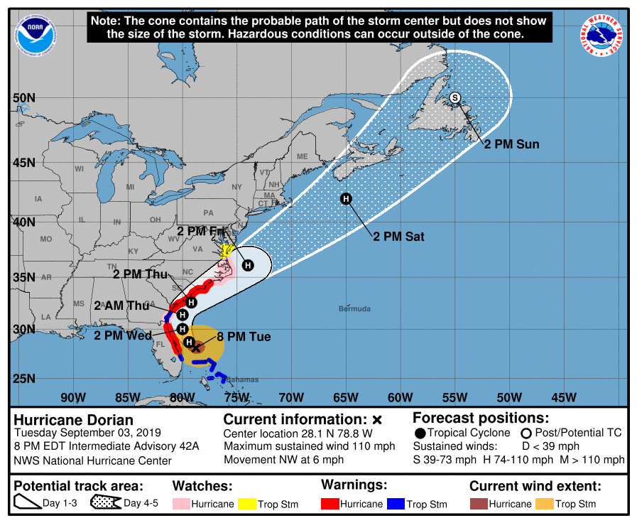
Although Dorian has weakened considerably since his peak on Sunday, the storm remains a strong Category 2 storm with winds of 110mph(177kph), and is on par to make contact with the coast of the southeast US in the coming days. Despite the winds being weaker, the wind field of the storm is expanding, so even if the storm does not make a direct landfall on the coast, hurricane force winds are still likely to be felt here. Hurricane warnings are now in effect for the coastlines of Florida, South Carolina, and North Carolina, while a state of emergency remains in effect for these states as well.

Forecast models depict Dorian remaining offshore, with it’s center just skirting the coastline, as it travels northward. A landfall along the coast of one of these states still cannot be completely ruled out at this time, however. The slow moving nature of the storm has giving residents of the Southeast lots of time to prepare, as storm surge, hurricane force winds, and flooding rains are poised to start effecting the region in the next 24 hours.

Hurricane Dorian Shifts Track; Targets Carolinas!

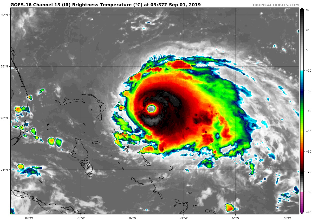
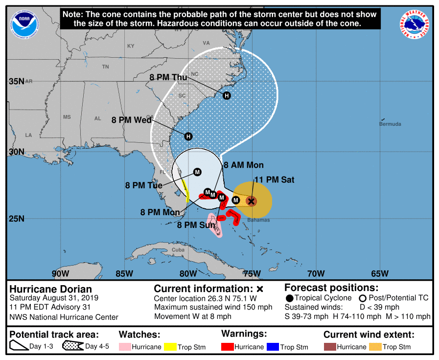
Hurricane Dorian once again has strengthened within the last 24 hours. The Category 4 storm, currently positioned to east of the Bahamas, has sustained winds of 150 mph (241kph), which is only 7mph shy of Category 5 status. It is very possible the storm may reach Category 5 status in the coming days, as it is forecast to move over a deep layer of very warm water, just east of the northern Bahamas. Dorian is also moving quite slowly, at 8mph, which will allow the hurricane to tap into the energy from that warm water. Coupled with a favorable upper atmospheric environment, weakening is highly unlikely in the near future. Dorian’s satellite presentation continues to look outstanding. With a well defined eye, and near perfect symmetrical shape, Dorian is a classic looking text book hurricane.


Although Dorian has maintained it’s intense strength, one thing that has changed dramatically is his track. As of yesterday, it was looking as if a landfall along Florida’s east coast was likely, but as of today, it seems that Dorian may move northward into the Carolinas instead. New forecast data coming in has suggested that an upper level trough of low pressure will steer Dorian more to the north, sparing the Florida peninsula of a direct hit. This may be good news for Florida, however, that does not mean the state will be completely free from the dangers of this hurricane. Fringe effects are still very possible, which has led to tropical storm watches being issued earlier today along Florida’s east coast.

As one state breathes a sigh of relief, (sort of), three other states are now on high alert. In addition to Florida already being under a state of emergency, the governors of both North and South Carolina have issued a state of emergency earlier today. The coastal counties of Georgia are also under a state of emergency. Another hurricane is that last thing these three states want to see, as they are all still reeling from the effects of hurricanes Matthew, Michael, Irma, and Florence; all within the last three years.


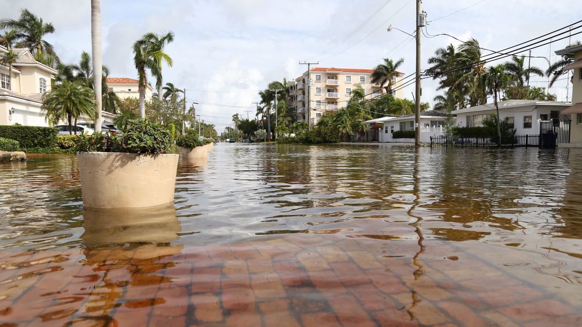
The track of Dorian remains uncertain it this time, as not all of the forecast models are in agreement of where the storm will go. The general consensus, as of now, it that Dorian will not make a landfall at all in the United States, but just skirt the coasts of Florida, Georgia, South Carolina, and North Carolina, before turning out to sea later next week. There are several models that do show a landfall along the South Carolina coast, while a few outliers still show a landfall in Florida. Even without a landfall, Dorian is very likely to bring devastating effects to the aforementioned states in the form of high winds, heavy rains, coastal flooding, and beach erosion. Dorian’s timing will also coincide with the presence of King Tides ( astronomical higher tides that happen seasonally), which will enhance coastal flooding significantly.

One thing that is certain, is that a prolonged period of life-threatening storm surge, devastating hurricane-force
winds, and heavy rains capable of life-threatening flash floods are
expected on the Abaco Islands and island of Grand Bahama in The
Bahamas Sunday through Monday, and a hurricane warning is in effect
for these areas. As Dorian passes through The Bahamas, and slowly
approaches the southeast coast of the United States through the
middle of next week, it is possible the track may change once again.
Nonetheless, all residents within the path of the storm should remain
vigilant, and heed all warnings and orders of evacuations from the
authorities. 

Tropical Rains Bring Deadly Flooding to Japan

Extreme rainfall has inundated parts of southwest Japan over the last few days leading to deadly flooding.

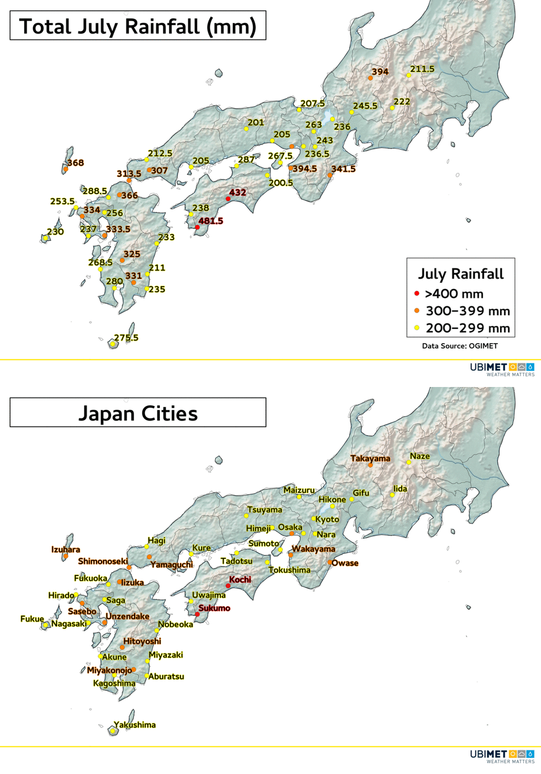
The city of Sukumo in Japan’s Shikoku Prefecture has received 390 mm of rain in a 24 hour period over the weekend. 334 mm of that fell in just 6 hours.

That easily places Sukumo at over 400 mm of rain for the month of July.

Other Japan Prefectures such as Kyushu, Chugoku, Kansai, and Chubu have also been affected by heavy rain and destructive flooding.

According to CNN, over 40 people have already been killed, and that tally could continue to rise over the coming days.

One of the main factors that contributed to the heavy rain was a stalled frontal boundary over the area. Copious amounts of tropical moisture rode along the frontal boundary dropping the extreme rainfall in a short period of time.

Additional showers will continue on Sunday, however, the heaviest rainfall has ended for most areas.

The region will get a much needed break from widespread precipitation for much of the upcoming week.