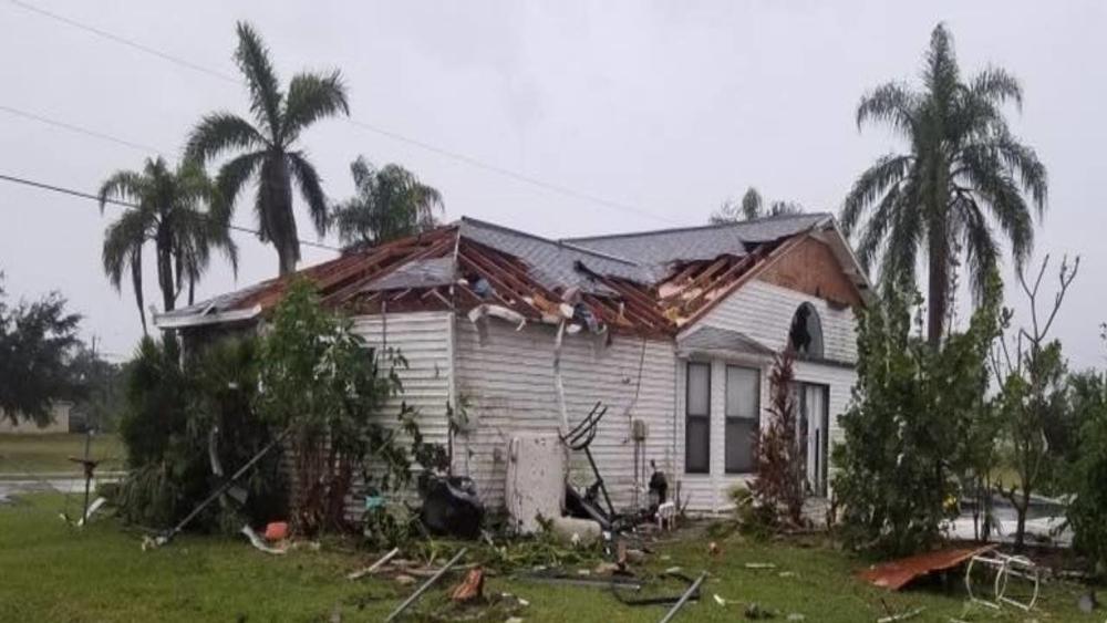
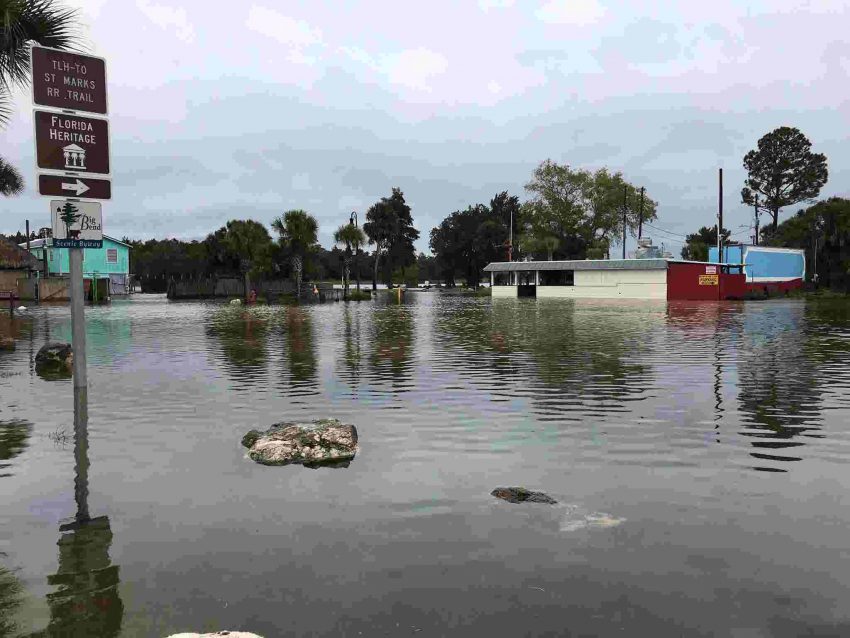
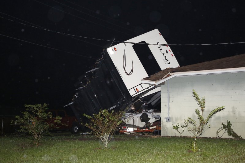
Bushfires Approach Australian Capital Of Canberra

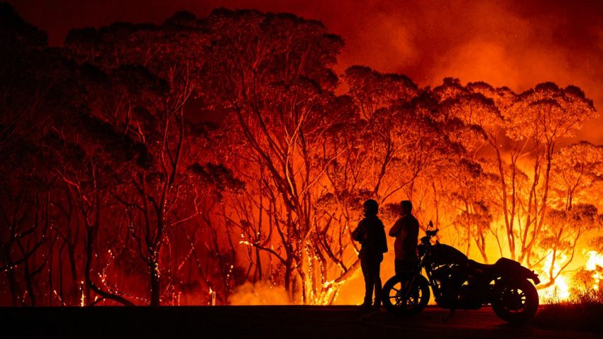
Bushfires are currently burning just south of the Australian capital city of Canberra. 35,800 hectares(88,500 acres) where burned by Saturday afternoon in the Orroral Valley in nearby New South Wales. This has prompted a state of emergency to be declared in the capital district and surrounding areas, which is the first time this has occurred since 2003. Residents in the city of 400,000 are on edge as heat, combined with dry, and windy conditions are creating the perfect setup for fire to spread rapidly. Many fear a repeat of what happened in 2003, in which 500 homes were destroyed in one day throughout the district. So far, only 20 homes have been destroyed within the district.

A total fire ban has been enacted, while officials have urged residents to fill up their sinks, buckets, and bathtubs so that they have access to safe water to drink and to extinguish flames when fires arrive. Canberra set an all time record high for February on Saturday with 42.7 degrees(109 degrees Fahrenheit). The record heat has been accompanied by strong, drying winds, which is making it very difficult for firefighters to control the flames. Isolated thunderstorms in the area have proven to be more detrimental than beneficial, as they are producing more lighting than rain, leading to additional fires being ignited. The fires themselves have been generating their own weather patterns in some cases, in which lighting and strong winds are developing within them, leading to even more fires. The extremely fire conducive conditions will last until Monday. By then, cooler temperatures, higher humidity, and less wind should assist firefighters with getting a handle on the blazes.

This latest round of fires is coming on the heels of an already deadly and destructive bushfire season for Australia. Since September, 33 people have been killed nationwide, while 3000 homes have been destroyed. 10.5 million hectares(26 million acres) have burned, and scientists estimate that over one billion animals have perished.

Multifaceted Winter Storm To Target Central Plains & Eastern U.S.

A very dynamic and potent winter storm, with characteristics more typical of spring, is currently underway across the center of the nation. The storm, which is expected to last throughout the weekend, will feature many different types of weather, and affect millions of people. With snow in the Midwest, tornadoes in the south, and record warm temperatures in the east, it will truly be a storm that gives a taste a several seasons.

The most dangerous part of this storm system will be the severe weather potential. Severe thunderstorms containing damaging winds, large hail, and even tornadoes are possible throughout the next few days. The area at highest risk will stretch from the southern plains to the southeast. Tornadoes have already been confirmed in the states of Oklahoma and Missouri. Numerous homes have been destroyed in the town of Fair Play, Missouri. Tornado warnings, flash flooding, and hail were reported on Friday evening in the Dallas, Texas area, while many flights at the Dallas airport have been delayed or canceled. Tornado watches are currently in place across several states including Arkansas and Louisiana, as the threat of even nighttime tornadoes looms. As the storm moves east, so too will the threat of severe thunderstorms.

Another aspect of the storm will be flooding rains. The heavy rain will stretch from Texas to Ohio. On average 2-4 inches(50-102mm) of rain is expected, with isolated amounts greater than 5 inches(127mm). Flash and river flooding is very possible, especially in the Ohio River Valley, as soils are already saturated from recent rains.

On the cold side of the storm, snow and ice will be the main concern. Snow has already fallen in states such as Kansas and Nebraska, with amounts ranging from 3-8 inches. As the storm ramps up on Saturday, snow and ice coverage will expand to include states in the upper Midwest and northern Northeast. Amounts will vary from 3-5 inches(7-13cm) in most areas, while portions of Michigan may see up to 12 inches(30cm). Ice accumulations of .10” (0.25cm)or greater are also possible in these areas. Strong winds will accompany the snow and ice, which may lead to power outages.

While the central and northern parts of the country get battered by extreme winter weather, most of the eastern seaboard will bask in springlike warmth. With temperatures reaching well into the 60s and 70s (16-25 degrees) over the weekend, which is 25-30 degrees above average, many people will be asking if it’s January or May. The unusually warm temperatures will lead to many records being broken, if not shattered in the coming days.

Tropical Storm Nestor Brings Some Damage To The Southeast

Tropical Storm Nestor, the 14th named storm of the 2019 Atlantic hurricane season, made landfall on St. Vincent Island, Florida, Saturday afternoon. With sustained winds of 45mph(72kph) at landfall, the highest gust observed was 61mph(98kph). Nestor brought strong wind gusts, heavy rain, and coastal flooding, but perhaps will be best remembered for the amount of tornadoes it spawned.

So far, 8 tornadoes have been reported across the Southeast. Mainly in the states of Florida, Georgia, and South Carolina. The strongest was rated an EF2, containing winds of up to 135ph(217kph), which touched down near the Lakeland Regional Airport in central Florida. This particular twister damaged 50 homes in that region, along with uprooting hundreds of trees, and knocking out power to several hundred people. One resident of Seminole, Florida described the storm as “Scary, I was never so scared”.

Aside from destructive tornadoes, Nestor brought some minor storm surge to the Florida Panhandle. A water level rise of 3.2 feet was observed in Apalachicola, Florida. Rainfall amounts have averaged 2-4 inches(51-102mm). Although some areas of Florida and Georgia did experience some flash flooding, the rains have proven to be more beneficial than harmful. The Southeast has been experiencing a short term, but severe drought in the last several months. Nestor’s rains will surely put a dent in the drought, as well as have farmers and gardeners alike rejoicing.

Nestor made landfall in roughly the same area as Hurricane Micheal did last year. The area is still recovering from the severe blow dealt by that category 5 storm. A tropical system is never something people want to see coming to their area, but in the case of Nestor, which is paltry compared to Michael, many residents of the Florida panhandle say they’ll take it.

Typhoon Hagibis Pummels Japan!

Typhoon Hagibis made landfall on the Izu Peninsula of Japan on Saturday evening. With winds of 144kph and gusts up to 160kph at landfall, Hagibis is the second typhoon to strike Japan within the last month. So far, 35 people have been killed, and hundreds have been injured, with dozens more missing, or unaccounted for. 500,000 homes are in the dark as crews are feverishly trying to restore the power. Many government officials and residents alike are calling this the worst storm to strike Japan since Typhoon Ida in 1958. Tokyo, one of the world’s most populous metropolitan regions, was brought to a complete standstill on Saturday as Hagibis roared through.


Although the winds were damaging, the most destructive facet of Hagibis was the rainfall. A record breaking total of 939mm was recorded in the town of Hakone, while amounts between 200-500mm were observed elsewhere in the country. These staggering amounts of rain have led to widespread flooding as many rivers have come over their banks, and levees have collapsed. Landslides have also been numerous in mountainous regions. Several hundred of Japan’s iconic bullet trains have been damaged as the rail yards they sit in were flooded.


Countless dramatic scenes have unfolded throughout the country in the last 24 hours. As residents have been trapped on their roofs, military helicopters have come to their aid by airlifting them to safety. Unfortunately, not all of the people being rescued made it to safety. One 77 year old woman fell to her death while being rescued, as rescuers incorrectly put her harness on while she was being airlifted. In Tokyo Bay, a 1,925 ton cargo ship sank in the violent surf. It’s crew members were tossed into the bay, but luckily were rescued promptly.


Despite Japan being well prepared for tropical cyclones, Hagibis delivered a particularly hard blow to the country. The extremely high rainfall rates were just too high for the infrastructure to handle, and water tables have been running high since the last storm. Nonetheless, had Japan not been as prepared as it is, the devastation from Hagibis would have been far greater.