Two Days of Twisters Roll Across the Plains


A series of strong springtime storm systems has moved out of the Rocky Mountains in the past few days. These systems have tapped into warm Gulf moisture, sparking intense supercells from Texas up to Nebraska and Iowa. Tornadoes have ravaged several towns, leveling homes and businesses and claiming at least one life so fart.
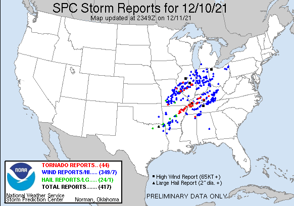


Much of the strongest tornadic activity on Friday struck portions of Nebraska and Iowa. Tornadoes affected densely-populated suburbs of major metropolitan areas like Lincoln and Omaha. The town of Elkhorn (population 6,062) was particularly hard hit by a massive wedge tornado (see video below). This tornado has been rated an EF3 with winds up to 165 mph (265 kph).


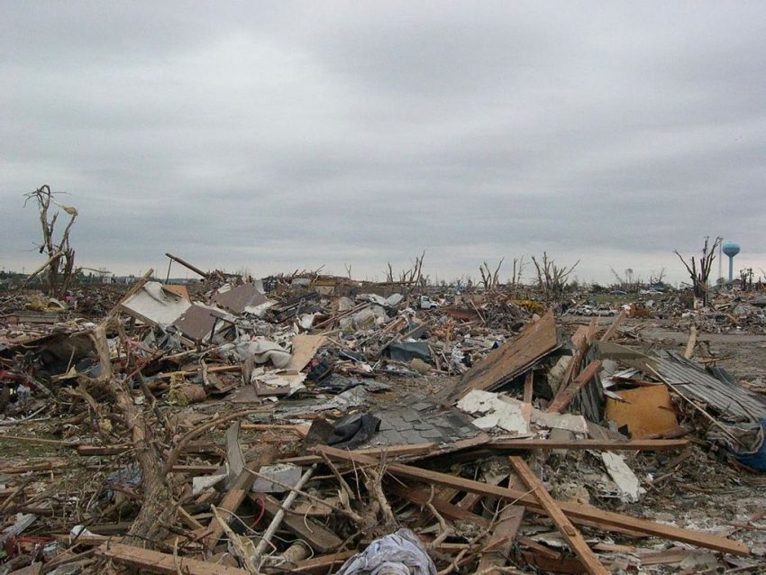
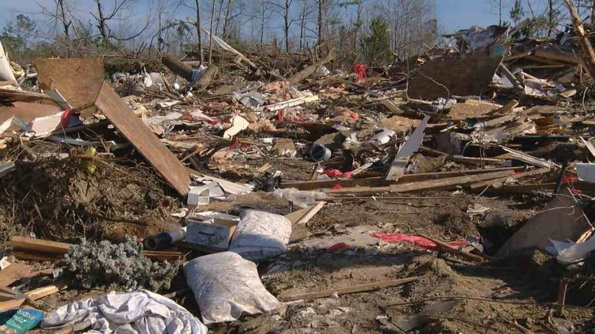
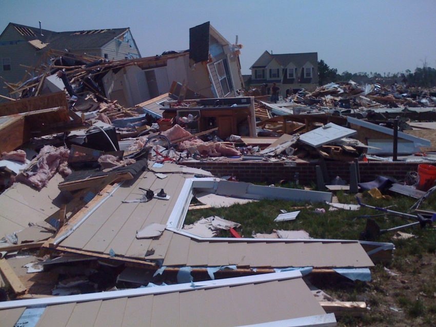
The tornado threat shifted a bit further south on Saturday towards Oklahoma, Kansas, and Missouri. Many of these twisters struck after dark, the most dangerous kind of tornado activity. The town of Sulphur, Oklahoma (population 5,065) was largely demolished by not one but two tornadoes. The second struck just as emergency personnel were starting rescue operations for the first. The startling video clips below show the extent of the devastation. They also reveal the tornado’s power, with winds strong enough to embed small branches into concrete pillars.ย Lead photo courtesy Flickr user rbeard113.


Deadly Tornado Outbreak Rips Across the Mississippi Valley!


Dozens are feared dead in the wake of severe tornadoes that roared over portions of six states on Friday night. One long-lived tornadic storm alone may have shredded a path of destruction nearly 230 miles (370 km) long. Just weeks ahead of Christmas, thousands are now facing a holiday season mourning the sudden loss of their businesses, homes and even loved ones.


The outbreak was unique in that it occurred in mid-December, typically a quiet time of year for severe storms. It was also exclusively a nighttime event. Fast-moving, strong tornadoes are particularly dangerous at night due to the lack of visibility and potential to catch people off guard.ย As of Saturday night, 44 tornado reports had been received by the Storm Prediction Center from the period between 7 p.m. and 2 a.m. Friday night. More will probably accumulate as National Weather Service teams continue to survey the catastrophic damage in the coming days.


A tornado rated EF3 on the intensity scale struck Bowling Green, Kentucky just after midnight. Another EF3 tore through Edwardsville, Illinois producing winds up to 155 mph (250 kph). It caused the partial collapse of an Amazon warehouse there, claiming six lives in the process. A candle factory in Mayfield, Kentucky was completely leveled with 100 people inside. First responders have rescued 40 workers, but the rest are still missing and feared dead. The damage is still being analyzed, but early speculation suggests the Mayfield tornado could be EF4 or even EF5, the maximum end of the scale with winds over 200 mph (320 kph). It has been eight years since the last EF5 struck anywhere in the United States, and more than 45 years since there was tornado of that intensity in Kentucky.

All told, this outbreak may claim a triple-digit death toll, making it one of the most deadly outbreaks in decades. President Biden has approved an emergency declaration for Kentucky, opening up federal recovery funds. His administration stands ready to approve the same measures for the other states affected as necessary.ย Lead photo courtesy National Weather Service.

Another Monster Hurricane Has Central America In Its Sights!


Hurricane Iota is bearing down on the east coast of Nicaragua with landfall expected Monday night. Iota is a lethal Category Five hurricane with sustained winds to 160 mph (260 kph), the strongest hurricane of this busy 2020 season. It’s also the latest-forming Category Five ever in the Atlantic basin. Iota, like Hurricane Eta less than two weeks ago, has rapidly intensified over the unusually warm waters of the southern Caribbean. In fact, Iota’s intensification is among the five fastest on record. Unfortunately, the resulting storm is even stronger than Eta was on virtually the same trajectory.


One difference between the two storms is that Eta slowed to a crawl as it approached the Nicaraguan coast. That meant a prolonged period of torrential tropical rainbands lashing the region, leading to massive flooding. Rainfall amounts likely exceeded three feet (915 mm) in some mountainous areas. Hundreds of thousands were forced to evacuate homes threatened by raging rivers and landslides. Many of these people remain homeless weeks later, forced to take shelter in temporary shelters or even tents (see tweet video below). They will be particularly vulnerable as Hurricane Iota approaches. Iota isn’t sprinting but is moving faster than Eta, and rainfall amounts should be less. However, rains locally upwards of two feet (610 mm) falling on saturated soils and swollen rivers will lead to renewed catastrophic flooding. Iota could also bring even higher winds gusting to 190 mph (305 kph) as well as storm surge up to 20 feet (6 m) to this region. Already-weakened infrastructure could collapse, leading to much higher death tolls and widespread homelessness.


Hurricane Eta turned north after impacting Central America and brought significant impacts to portions of Cuba and Florida. Model guidance suggests that Iota’s impacts will not expand beyond Central America, but that’s cold comfort for anxious residents of that battered region.

Deadly Tornadoes Rip Through Southern U.S. on Easter

Amid the horrors unleashed by Covid-19, residents of several southern states have been thrust into another dangerous scenario as severe weather has struck the region this Easter weekend. Violent storms containing hail, heavy rain, and tornadoes have moved through the states of Texas, Tennessee, Louisiana, Mississippi, Alabama, Arkansas, and Georgia. As of now, 6 people have been confirmed dead due to tornadoes in Mississippi, while close to 365,000 are without power across the aforementioned states.

The damage has been deemed catastrophic in many areas. One such area is the city of Monroe, Louisiana. Here, a tornado with winds estimated to be around 165mph (266 kph) touched down on Sunday afternoon, destroying or damaging at least 300 homes. The cityโ€™s airport sustained substantial damage, estimated to be around $30 million dollars. Fortunately, no fatalities were reported in the city, although some residents sustained minor injuries.

It appears Mississippi has taken the brunt of the storm system, as multiple tornadoes touched down across southern portions of the state. The twisters ravaged towns including, Soso, Heidelberg, and Pachuta, with winds estimated by Doppler radar to be between 170-205 mph (274-330 kph). This would equate to a rating of EF4 or EF5 on the Enhanced Fujita Scale. At the height of the tornado outbreak, two Tornado Emergencies were issued by The National Weather Service. This is an occurrence that does not happen frequently. Two of the tornadoes sent debris 20,000 feet (6096 meters) into the air. Oneย  meteorologist claimed that these were the most intense tornadoes he has ever seen on radar throughout his career.


The combination of extremely favorable conditions in the upper levels of the atmosphere, and deep moisture from the Gulf of Mexico in place, is what led this multi-faceted storm system to become so destructive. As this system moves eastward on Monday, the threat of severe weather will shift to the East Coast and Mid-Atlantic regions. Conditions will not be as conducive for tornadoes as they were on Sunday, but a few isolated tornadoes may occur. Damaging winds, hail, and torrential downpours look to be the greatest hazards.