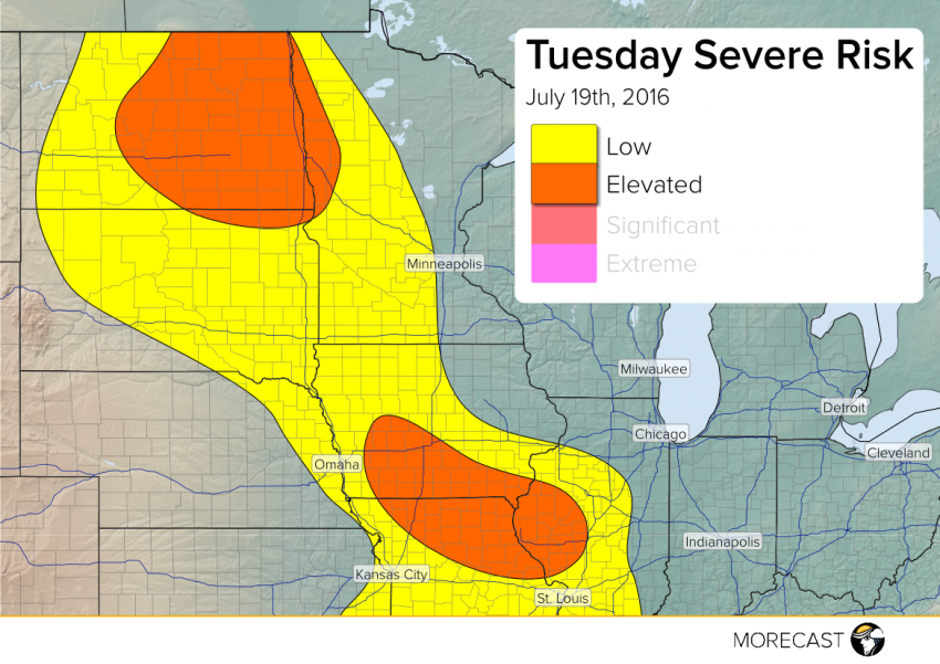
Upper Midwest, Northern Plains to See Severe Weather

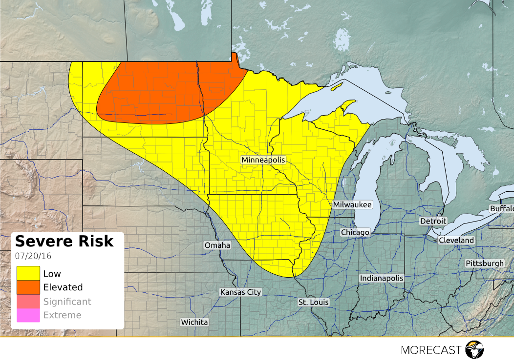
Isolated severe storms will be likely across parts of the Northern Plains and Upper Midwest on Wednesday afternoon and evening. North Dakota and northern Minnesota could see more organized convection into the overnight hours.

Read full article

The North American Monsoon

Before getting into the North American Monsoon (NAM), it’s important to understand what a true monsoon really is. The definition is a seasonal shift in winds that causes a drastic change in weather to occur (mostly changes in rainfall amounts). There’s some controversy as to whether the NAM is actually considered a true monsoon because the seasonal shift in winds is not very pronounced compared to other monsoons in the world. The NAM is proven through various studies that it is indeed a monsoon because during the season there is a drastic increase of rainfall over Mexico and the Southwestern United States due to the not so pronounced wind shifts. The increase in rainfall over these desert areas are due to the intense solar heating that results in an area of thermal low pressure to form. This causes the flow from dry land areas to reverse to be from moist ocean areas. The lower atmosphere moisture is mostly transported from the Gulf of California while the upper atmosphere receives its moisture from the Gulf of Mexico. A mid atmospheric high pressure ridge over the Southwest is what brings in the moisture from the Gulf of Mexico which can be seen below in Figure 1. The location and strength of this ridge is important to distinguish the location and how far north the thunderstorms will occur.

Figure 1: Mean 500mb height pattern, July. Subtropical high is near maximum seasonal strength over New Mexico. (from Tucson, AZ National Weather Service.)

Read full article