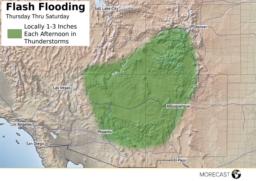
Author: Meteo Expert Josef Lukas
Monsoon Storms to Flood Southwest
Heavy monsoonal rain and storms continues to bring an increased flood threat to the Southwest through Saturday.
Significant Risk Of Severe Storms Across Northern Plains
Low pressure will organize and track northeastward from northeast Montana to southern Manitoba Wednesday afternoon and night bringing a high likelihood of severe storms across the Dakotas and parts of Minnesota.
Read full article
Severe Threat Across the Northern Plains Once Again
Another active day is expected across the Northern Plains as a cold front sweeps east across North Dakota and western Minnesota. Storms are expected to develop across eastern North Dakota into western Minnesota this afternoon and will bring a wind and hail threat to cities like Fargo, Grand Forks, and north into Winnipeg, Manitoba.
Storms will continue to develop across South Dakota and southwest Minnesota during the late afternoon and evening hours also with wind and hail being the main threat.
A few scattered strong storms will be possible across portions of Nebraska and we will see storms develop across Iowa later in the evening into the overnight. These storms will carry mainly a hail threat but some gusty winds will also be possible.
Flash flooding will continue to be a threat along a stationary boundary in southwest Iowa into Missouri. Some areas have already seen 2.0-3.0″+ and could see up to an additional inch through mid-afternoon.