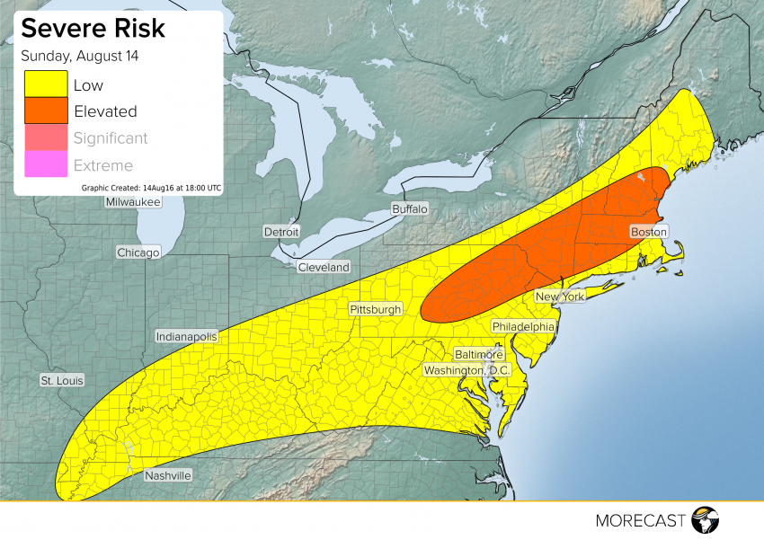
There could be some relief in the forecast later today into tomorrow! A cold front will start moving across the Northeast that will help dry out the atmosphere a little. The warm temperates will still be there but dew points will start to drop as this cold front moves through today into tomorrow. Read full article
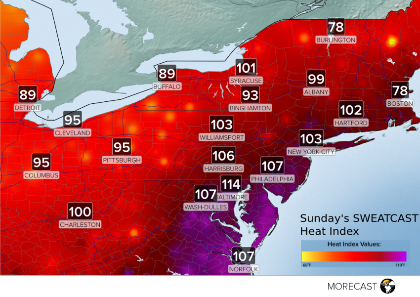
Saturday was a saultry day for many communities across the Northeast and Mid-Atlantic, and Sunday afternoon will bring more of the same. Air temperatures on Saturday climbed well into the 90s and even low 100’s, while high humidity prompted heat indicies to soar above 110°F during the hottest part of the day.
A slow moving area of low pressure is pulling tropical moisture from the Gulf of Mexico toward Louisiana and Eastern Texas. Continuing heavy rain is expected tonight in localized areas across the region. A state of emergency remains in effect through Louisiana, where excessive rainfall and flooding has occurred.
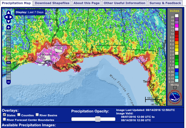
A deep moisture plume, sourced from the warm waters in the Gulf of Mexico, has been funneled onto the coast by a weak area of low pressure over the past several days. Earlier in the week, the big bend of Florida bore the brunt of the rain, with over 10″ of total rain in some areas. The impulse fueling these tropical downpours has shifted further west and is pulling the deepest moisture over Louisiana. Portions of Louisiana have already seen totals of over 20″ in just a 36 hour time frame.
Extreme flooding has already impacted many cities in Louisiana and Mississippi, including New Orleans and Baton Rouge. A state of emergency was declared for the entire state of Louisiana on Friday. Roads have become impassable in several cities and a flash flood emergency has been issued for portions of southern Mississippi and eastern Louisiana.
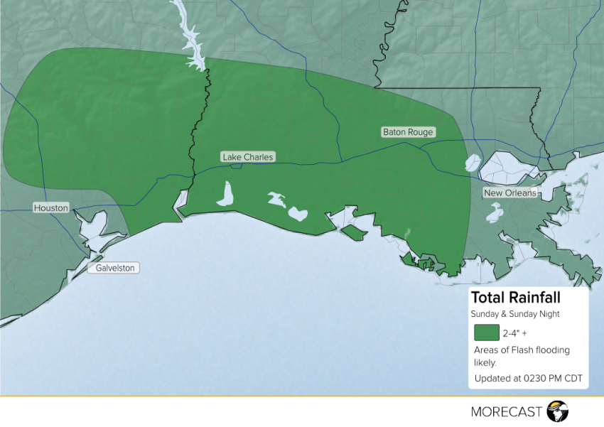
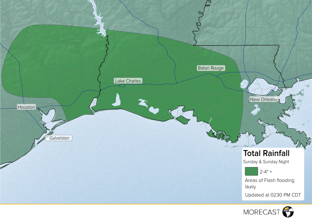
Moisture continues to be pulled into Louisiana and Eastern Texas, leading to additional rainfall throughout the day Sunday.
The heaviest rainfall totals are expected in Western Louisiana and parts of East Texas, where localized 2-4″ + amounts are possible.
Later today, the moisture feed will shift further to the north and east. Some temporary drying is likely for early Monday morning across the region. Unfortunately, more rain is expected to move in late Monday morning into the afternoon. The good news is that rainfall totals are forecast to be much less than what has already fallen across parts of the region.
Residents in Western Louisiana and Eastern Texas should use extreme caution over the next 24 hours as flooding and flooded roads can be life threatening.
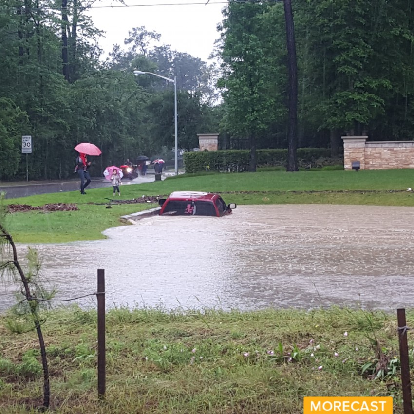
Flooding from heavy rain submerged a truck along the Gulf Coast on Wednesday, August 10th
Capture a picture of the flooding? Share your picture on the MORECAST app and stay tuned to MORECAST’s Facebook and Twitter pages for additional information on the rain impacting the Gulf Coast.
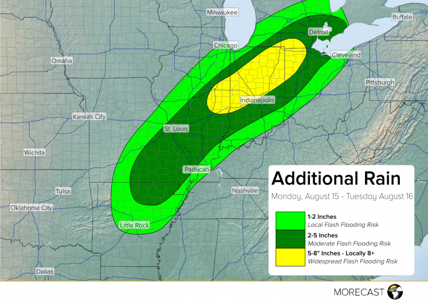
A front across the Midwest with waves of tropical moisture riding north along it have brought torrential rainfall to Missouri and southern Illinois, resulting in periods of torrential rainfall from today into Tuesday. Conditions will continue into Tuesday, with the threat of flash flooding shifting towards central Illinois and Indiana.