Soaking rain and storms set to drench southern QLD/NE NSW
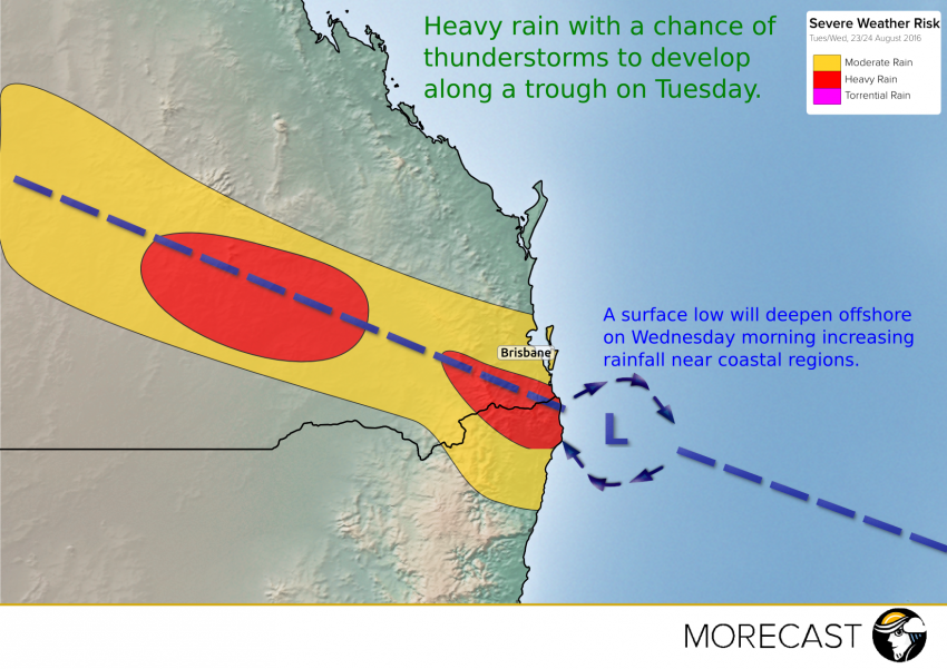
As winter draws to a close much of QLD and NE NSW will get an early taste of Spring storms and rain.
As winter draws to a close much of QLD and NE NSW will get an early taste of Spring storms and rain.
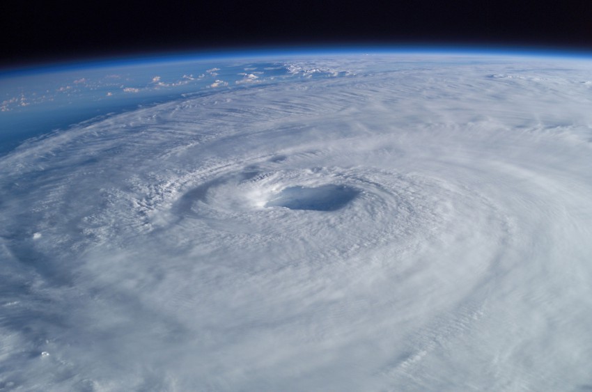
Tropical cyclones are some of the most impressive and energetic weather phenomena on planet Earth. Cyclones can bring destructive winds, torrential rains, storm surge, and numerous other hazards to very large areas while being some of the most fragile storm systems observable. Here are a few of the ingredients that need to come together to unleash the full potential of nature’s fury.
Read full article![]()
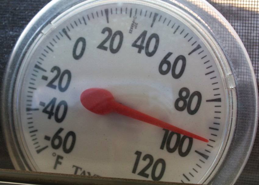
Scorching heat is expected to continue into at least the first half of the weekend across the Pacific Northwest. Temperatures early Friday afternoon were well into the 90s in places around Seattle, with the mercury approaching or exceeding 100 degrees in cities such as Portland, Eugene, Salem, Medford and Redding. The only relief is places immediately along the coast, where the cooler ocean waters are keeping seaside towns locked in the 50s and 60s. But you only have to go inland about a dozen miles or so to see temperatures spike up into the 90s.
As of 2 p.m. PDT Friday, Seattle and Portland had already surpassed their daily record highs, which were 89 and 97 respectively. Salem, Oregon has also broken the record high of 99 for Friday, while Eugene was just a couple degrees shy of their record high of 101. (UPDATE: Eugene did set a record, topping out at 104 degrees Friday afternoon)
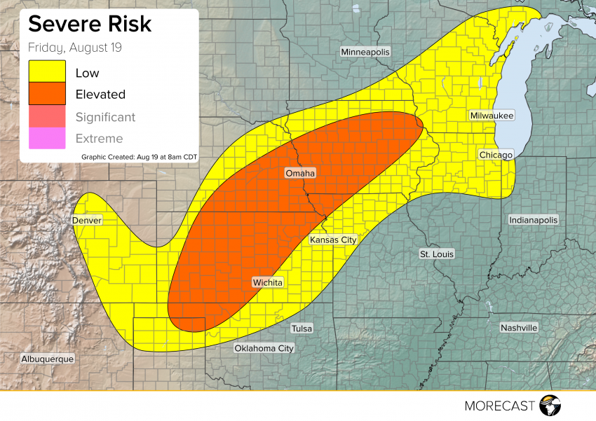
A cold front diving out of the Front Range will bring the potential for severe activity to a broad area to round out the work week Friday afternoon.
Read full article![]()