Labor Day Severe Storms Expected in the Northern Plains
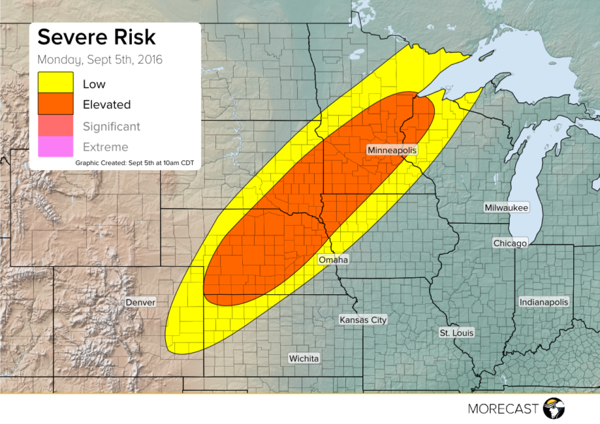
A frontal system stretches from Colorado to Minnesota this Labor Day. Due to the front, severe storms are forecast to develop in the Northern Plains later today.
A frontal system stretches from Colorado to Minnesota this Labor Day. Due to the front, severe storms are forecast to develop in the Northern Plains later today.
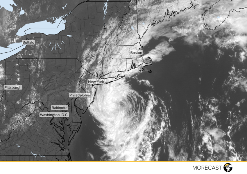
Post-Tropical Storm Hermine is likely to bring localized hazardous conditions to coastal New England.
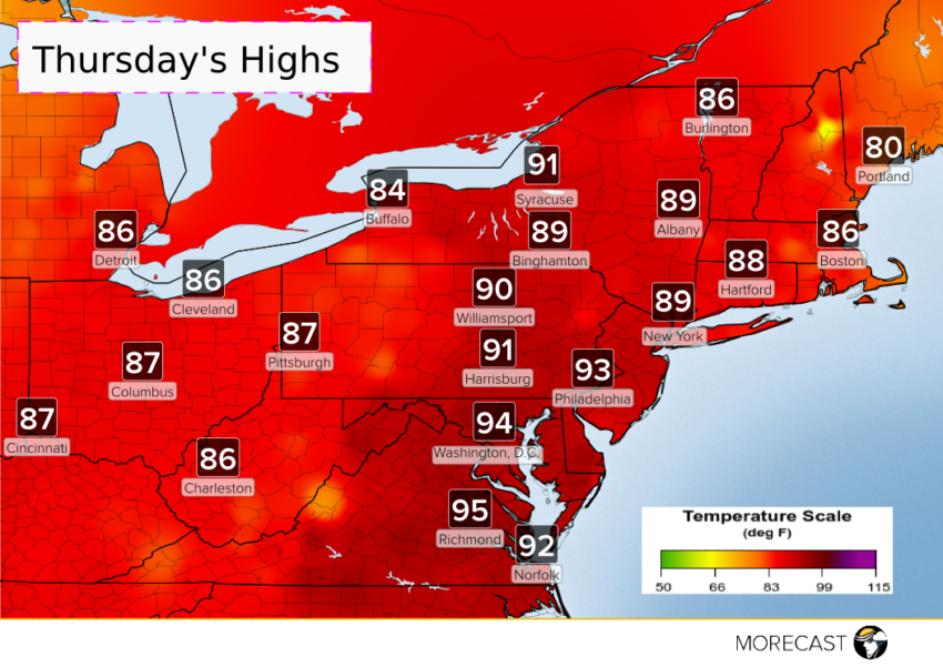
What was once Hermine will no longer be a worry for the Northeast come Thursday, but a late week heat up will be. A warmer and more humid air mass will be building into the Northeast during the day Wednesday. This will bring above average highs for Thursday and Friday.
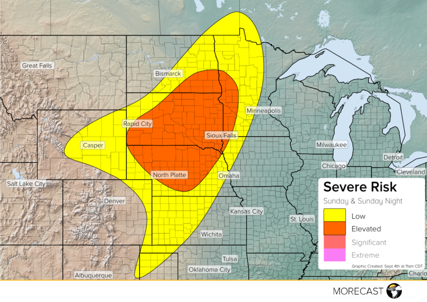
A slow moving frontal system stretches from eastern North Dakota to central Wyoming on Sunday. The front will slowly sink to the southeast, sparking scattered strong to severe storms.
A disturbance will push towards the north-central Plains later Sunday afternoon and evening. Moderate instability and a good moisture feed will fuel severe potential. Storms will fire across eastern Wyoming and the central High Plains after 3pm local time.
Damaging wind and large hail will be the primary concerns. Tornadoes also cannot be ruled out as more storms fire across South Dakota and Nebraska later in the afternoon.
After dusk, one or two lines of storms should set up and track northeastward. Damaging winds will be the main threat as storms merge and track through the eastern Dakotas and western Minnesota later at night.