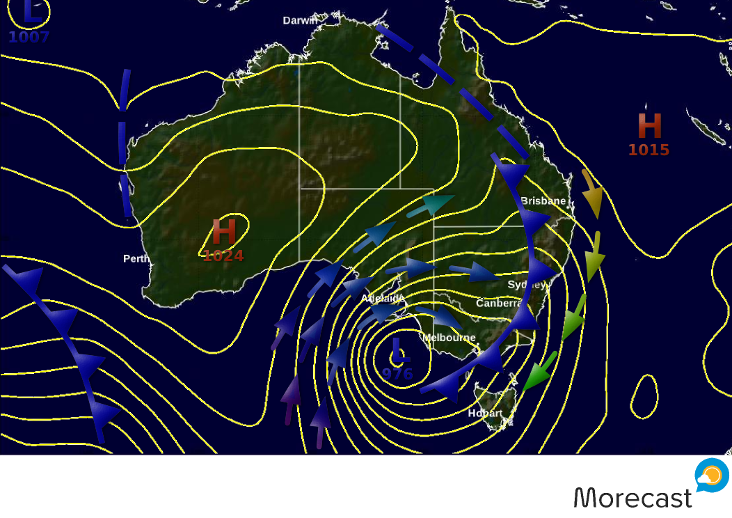
Major storm system for SE Australia

Models have remained fairly consistent in recent days on a major storm system impacting southeast Australia, particularly southeast SA, in the next couple of days.  Last week we posted on our Facebook page (click here in case you missed it) about this storm’s potential and now it looks sure to be a big one.  Below is what Thursday morning’s synoptic map might look like, with a deep low bearing down on southeast SA.

sastorm
Above. How Thursday morning’s synoptic chart might appear.

Read full article

Tropical Storm Risk for Windward Islands and South America?

The Morecast team is watching a tropical system over the open Atlantic, currently gaining strength in an area of warm ocean waters and low shear.  This system has a strong potential to become a tropical cyclone as it moves west over the next few days, aiming for the Windward Islands or possibly even the northern coast of South America.

Read full article

Flooding Continues Across Texas

Rain continues to fall across southern Texas and will not ease off until Tuesday night into Wednesday morning. Rainfall rates of 1-2 inches will cause localized flash flooding.

Read full article