The Rise and fall of the Maya civilization

One of the first and best-known advanced civilizations on earth were the Maya.
Read full article![]()
One of the first and best-known advanced civilizations on earth were the Maya.
Read full article![]()
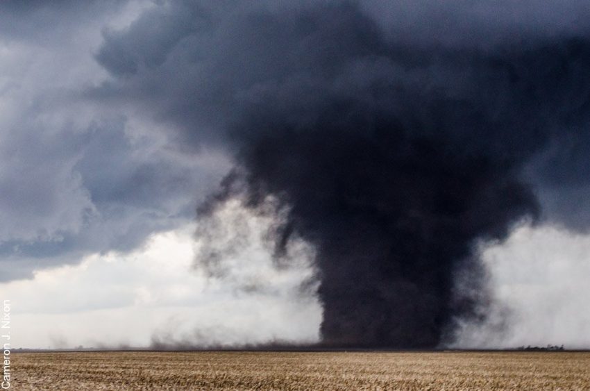
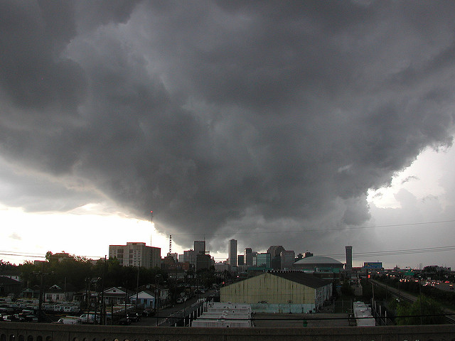
Dangerous severe storms will erupt across the Plains and Upper Midwest by mid-afternoon Tuesday. Huge hail, damaging high winds, even isolated tornadoes will occur!
We’ll see damaging wind for the Upper Midwest, and large hail for the Southern Plains from Monday afternoon into Tuesday morning.
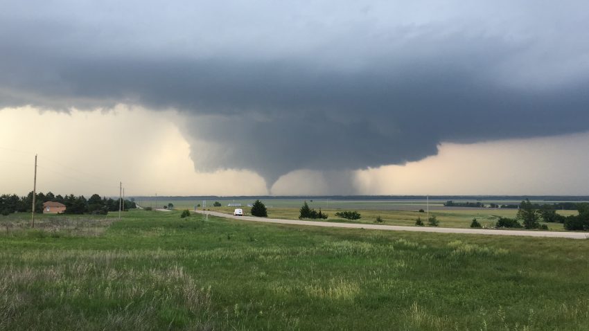
Severe weather is typical in the Great Plains and Midwest during the spring, but this coming week is shaping up to be especially active. In fact, there will be a near daily risk for severe storms all the way through next weekend across interior parts of the country.
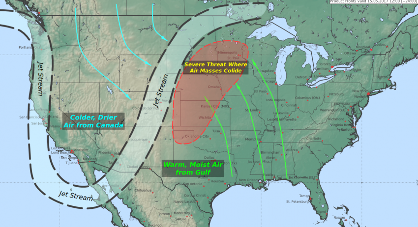
A large dip in the jet stream, known as a trough, will form across the Western United States early this week and remain locked in place through next weekend. The lack of west-to-east progress of the trough will keep the severe threat focused on the Central US.
Within the trough, cooler and drier air will dive down out of Canada. Meanwhile, out ahead of the trough, southerly winds will drive warm and moisture-rich air out of the Gulf of Mexico as far north as the US-Canadian border.
The collision of these vastly different air masses is where thunderstorm development is likely. The storms will be strengthened by strong wind shear–differing wind speeds and directions throughout the atmosphere. Shear is important, because it allows thunderstorms to create a balance between their updrafts and downdrafts. This increases the lifespan of storms, which gives them the time to strengthen into the severe storms that produce damaging winds and hail, torrential rain, and in some cases, tornadoes.
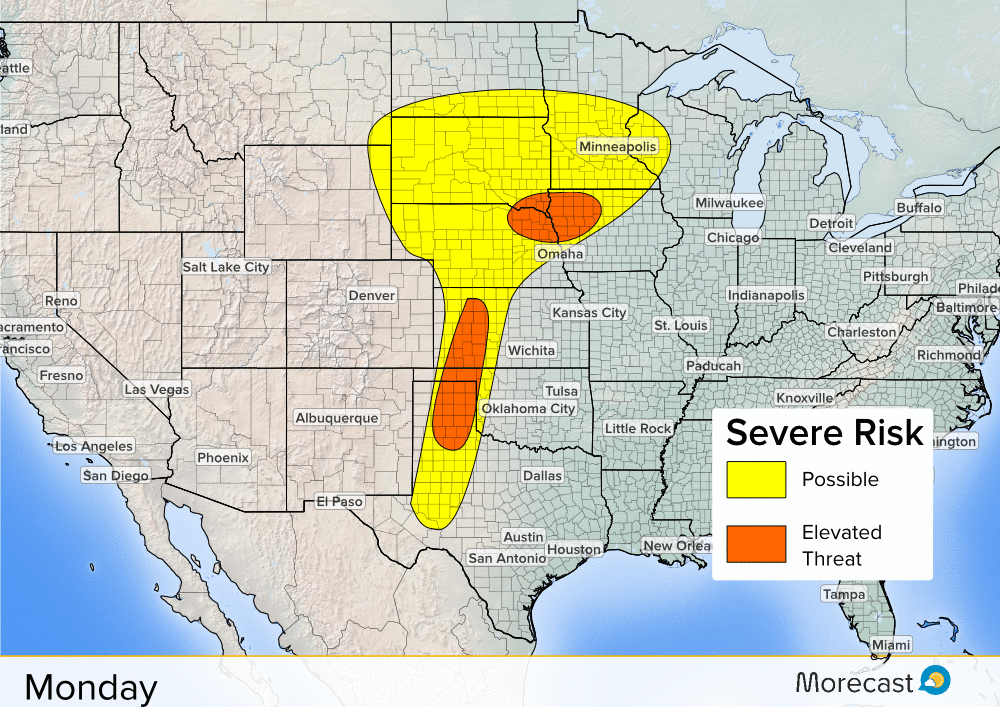
The risk for severe storms Monday will span from West Texas all the way up into the Upper Midwest, including the Twin Cities. Hail and wind will be possible from these storms, with a few tornadoes not out of the question in the ‘Elevated Threat’ areas. The stationary nature of the pattern will put many of these same areas under the gun for more severe storms Tuesday.
Wednesday offers the best chance at a break for most of the Central US, though a few severe storms may still form near an area of low pressure across portions of Iowa, northern Missouri and eastern Nebraska. But as the western trough recycles itself, another round of widespread severe weather is probable across the Southern and Central Plains for the second half of the week into next weekend.
Note that the areas highlighted for severe weather beyond three days may shift somewhat since model accuracy drops the farther out you go. However, the outlook still signifies how many areas are likely to experience multiple rounds/days of severe weather this week. As is always the case, it’s best to be prepared ahead of any storms instead of being caught off guard. Take any necessary precautions and make sure to have a way to monitor the weather in your area. That includes severe watches and warnings issued by the National Weather Service.
The Morecast team of meteorologists will be following the situation all week and post updates on Facebook and Twitter. You can also time out the storm chances for your location using the Morecast App.