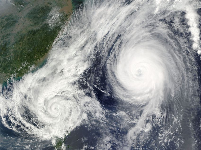
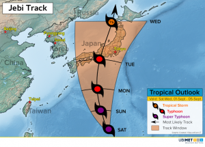
Powerful Jebi Targets Japan Next Week

Jebi is a powerful cyclone spinning across the West Pacific, and the storm will track steadily northward toward Japan by early next week.


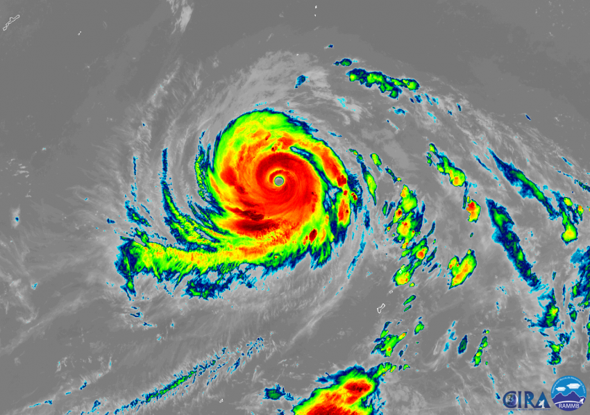
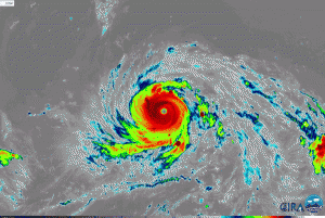
Jebi reached Super Typhoon status late this past week, meaning that sustained winds are greater than or equal to 130 knots. Ideal environmental conditions of warm sea-surface temperatures and light wind shear will keep Jebi quite powerful into the first part of next week.

Weather models are fairly consistent in tracking Jebi toward the north over the next few days. Steering winds are expected to take the cyclone into Japan on Tuesday and then into southeast Russia on Thursday.

Impacts to Japan from Jebi could include damaging winds, flooding rain, and a significant storm surge near the area Jebi makes landfall. Major Japanese cities such as Osaka and Tokyo will likely experience some adverse impacts from the cyclone.

Confidence in more specific details regarding impacts to Japan will become clearer this weekend as Jebi inches closer to the island nation.

Lane Expected To Become A Major Hurricane & Pass South Of Hawaii Next Week

Lane developed in the Eastern Pacific Ocean on Tuesday and achieved hurricane status on Thursday. The cyclone is expected to reach major hurricane status (category 3 or higher) this weekend.

Environment conditions will be ideal for Lane to strengthen over the next several days. Wind shear is weak, and sea surface temperatures are between 28-30°C.

Lane is expected to acquire major hurricane status this weekend. Major hurricanes contain sustained winds that are 96 kts and greater.

Initially, Lane will be tracking toward the northwest through Sunday. Beyond this weekend, a ridge of high pressure north of Hawaii will try and force Lane to take a more westerly track next week.

If the ridge is weaker than expected, Lane could take a track closer to Hawaii. However, a stronger ridge of high pressure would force Lane farther to the south away from Hawaii.

Many Mid-Atlantic Cities Set To Have Wettest Summer On Record

Residents across the Mid-Atlantic have experienced day after day of tropical downpours in recent weeks setting the stage for many locations to have their wettest summer on record.

Across Pennsylvania, Maryland, and northern Virginia there are 10 locations experiencing their wettest summer on record. The data is based on meteorological summer which covers the months of June, July, and August.

Looking back to mid May, many locations in the Mid-Atlantic have seen 20-30 inches (~500-760 mm) in a 90-day period. Several rain events this summer have lead to moderate and even major flooding problems for some communities.

The copious amounts of rain since mid-May have lead to rainfall departures of 8-16 inches (200-400 mm) in a 90-day period.

“Fujiwhara” Phenomena Possible In East Pacific This Weekend

Two cyclones spinning in the open waters of the eastern Pacific Ocean will have an opportunity to undergo an interesting meteorological phenomena this weekend known as the “Fujiwhara effect”.

The Fujiwhara effect occurs when two nearby low pressure circulations get closer together and then merge into one circulation. This interaction was first described by Japanese meteorologist Sakuhei Fujiwhara.

Hurricane John and Tropical Storm Kristy will gradually move closer to each other through the end of this week. Over the weekend the two circulation could get close enough to achieve the Fujiwhara effect.

The animation above represents a model solution for John and Kristy which shows the Fujiwhara effect between the two cyclones. John is modeled to have a larger circulation than Kristy, so John’s circulation would most likely absorb Kristy’s smaller circulation.

Neither system will be a threat to land, and the surviving circulation will most likely lose tropical characteristics by later next week.