Keni Acquires Severe Tropical Cyclone Status; Batters Fiji
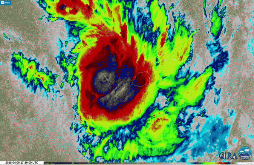
Cyclone Keni strengthened into a severe tropical cyclone on Tuesday. Keni is expected to batter Fiji with heavy rain, damaging winds and coastal flooding Tuesday into Tuesday night.
In anticipation of the storm, the Fiji National Disaster Management Office briefed government officials and tweeted out a statement saying they are prepared for the cyclone.
Happening now! We’re briefing @FijiPM and government permanent secretaries on #TCKeni and the continuous preparation in place by our uniformed and non-uniformed servicemen. #Fiji, your @FijiNDMO stands ready to respond! 💪🏻🇫🇯❤ pic.twitter.com/gDip53ZWmc
— Fiji National Disaster Management Office (@FijiNDMO) April 9, 2018
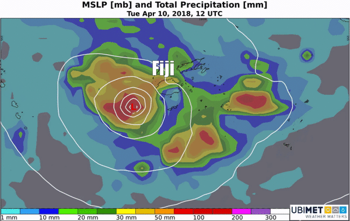
Cyclone Impacts
Keni is expected to drop between 50-100 mm of rain on the northwest side of Fiji’s largest island, Viti Levu. The southeast side of Viti Levu will see less rain because of downsloping winds from the mountains in the middle of the island.
Winds of 80-100 kph are expected across Viti Levu, particularly across the southern part of the island which will be closer to the central of the cyclone.
The good news for Fiji is that Keni will be a quick moving cyclone. On Wednesday, some sunshine will return to the area as Keni marches southeast away from the country.
Keni is the seventh named cyclone of the South Pacific cyclone season, which runs from November 1st to April 30th each year.