Multiple upper level disturbances have been moving along a stationary front from the Mid-South into the Midwest in the past several days. The strongest trough brought destructive storms from Texas to Ohio on Wednesday with over 800 reports of high winds, giant hail, and tornadoes. Subsequent waves have been somewhat less intense in terms of severe storms. However, days of torrential rainfall are starting to push streams and rivers into major if not historic flood levels.
One of a million reasons I will never move back to the south.
This was in Arkansas today.
If you’re not familiar with tornado sizes – that’s a big fucking tornado. pic.twitter.com/pAhgmrCa4T
— Snark Queen Bee 🖕 (@SnarkQueenBee) April 3, 2025
First light drone over Lake City, Arkansas. Video below #ARwxhttps://t.co/LsoKxQagvY pic.twitter.com/0dcIndNbEO
— Aaron Rigsby (@AaronRigsbyOSC) April 3, 2025
More than 60 tornado reports were reported to National Weather Service offices on Wednesday from southwest Arkansas all the way up to southern Michigan. The strongest twister may have hit Lake City, Arkansas (see video and damage pictures above). An EF-3 rated monster packing winds up to 150 mph (240 kph), the tornado leveled numerous homes and businesses. Massive hail up to 2.75 inches (7 cm) and non-tornadic wind gusts to 100 mph (160 kph) also caused severe damage.
A house is floating down the river in Frankfort – shared by a friend who is flooded. So sad @LEX18News pic.twitter.com/hWq67yk17T
— Leigh Searcy (@LSearcLex) April 5, 2025
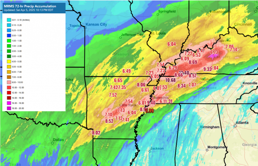
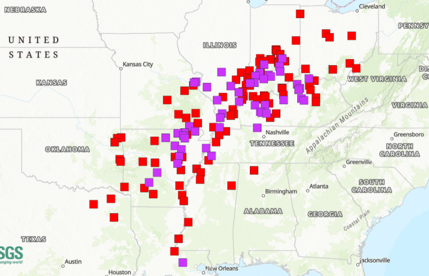
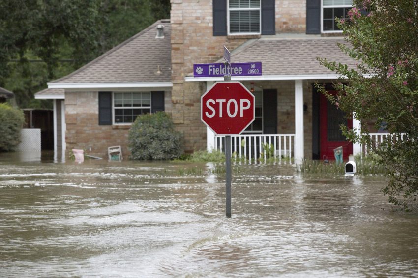
Fewer reports of severe storms have been received in the ensuing days. However, slow-moving, training storms have been dumping tremendous rainfall across the region. Amounts of 6-10 inches (150-250 mm) have been recorded over a very large area with localized totals over a foot (see rainfall map above). This overwhelming surplus of water has already pushed streams and smaller rivers to major flood levels with some threatening all-time records. Larger rivers like the Mississippi will likewise exceed major flood stages in the coming days as the water moves downstream (see forecast gauge map above with purple representing major flood status). Whole communities will be cut off if not entirely inundated. At least sixteen lives have been claimed so far by the severe storms and flooding of the past several days.