Cyclone Alfred slowly approached southeast Queensland and northeast New South Wales from mid- to late last week with increasing winds and rains. Alfred made landfall near Moreton Bay Friday night and has been moving slowly north and west the past few days. The slow forward movement and surge of tropical moisture on the south side of the circulation has led to severe flooding, including in the Brisbane metro.
Tropical Cyclone Alfred has caused widespread destruction along the Queensland and Northern New South Wales coasts overnight, with powerful winds toppling trees and bringing down power lines.
Nearly 240,000 homes and businesses are without power due to the storm’s strong winds… pic.twitter.com/tRax1H5cy0
— 10 News First Sydney (@10NewsFirstSyd) March 8, 2025
Alfred was a borderline Category Two cyclone as it approached land. Days of storm surge and massive waves led to severe erosion of the coastline. Wind gusts of 90-115 kph (55-70 mph) were common from Brisbane down to the northeast NSW coast. These winds combined with the rain-weakened soils have brought many trees and powerlines down. At one point Friday night there were over 300,000 customers without power in southeast QLD alone.
Disaster in Hervey Bay: Fish also entered the house along with the floods water#cyclone #Australia #Flood #flood #cyclone #HerveyBay #CycloneAlfred pic.twitter.com/1I2ibg6hAO
— MOHAMMAD AHSAN🎗️ (@MOHAMMAD_AARSH) March 9, 2025
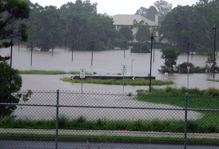
Massive floods due to ex-cyclone Alfred in Brisbane of Queensland, Australia 🇦🇺 (09.03.2025) pic.twitter.com/GB1nAxPSox
— Disaster News (@Top_Disaster) March 9, 2025
However, as the cyclone has weakened and slowed to a crawl, the most significant hazard has increasingly been severe flooding. The heaviest rains fell first in the hills of northeast NSW and the QLD-NSW border from mid to late last week. As Alfred moved north, the focus shifted to the Brisbane region this weekend with rainfall rates peaking Sunday and Sunday night upwards of 80 mm (3 in) / 3 hr. A stationary band in the Hervey Bay area dropped 108 mm (4.3 in) in one hour! Overall totals of 300-600 mm (12-24 in) have been common from southeast QLD to northeast NSW. Isolated totals up to 800 mm (31.5 in) have been recorded in the favorable terrain. These tremendous falls have led to severe flash flooding in Brisbane and elsewhere with houses and roads inundated and cars stranded. Runoff will prolong the threat of creek and river flooding through the week. Lead photo courtesy flickr user David Jackmanson.