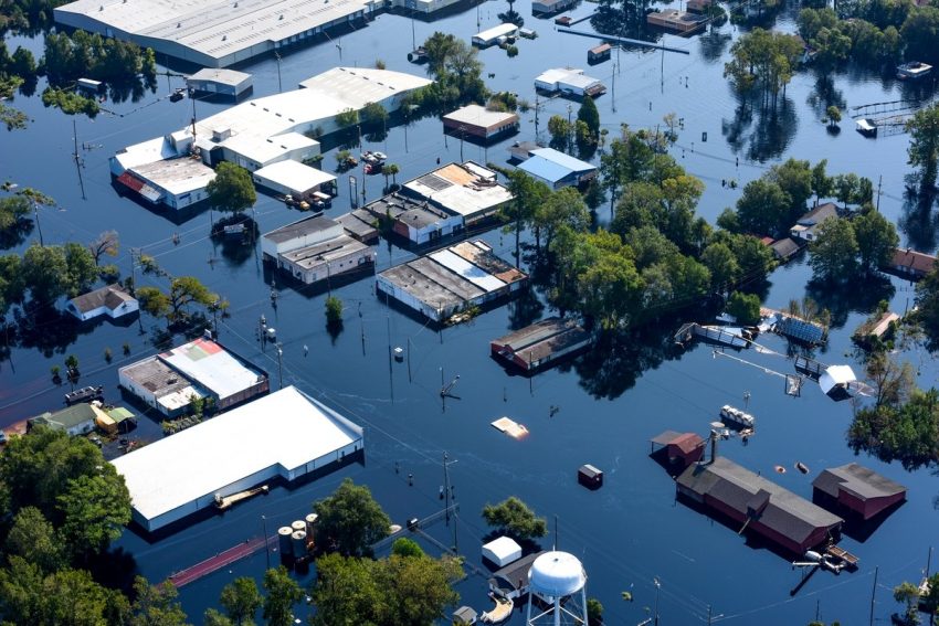
Hurricane Milton set a record for the fastest Atlantic storm to reach Category 5 status earlier this week. It was still a dangerous Category 3 hurricane as it roared ashore just south of Tampa on Wednesday evening. Coming just a few weeks after Hurricane Helene swamped the area with severe surge flooding, Milton has added damaging winds, tornadoes, and more than a foot of torrential rainfall.
Now that the sun is up, here’s a 360-degree view of the damage Hurricane Milton caused to Tropicana Field’s roof and the inside of the ballpark. Absolutely heartbreaking 💔 pic.twitter.com/ZCtPHv6rE9
— Ryan Bass (@Ry_Bass) October 10, 2024
👀👀👀👀👀👀👀👀👀
DRAMATIC TORNADO FOOTAGE recorded by UCN Storm Team #2 earlier today near Ft. Pierce, FL. A semi truck overturned and our team along with some Good Samaritans were able to extract the driver to safety. We are told the driver is in stable condition. 🙏🫡💪… pic.twitter.com/s4lduttpZ2— United Cajun Navy (@Unitedcajunnavy) October 10, 2024
Milton formed on Saturday, 5-October in the unusually warm waters of the southwestern Gulf of Mexico. It intensified as rapidly as any Atlantic hurricane on record. By Monday afternoon it had become one of the strongest Atlantic hurricanes ever with a central pressure of 897 mb. It is incredibly difficult for a hurricane to maintain that intensity even in ideal circumstances. Milton encountered strong vertical wind shear and cooler waters on Wednesday and entered a steady weakening phase. Nonetheless, high winds and tropical downpours starting rolling into central FL on Wednesday afternoon as the seas rose.
CAKED IN FEET OF SAND in Venice Beach, Florida from Hurricane Milton pic.twitter.com/xOpYefIQ0m
— Reed Timmer, PhD (@ReedTimmerUSA) October 10, 2024
Widespread gusts of 70-100 mph (110-160 kph) brought down trees and powerlines across central Florida, including a gust to 97 mph at Tampa, 102 mph at Saratoga, and 92 mph at the Kennedy Space Center. More than two dozen tornadoes, some of them long-tracked, fast-moving, and intense, caused severe damage across south-central Florida. A band of heavy rains commonly 8-14 inches (200-350 mm) in total have pushed rivers quickly above major flood stages, in some cases to record levels. Storm surge also inundated numerous communities along the Gulf coast up to the roof lines, wrecking homes and businesses.
