History was made over the weekend as Hurricane Hilary moved north just off the Baja California. The storm weakened rapidly as expected. However, Hilary still managed to make landfall in the L.A. Basin Sunday night as a tropical storm, the first since 1939. Gusty winds affected the immediate coast but by far the most widespread and severe impacts have been from heavy rain.
LINK: Full footage of the massive mudslide that cut off the community of Forest Falls, California today. #CAwx #Hilary @accuweather https://t.co/7io7t1V7ZH pic.twitter.com/LCFNZVywqd
— Aaron Rigsby (@AaronRigsbyOSC) August 21, 2023
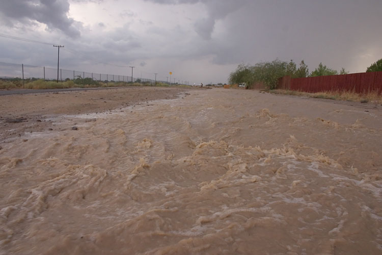
Prolonged southerly flow has pumped copious moisture from the tropical Pacific into the Southwest US, especially southern California. Rainfall of 3-6 inches (75-150 mm) has been common over the high deserts and mountains with amounts of 1-3 inches (25-75 mm) in metro Los Angeles. The 4-5 inches (100-125 mm) recorded around Palmdale are close to the yearly average for the area. The heaviest bands were producing up to one inch per hour at times in places like Burbank and Palm Springs.
Flood due to passing Hurricane Hilary in Palm Desert of California, USA 🇺🇲#HurricaneHillary pic.twitter.com/4oyoihdiLl
— NEWS ALL TIME (@NEWS_ALL_TIME) August 21, 2023
Holy crap it happened again I’m trapped in Oak Glen!!! #breaking #HurricaneHillary pic.twitter.com/boKpUDVAtw
— FirePhotoGirl (@FirePhotoGirl) August 21, 2023
Hurricane Hilary – Dodgers Stadium flooded 👀 #Hilary #HurricaneHilary #California #Alert #Hurricane #PalmSprings #LosAngeles #LasVegas #SanDiego #earthquake #TropicalStorm #flooding pic.twitter.com/WNgkQBgsAq
— Chaudhary Parvez (@ChaudharyParvez) August 21, 2023
This torrential rainfall has led to widespread flash flooding as well as mud and rock slides. Major highways and interstates across the region have been damaged, closing off whole communities. Additional major flooding will spread north through Nevada and into the Northern Rockies. Lead photo courtesy Flickr contributor David O.