After ravaging western Cuba and the Florida Keys late Monday into Tuesday, Hurricane Ian rapidly intensified early Wednesday. Ian reached high-end Category Four status with sustained winds to 155 mph (250 kph) before making landfall at Cayo Costa, Florida. Social media reports confirm widespread and serious damage around the Naples – Fort Myers – Port Charlotte region.
Naples. Houses are moving pic.twitter.com/nFVY9oP1y4
— reallyryanbush (new acct) (@reallyryanbush) September 28, 2022
Got this from a friend in #Naples – just so sad. @ActionNewsJax #Ian pic.twitter.com/HtC0CtG228
— Jason Brewer (@JBrewerBoston25) September 28, 2022
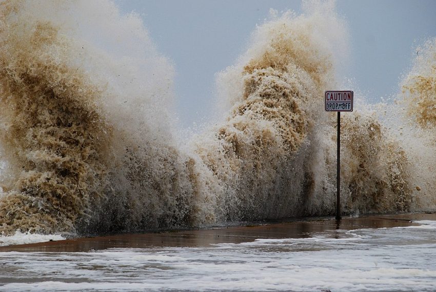
The large size and intensifying nature of the hurricane increased the surge flood potential as Ian approached landfall Wednesday afternoon. Both Fort Myers and Naples reported their highest surge flooding levels on record, up to 12 feet (3.7 m) in spots. A large swath of central Florida is seeing copious rainfall, up to 20 inches (500 mm) already to this point. This will lead to serious freshwater flooding issues in the next few days. Destructive winds have also leveled trees and powerlines across the area. A weather station in Port Charlotte reported a wind gust to 132 mph (212 kph). More than two million Floridians are without power as of Wednesday evening.
my dad just sent me this video from Naples Florida Hurricane Ian #HurricaneIan #naplesflorida #naples pic.twitter.com/2jK6GErZjb
— FOCUS Gradebook (@FOCUSGradebook) September 28, 2022
Hurricane Ian has weakened to Category One status as of Wednesday night but will continue to bring strong winds and flooding to Florida, Georgia, and the Carolinas in the next few days. Meanwhile, cleanup efforts will begin in earnest over the landfall zone on Thursday. A full recovery will take weeks if not months. Lead photo courtesy Scott Pena.