An unusually energetic storm system emerged from the Rockies into the Plains on Wednesday, bringing widespread damaging winds to portions of 14 states. Across the High Plains, these high winds picked up tons of dust and debris to create a blinding dust storm. Later in the afternoon, a squall line of severe storms raced from the Plains into the Upper Midwest, bringing destructive gusts to 100 mph (160 kph) and numerous tornadoes.
Terrible duststorm I-70 West Kansas – Colorado pic.twitter.com/TDRRQPUUtx
— Aleksander Onishchuk (@Brave_spirit81) December 16, 2021
This is just wild to see on satellite. Dust blowing as the storm pivots north. Dry conditions combined with heavy winds = massive dust storm. Shades of the 1930s here, remarkable to see, not gonna lie. pic.twitter.com/51sOqJCmOb
— Chris Martz (@ChrisMartzWX) December 16, 2021
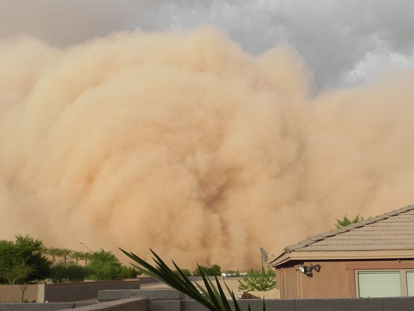
Anticipating the hurricane-force wind storm, officials in many areas preemptively closed schools and government offices. Winds ramped up in the mid-morning over eastern CO and NM. The winds picked up copious dirt and debris, resulting in a dust storm that rolled towards western KS in the early afternoon. Visibilities dropped to near zero within the dust storm. Traffic was brought to a halt (see video above), forcing the closure of Interstate 70. The satellite image shown above shows the vast area affected by the choking dust (ribbons of brown swirling into the bottom side of the circulation). Dust entrained into the system in Colorado has been deposited as far east as Missouri and Iowa.
WHOA! #SurveillanceVideo shows a powerful storm passing over Hickman, Nebraska. A trampoline and slide can be seen being pushed over due to the high wind Credit: Devin Petrzilka #storms #wind #Nebraska #severeweather pic.twitter.com/p7nyqmrkBS
— Channing Frampton (@Channing_TV) December 16, 2021
By mid-afternoon, severe storms boiled up along a squall line from central Kansas into central Nebraska. This squall line raced quickly east at speeds up to 100 mph (160 kph), faster than the fastest highway traffic. Brief but lightning-fast tornadoes spun up along the line, knocking down trees and barns and flipping semi trucks. Even away from the tornadoes, widespread straight-line wind gusts of 75-100 mph (120-160 kph) have resulted in thousands of power outages. In fact, more reports of gusts exceeding 75 mph were received by the Storm Prediction Center today than any other day on record. Lead photo courtesy Wikipedia contributor Roxy Lopez.