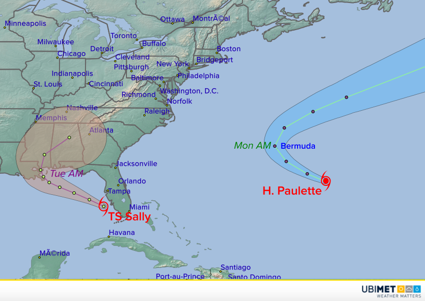
The climatological peak of hurricane season in the Atlantic Basin just occurred on 10-September. Appropriately, the tropics are very active. Currently there are four storms rolling across the Basin, including Hurricane Paulette and Tropical Storm Sally, both strengthening. Paulette will pass directly over the island of Bermuda in the next few days. Meanwhile Sally is expected to strengthen rapidly and approach the central Gulf Coast as a hurricane later this week.
#Paulette has been upgraded to a #hurricane – the 6th of the 2020 Atlantic season to date. The average full Atlantic hurricane season has 6 hurricanes. pic.twitter.com/QHrTgdWPOd
— Philip Klotzbach (@philklotzbach) September 13, 2020
Paulette is a minimal hurricane as of Saturday evening, however conditions are favorable for steady strengthening in the next few days. Paulette will continue to move northwestward, bringing the center of the storm directly over Bermuda by Monday morning. Hurricane landfalls are not uncommon for the tiny island nation, occurring every few years, and local residents have well-practiced procedures to deal with the impacts. However, strong winds, heavy rains, and surge flooding can still major disruptions, including power outages. After passing Bermuda, Paulette will turn northeast and accelerate towards the northern Atlantic.
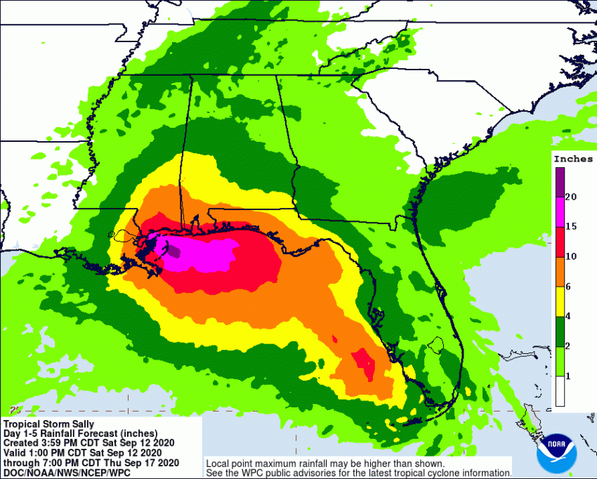
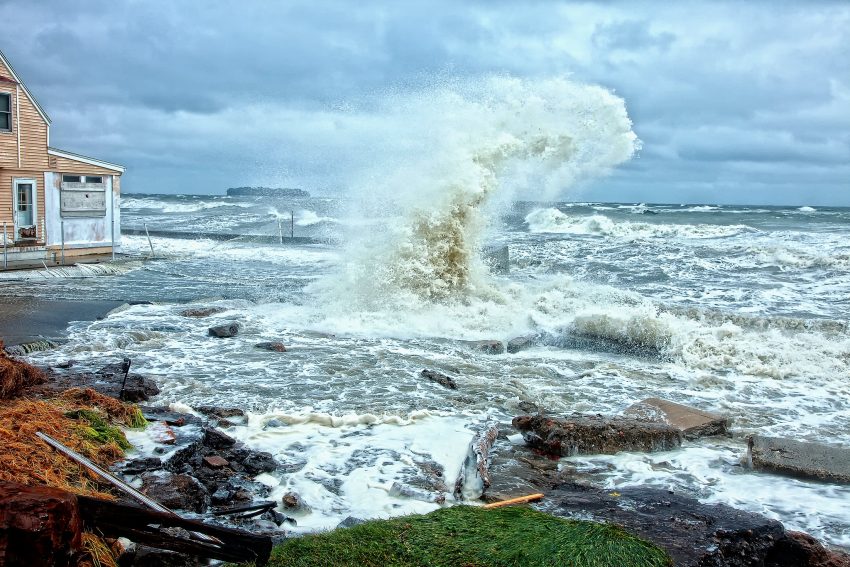
Tropical Storm Sally has already caused very heavy rainfall and gusty winds over south Florida on Saturday. Now the storm has entered the eastern Gulf of Mexico with warm waters and low shear ahead. Intensification is likely and Sally could be a hurricane by Monday. Steering winds are not very strong and will diminish further in the coming days. Consequently, Sally will slow down as it moves close to the central Gulf Coast. Landfall is projected to occur somewhere between southeast Louisiana and the Florida panhandle on Tuesday. Slow storm motion will lead to heavier rainfall totals, exceeding 12 inches (300 mm) in some areas (see map above), leading to serious freshwater flooding. A life-threatening storm surge and destructive winds will also occur near and just east of the landfall point. Additional updates will likely come out as Sally approaches landfall. Lead photo courtesy flickr user Jerry Angelica.