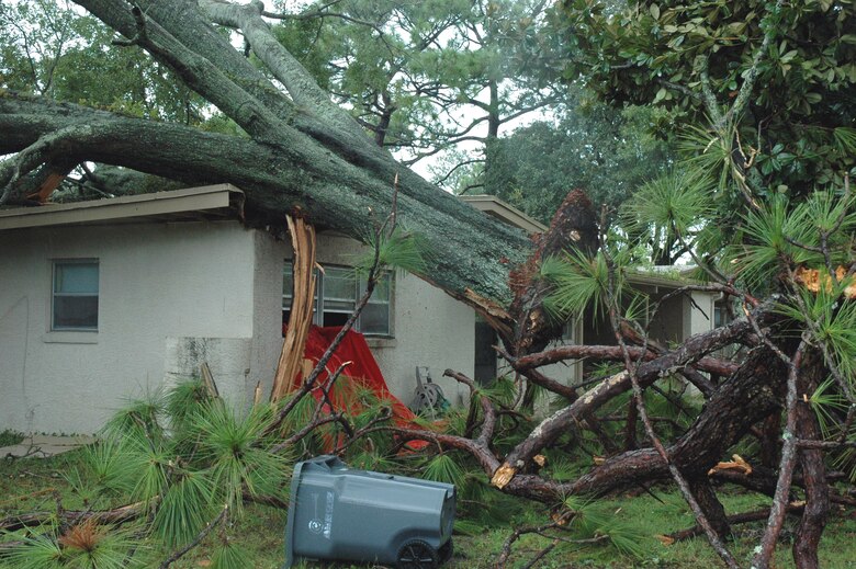
A swath of destructive winds up to 110 mph (175 kph) accompanied a long-lived squall line known as a derecho through the Midwest. The 700+ mile (1,125+ km) path included the Chicago metro area on Monday afternoon. An embedded tornado within the squall caused enhanced damage on the city’s north side. More than a million residents in the region remained without power as late as Tuesday morning.
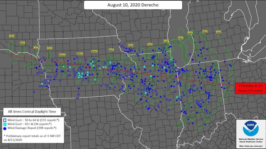
The derecho began as a cluster of severe storms along the South Dakota-Nebraska border early Monday morning. In the first few hours, giant hail was the main hazard with some stones up to softball-sized. By late morning the cluster had organized into a fast-moving bow echo raking central Iowa. This was probably where the highest winds and worst damage occurred. Midway, Iowa recorded a gust to 112 mph (180 kph), as strong as a Category Two hurricane. Residents reported these intense winds lasted up to 15-20 minutes. They compared the destruction to tornadoes that typically cover a smaller area and last a shorter amount of time. Officials estimate up to one-third of the state’s staple corn crop was destroyed, only weeks after the region had celebrated recovery from a drought. The damage was so widespread that it was visible on satellite imagery the next day (see bottom tweet).
#derecho that hit Cedar Rapids, IA, caused widespread damage, snapped power line poles like toothpicks, caved walls on homes, ripped buildings to pieces. 100+ mph sustained winds. pic.twitter.com/THkgyElEew
— Tyler Schuett (@tyshut) August 11, 2020
Scranton Iowa pic.twitter.com/298IXFlSJS
— David Hollander (@DavidHollander1) August 11, 2020
Crop damage from yesterday’s #derecho2020 is visible from satellite images over #Iowa’s #corn belt. I was in the storm, and yeah, it really kinda sucked. pic.twitter.com/0tAkfQxSfX
— ☭ Proletariateats ☭ (@proletariateats) August 11, 2020
The squall line crossed into northern Illinois early in the afternoon, slamming Chicago in the mid- to late afternoon. Gusts were measured up to 80 mph (130 kph) in the city, felling many trees and powerlines. The derecho slowly weakened in the evening, but continued to cause significant damage across northern Indiana and even northwest Ohio. By the end of its 14-hour lifespan, the derecho had produced more than 500 high wind reports across eight states and covered 770 miles (1,240 km). That’s an average speed of 55 mph (90 kph), but at its peak the squall moved as fast as 70 mph (110 kph)!