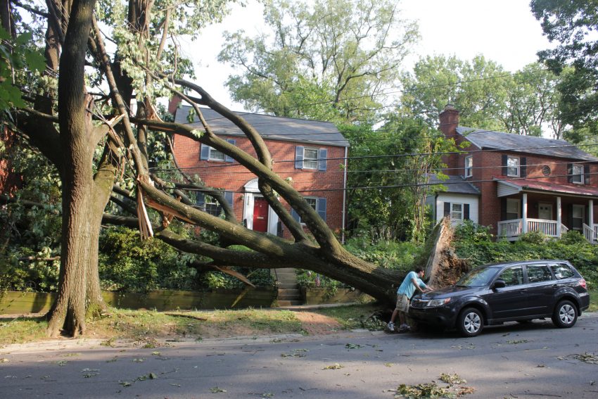
Hurricane Isaias made landfall in southern North Carolina late on Monday evening. Less than 24 hours later, the storm is leaving the New England states. In between lies a path of damaging winds, flooding rains, and tornadoes. The densest population centers in the U.S. saw widespread winds of 60-80 mph (100-130 kph), felling countless trees and powerlines and leaving millions without power.
Observed peak wind gusts (mph) from Isaias as of 7 pm Tuesday August 4th. pic.twitter.com/AAYMR8XmmZ
— NWS Eastern Region (@NWSEastern) August 4, 2020
#Isaias left behind path of damage across Tri-state. @ABC7NY pic.twitter.com/nHvomprBoD
— Mike Marza (@mikemarzaABC7) August 5, 2020
Kelly Drive and Schuylkill River merge?? 😳😳 Stopped and flew @FOX29philly #skyfoxdrone on the way home. Check out the show at 10pm for updates on insane amounts of #tropicalstormisaias flooding. Stay safe out there! #wegothere #drone #mavicmini pic.twitter.com/LgzL678ZPk
— Bill Anderson (@BillAFox29) August 5, 2020
Isaias has left a unique mark on the history of tropical cyclones. The storm experienced a surge of intensification before landfall near Ocean Isle Beach, NC. That intensification helped produce a dangerous surge up to six feet (1.8 m) high for coastal NC, flooding homes and cars and leaving a thick layer of beach sand burying whole communities. Isaias interacted with a large trough in the Midwest that injected extra energy into the storm. The storm was thus able to retain strength over inland areas where most cyclones die. Destructive winds swept up the entire East coast with gusts of 70-80 mph (115-130 kph) reported as far north as the Big Apple. The highest winds lasted only a few hours with the storm sprinting north, but it was plenty enough to cause widespread damage. At least 25 tornadoes were also reported during the morning hours in the Mid-Atlantic, producing smaller pockets of extreme damage. Inland areas saw heavy rain up to ten inches (250 mm) leading to localized flooding. Lead photo courtesy flickr user woodleywonderworks.