Hurricane Isaias roared through the Bahamas today, producing heavy rains and high winds (see video tweet below). Fortunately, little in the way of major damage has been reported. Passage through the Bahamas has resulted in Isaias weakening back to tropical storm status. Upper level wind shear has exposed the core of the storm. However, there is still a dangerous landfall threat in eastern Florida on Sunday. Isaias will continue to move north-northwest, scraping the entire Atlantic coast of the Southeast with high winds, rough surf, and damaging winds through the next few days.
Strong winds buffet the #Bahamas as Hurricane #Isaias blows through the Caribbean pic.twitter.com/7MZwbeJ7ir
— Press TV (@PressTV) August 2, 2020
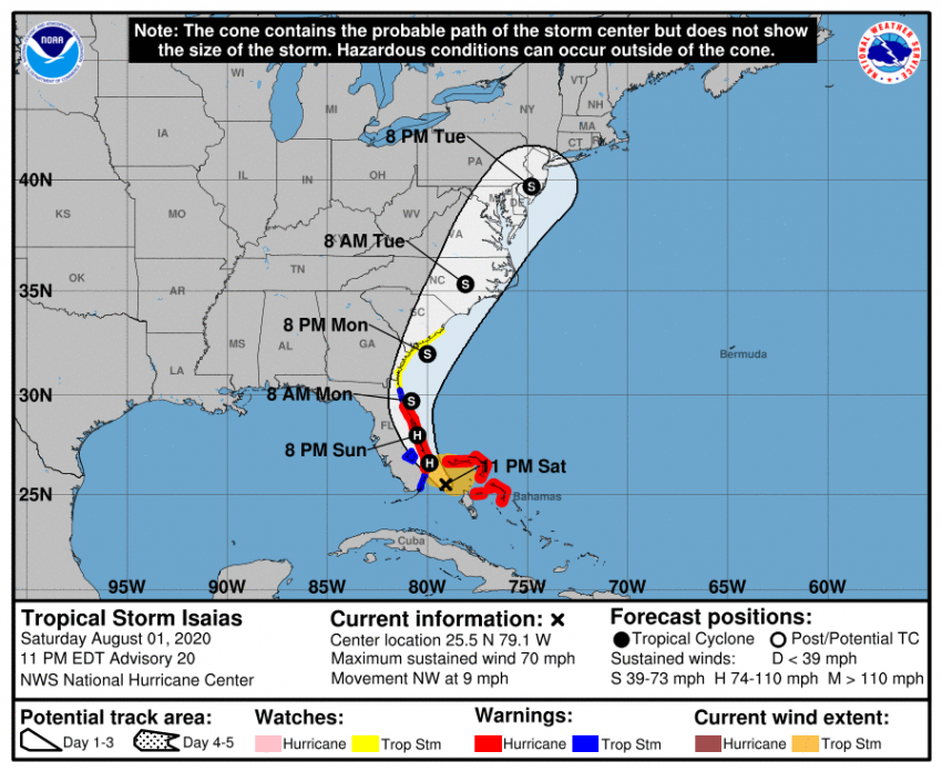
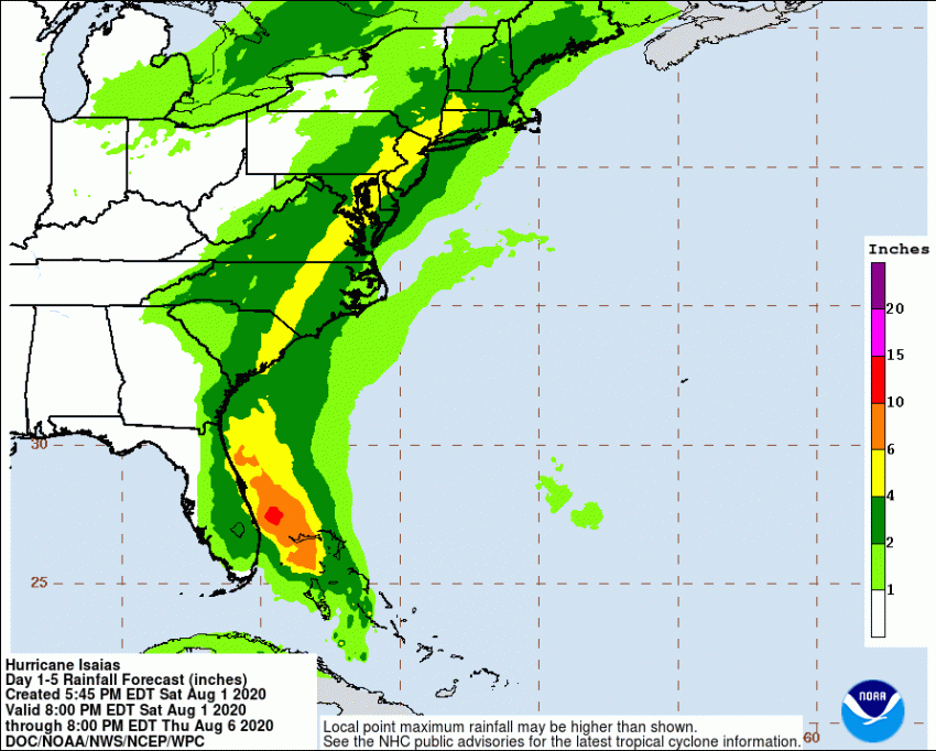
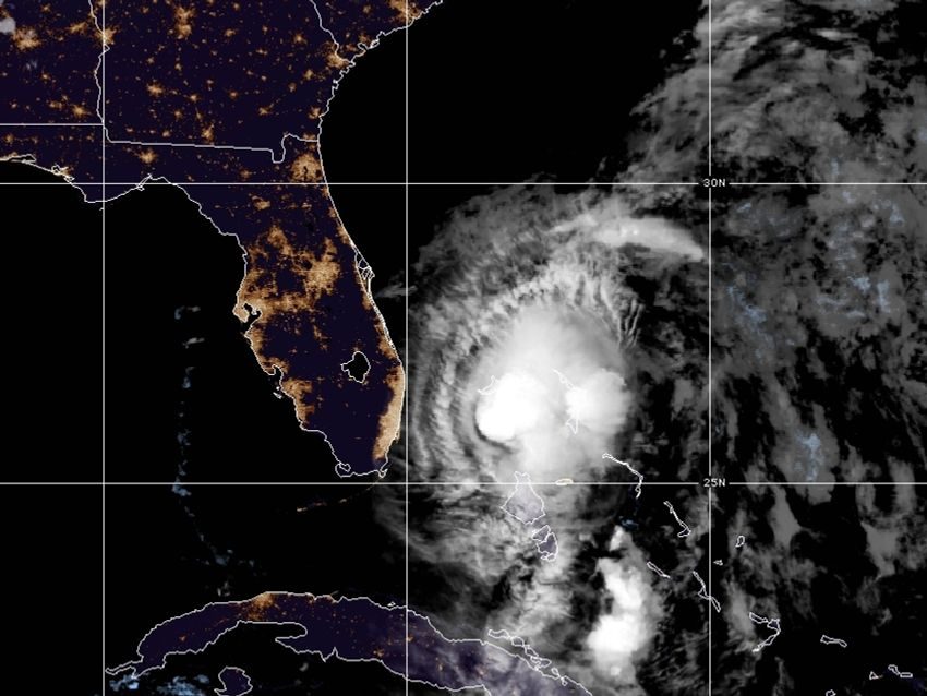
As of late Saturday evening, Isaias was located about 80 miles (130 km) east of Miami, Florida. Most of the heaviest weather is east of the center, so impacts so far in Florida have been minimal. The storm will move slowly through the next few days. It will gradually turn north and then northeast as it’s picked up by a larger system in the Midwest U.S. Eventually this will accelerate Isaias through the Mid-Atlantic and Northeast states early next week. The larger system will help spread tropical moisture over a larger area, bringing a threat for flooding rains from the eastern Carolinas through Maritime Canada (see map below). High winds will be more localized, mainly occurring east of the track along the immediate coast of the Carolinas and southern New England. There will also be an isolated tornado threat to the east of the track. Storm surges of up to around three feet (one meter) are possible along the southeast coast.