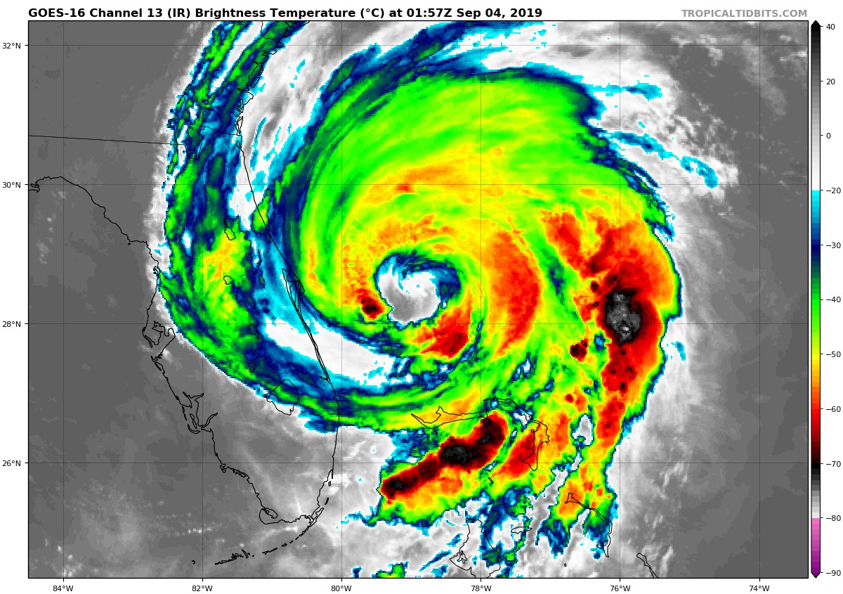
After ravaging the northern Bahamas for the last few days, Hurricane Dorian has finally started to turn northward, with its eye set on the southeast coast of the US. The storm, which is responsible for at least 7 deaths so far, is departing the Bahamas after spending the last two days pummeling the area with punishing winds, torrential rains, and a ferocious storm surge. Dorian became the strongest hurricane to ever hit The Bahamas, as it made it’s first landfall on Sunday with sustained winds of 185mph(298kph), on the Abaco Islands. With a central pressure of 910mb before it’s first landfall, Dorian had the lowest pressure ever recorded in the Atlantic east of Florida and north of the Caribbean. Within just nine hours on Sunday, it’s peak winds increased from 150mph(241kph) to 185mph(298kph) making it the fastest intensifying hurricane of this magnitude ever seen in the Atlantic Basin.
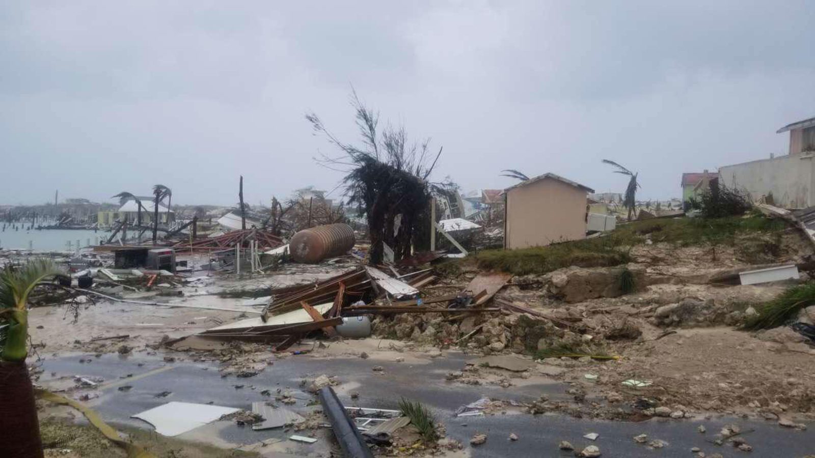
Aside from breaking records, Dorian has delivered a devastating blow to the Abaco Islands and Grand Bahama Island. After several landfalls, and two days of basically stalling over the area, these islands have been completely inundated by the storm. Homes have been leveled, trees stripped of their leaves, and roads have been turned into raging rivers, as the ocean became one with the land. The islands remain without power, or running water, as many residents remained stranded, trapped in their homes, and are awaiting to be rescued. Numerous people are still unaccounted for.

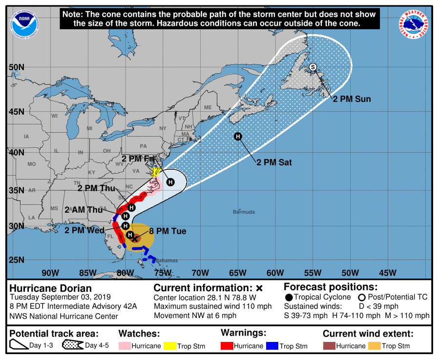
Although Dorian has weakened considerably since his peak on Sunday, the storm remains a strong Category 2 storm with winds of 110mph(177kph), and is on par to make contact with the coast of the southeast US in the coming days. Despite the winds being weaker, the wind field of the storm is expanding, so even if the storm does not make a direct landfall on the coast, hurricane force winds are still likely to be felt here. Hurricane warnings are now in effect for the coastlines of Florida, South Carolina, and North Carolina, while a state of emergency remains in effect for these states as well.
Forecast models depict Dorian remaining offshore, with it’s center just skirting the coastline, as it travels northward. A landfall along the coast of one of these states still cannot be completely ruled out at this time, however. The slow moving nature of the storm has giving residents of the Southeast lots of time to prepare, as storm surge, hurricane force winds, and flooding rains are poised to start effecting the region in the next 24 hours.