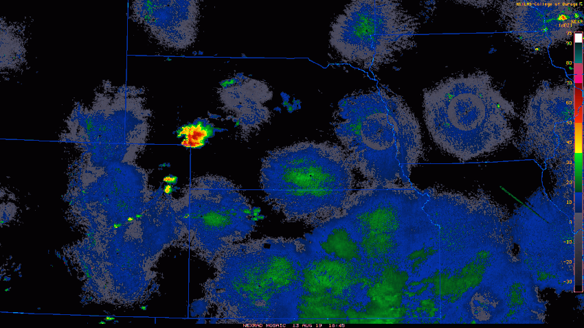
High heat and humidity provided plenty of fuel for building storms over the High Plains on Tuesday afternoon. A few isolated supercells eventually coalesced into a raging squall line that slammed south along the Colorado-Kansas border. Destructive winds, tornadoes, and record-breaking hail were the results.
Better quality image of the twin tornadoes that were in progress just northeast of Joes, Colorado for about a minute, at 2:11 p.m. #cowx @NWSGoodland pic.twitter.com/6vKHHd4IGL
— Quincy Vagell (@stormchaserQ) August 13, 2019
The atmosphere in the early to mid-afternoon became very unstable thanks to temperatures that soared into the 80s and lower 90s (lower 30s deg C). Isolated storms built quickly into severe supercells. Tornadoes were reported around 3-4 pm CT, including a rare phenomenon, twin tornadoes spinning down from the same storm (see tweeted pics above). Widespread wind gusts up to 80+ mph (130+ kph) blew over dozens of semi-trailers and powerlines along I-70 in northwest Kansas (see tweet pics below). Officials were forced to close the interstate temporarily to allow for clean-up, a rare event outside of blizzard season. Extremely large hail was also reported with this storm, possibly as large as five inches (12 cm) in diameter (see tweet pics at bottom). Once verified, it will be a new Colorado state record. It comes only a day after the old record of 4.5 inches was seriously challenged by four inch hail that fell near Otis.
I-70 between Hays and Wakeeney is closed due to multiple blown over semis and powerlines down. I’m currently in the backup, having seen seven of those semis blown over #kswx @JayPraterCBM pic.twitter.com/aH1kKretKs
— Tony Laubach (@laubacht) August 14, 2019
@NWSBoulder @NWSGoodland I am verifying what looks to be a record setting hailstone for #cowx Am told this fell near Bethune this afternoon. Would easily beat the 4.5″ record… Given the way the radar looked, I wouldn’t be surprised. Stay tuned! pic.twitter.com/LiUazILn6r
— Brian Bledsoe (@BrianBledsoe) August 13, 2019