Much of the Midwest and East baked under abnormally hot temperatures that set numerous records this weekend. Heat index values of 110 deg F and higher made it feel much worse. Fortunately, a break is on the way in the form of showers and storms, although a few residents may have to bear the cost of the cooldown with spotty flash flooding likely.
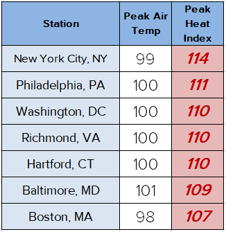
Extreme heat warnings lit up much of the central and eastern US in the past several days. The chart at left shows peak temperatures and heat index values for Saturday and Sunday in the mid-Atlantic and Northeast. Keep in mind that heat index values above around 104 deg F can cause serious health impacts. Heat exhaustion becomes likely at these temperatures, and heat stroke is a major risk with prolonged outdoor activity. The demand on electrical supply at one point forced Con Edison, electricity provider for New York City, to shut the power off for several neighborhoods in Brooklyn in order to prevent a much larger outage.
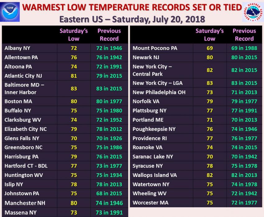
Not only were afternoon temperatures at dangerously hot levels, overnight lows remained very warm as well. The chart above shows the numerous cities that set warm low temperature records on Saturday morning alone. Note the warmest readings occurred in the major cities, where asphalt retains heat longer than soil. It’s a great example of what’s referred to as the “urban heat island” effect. These sultry overnight temperatures can exacerbate health issues by disallowing any kind of break that the human body needs from hot conditions.
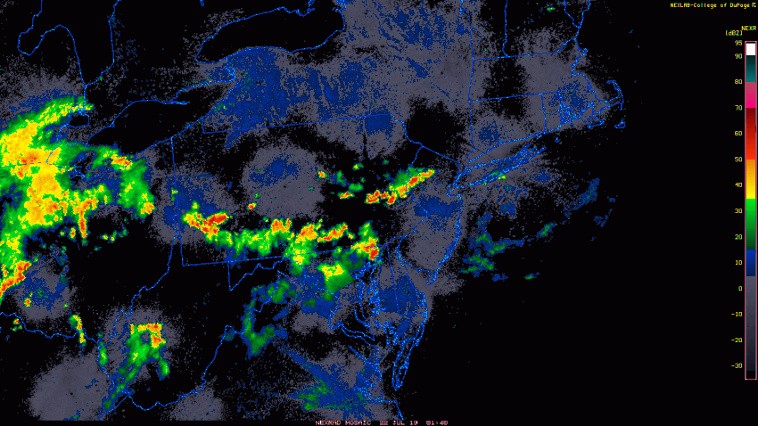
Fortunately, help is on the way. Already Sunday night, numerous showers and storms were moving along a front settling down into the Midwest and Northeast. This rain threat will continue through Monday. In fact, flash flood watches are in effect for much of this region. After the rain departs, temperatures will settle back down to warm but normal summertime levels.