A large, strong area of low pressure moving across eastern Canada produced very strong winds from this weekend into Monday. Areas of the Great Lakes, Midwest, and Northeast as well as southeast Ontario were hardest hit. Gusts exceeding 60 mph (100 kph) were common across the region with some areas seeing gusts of 80-100 mph or higher!
The 80 MPH Gust: Wind gust recorded at 80 MPH at 8:54am along Lake Ontario at the Oswego Coast Guard station. Here are 40 raw seconds captured in that timeframe. Hurricane force on this Great Lake today. @spann @JimCantore @StormHour @JamesGilbertWX @TomNiziol @wxbywilliams pic.twitter.com/saxiDHlaNW
— John Kucko (@john_kucko) February 26, 2019
WHOA! #Iceshove along the Niagara River in Fort Ontario after a boom gave way upstream and ice flowed down the river courtesy of 60+ MPH wind gusts. Video via @ViralHog pic.twitter.com/SbAPIqpFRc
— Mike Seidel (@mikeseidel) February 25, 2019
Craziest wind video of the day today…courtesy Lancaster Fire
Dash cam video from Lancaster chief car today on Brook St in Clinton, ma a roof blew off a building on the other side of the bridge pic.twitter.com/vPZOCZ1ycR
— Terry Eliasen (@TerryWBZ) February 25, 2019
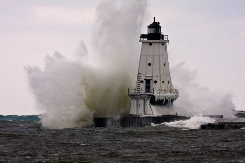
Mt. Washington, typically the windy spot in the Northeast U.S. saw a gust to 171 mph (275 kph), setting a new record for the month of February. Gusty winds toppled numerous trees, powerlines, street lights, and semi-trailer trucks. Strong westerly winds pushed chunks of ice onshore over portions of the Great Lakes (see video above). Already fallen snow was whipped around by the winds, leading to dangerous whiteout conditions that in some places rivaled the March 1993 Superstorm. Fortunately, winds have begun to subside as of Monday evening. Lead photo courtesy Wikipedia contributor James Marvin Phelps.